
Lake snow fizzles, temperatures slowly rise this week

SYRACUSE, N.Y. (WSYR-TV) — It’s been quite wintry the last few days, but a little break is on the way. When do skies brighten up again? Get the latest forecast below…
Latest radar
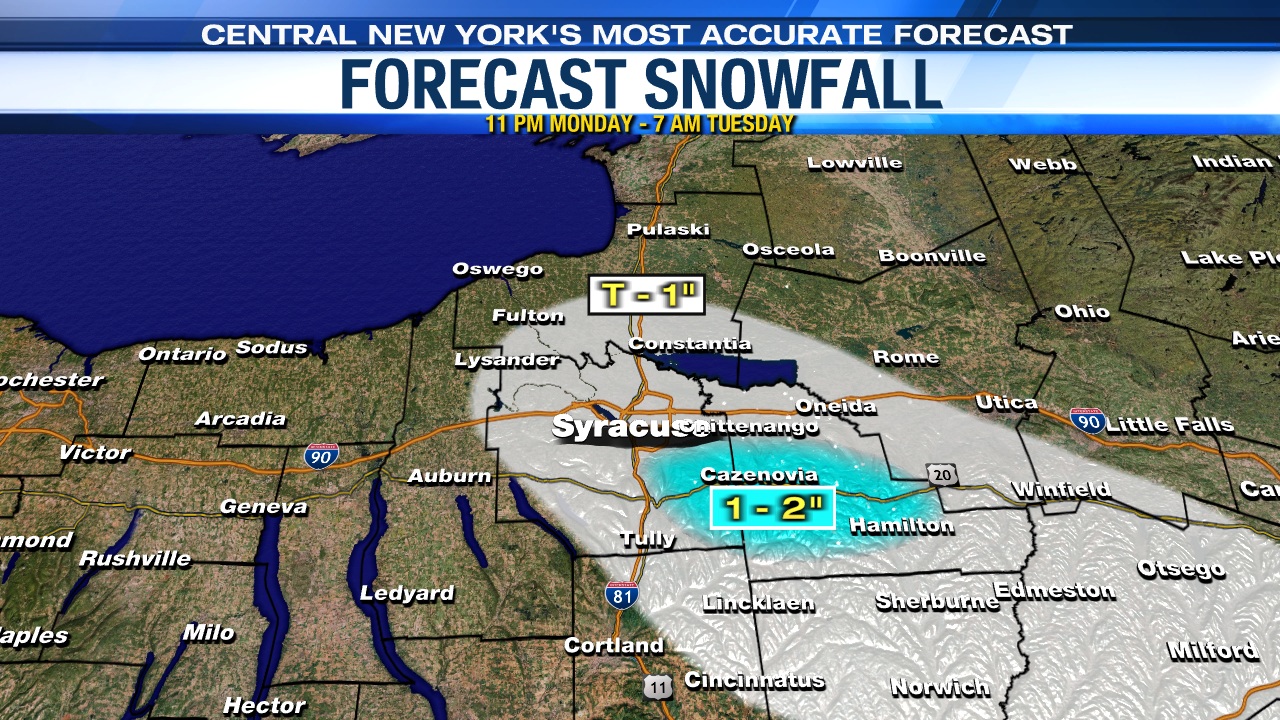
Lake effect snow showers are winding down
The lake effect snow really died down overnight. There may still be a few flurries flying around in the morning. But, for the most part we’re taking a break from the snow for a little while.
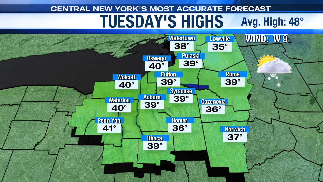
High pressure builds in during the day Tuesday, which should help the sun come out from time to time in the afternoon.
That won’t help the temperatures too much, however. Despite any sun and lighter winds, highs are still running almost 10 degrees below normal with temperatures struggling to reach 40.
Nicer midweek!
If you didn’t know, November is climatologically the cloudiest month of the year and anytime you see the sun it’s a bonus! When do we have a chance of seeing the sun? At least a little probably develops Tuesday as mentioned above, followed by even more sunshine Wednesday and possibly even into the start of Thursday!
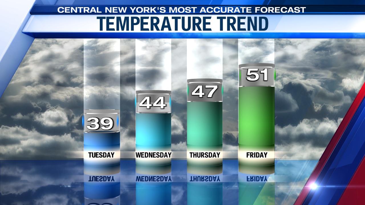
A slow rise in the temps
Highs warm back into the 40s the rest of the week and may sneak into the low 50s Friday!
Click here for your full 7-day forecast.


