
Storms winding down overnight; more to come Sunday
SYRACUSE, NY (WSYR-TV) – We’ve one of the hottest and longest stretches of weather for this early in June but there is relief in sight. We just have to get past a round of potential severe weather to end the weekend.
Showers and storms very spotty overnight
A stalled front moves back north of central New York as a warm front Saturday night and will provide the trigger for a few more scattered showers and storms. The threat of severe weather, however, has ended.
The storms from Saturday night are NOT the ones to bring relief from the heat and humidity. You’ll have to wait for Sunday’s storms to do that.
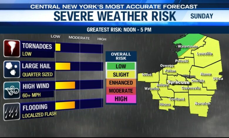
Severe threat increasing for Sunday
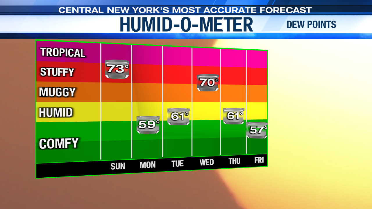
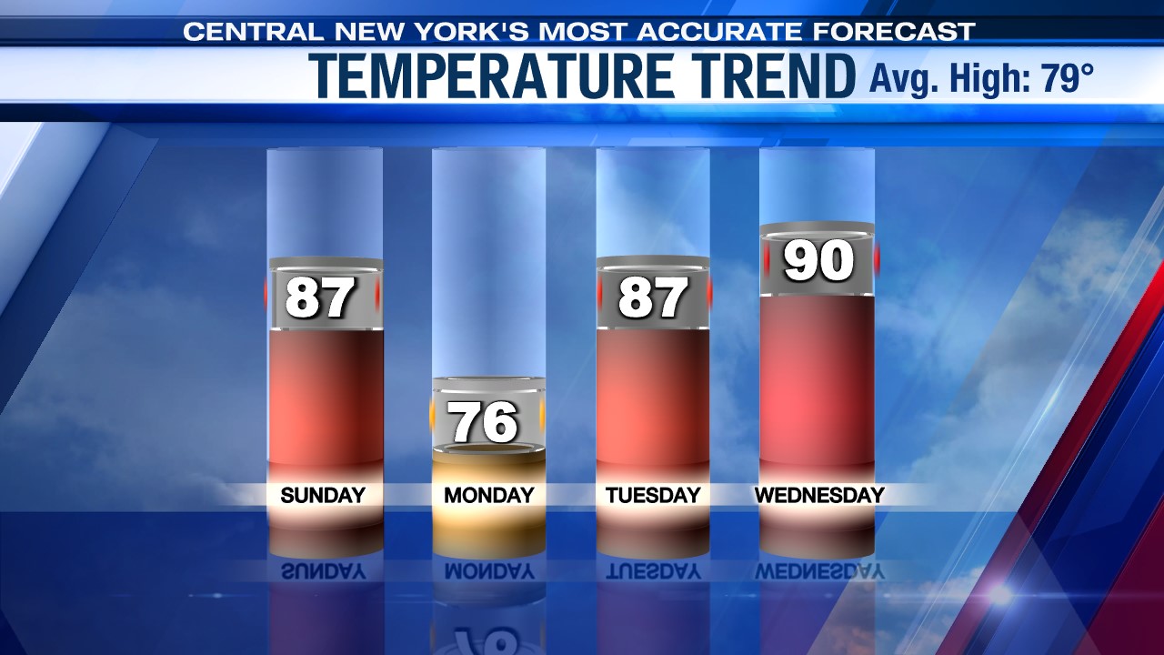
By the end of the weekend a stronger cold front is headed east from the Great Lakes and crosses central New York. That will take the fuel in the form of warmth (temperatures near 90° again) and high humidity (dew points near 70°) and create more widespread showers and storms.
We’ll have to keep an eye on these storms. A bit more wind shows up aloft than we have seen all week and that increases our chances of severe weather. The Storm Prediction Center has highlighted much of central New York in a ‘Slight’ risk with the most likely time for these stronger storms between Noon and 5 pm.
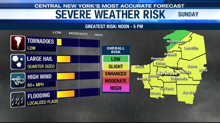
While damaging winds and hail are the greatest threat, there is a possibility of an isolated tornado or two, especially east of Syracuse.
When does the heat wave end?
It looks like one more day with temperatures well into the 80s with dew points in the 70s Sunday. Once Sunday’s cold front moves through we should see the relief return for Monday. Temperatures will struggle to get out of the mid 70s and there is much less humidity.
We figure there are lots of clouds and even showers to start the day, but we should dry out in the afternoon with even one late day sun.
How long does relief last?
The 70s don’t last long. We are already climbing back at least into the mid 80s Tuesday, but the good news is that the humidity is held in check.
We are closer to 90 and more humid Wednesday ahead of a new cold front Wednesday. That should lead to another round of showers and t-storms.
Check out the latest 7-day forecast.


