
Unsettled at times and still breezy Sunday
SYRACUSE, NY (WSYR-TV) – It was a soggy night and start to Sunday, but will we need to keep the umbrella handy throughout the day? Details are below…
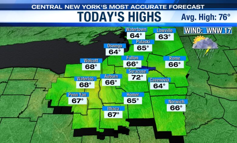
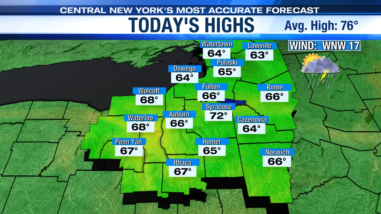
More drops to dodge Sunday?
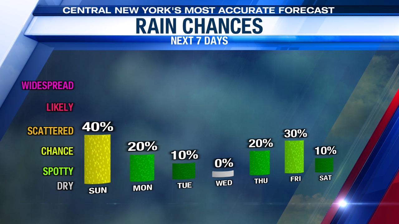
After a damp start, conditions turn drier through early afternoon with some increasing sunshine. However, after 1 or 2 p.m. the combination of cool air aloft, heating of the day and lingering moisture will trigger a scattering of showers and a storm or two into the start of the Sunday evening.
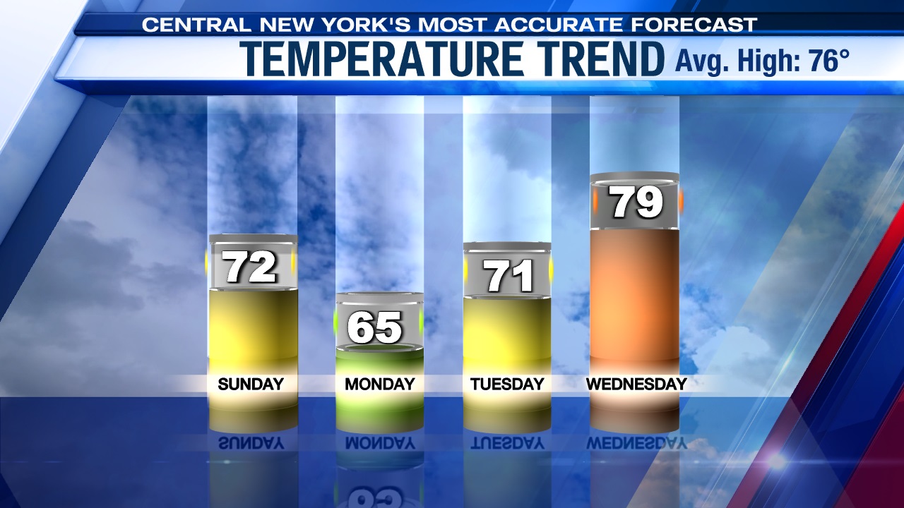
Thanks to some sun, we think temperatures will make the upper 60s and low 70s to end the weekend. Click here to see how you’ll fare if you head out to Greek Festival or try to mow Sunday.
Wind a factor into Monday
A gusty wind out of the west-northwest upwards to 20 to 30 mph makes it feel even cooler on Sunday. Also, those gusty winds will also make it choppy on area lakes, especially Lake Ontario and Oneida Lake. So, be careful if you are thinking of taking the boat out Sunday.
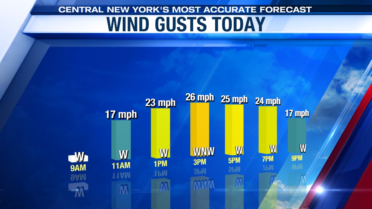
While the winds are strongest over the weekend, it will remain breezy on Monday too.
Not as showery, but cool to start the week
Monday features more dry time than not and is less showery than Sunday, with just a few spotty showers around to start the new week, but it does look to be the coolest day thanks to an abundance of clouds.
Highs on Monday likely won’t get any higher than the mid-60s! Yes, it may not be a bad idea to have a fleece/hoodie if you’ll be out and about Monday.
Why so cool and somewhat unsettled through the start of the week? Find out here.
Check out the latest 7-day forecast.


