
Severe storms possible this afternoon
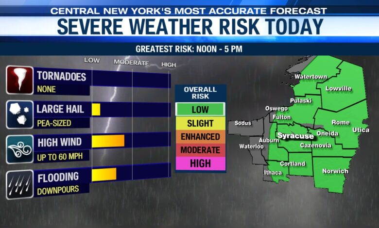
SYRACUSE, NY (WSYR-TV) – Showers and thunderstorms are in the forecast today, and a few of the storms may turn severe.
When are storms expected?
Showers have already developed west of Syracuse over parts of the Finger Lakes, and we expect a line of showers and storms to move east across the region heading into the afternoon.
This line will reach Syracuse and the I-81 corridor between about 1 and 3 p.m., and exit all of CNY by around 5 p.m. this afternoon.
Along with more dry time, there should be some sunshine breaking out toward day’s end after the storms move out.
What are the risks?
While the threat of severe weather is low, it is not zero. Most of CNY is in a level 1 of 5 zone on the severe risk scale, meaning that isolated severe storms are possible. No widespread severe weather is anticipated.
The primary risks with today’s storms include gusty, damaging winds up to around 60 miles per hour. Wind gusts this strong are enough to bring down some tree limbs and cause power outages.
Heavy rainfall is also possible in any storm today, which could lead to some localized flooding.
The threat for large hail and tornadoes is very low.
Current Radar


