
Turning hotter & more humid
SYRACUSE, NY (WSYR-TV) – Hotter and muggier air is on the way midweek, but will storms accompany the steamier air?? Details are below…
Mild night, followed by even warmer air
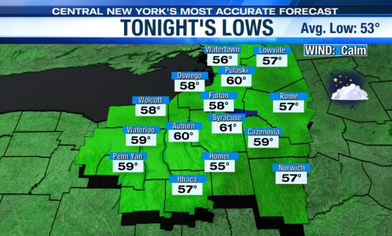
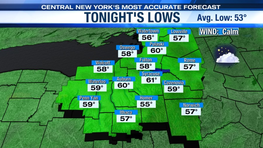
It’s mainly clear tonight with a low within a few degrees of 60.
High pressure keeps us high and essentially dry through Tuesday which is good news for your golf and boating plans Tuesday.
Highs rise into the mid to upper 80s come Tuesday and probably Wednesday too with more in the way of humidity expected to develop, especially come Wednesday. Do what you can to stay cool!
Shower/storm chances increase midweek
As mentioned above with the warmth comes more humidity. The increasing humidity combined with an approaching cold front later Wednesday afternoon/night into Thursday morning is expected to trigger scattered showers and storms, especially late Wednesday night into the start of Thursday.

Cooler, less humid and unsettled late week
The cold front itself slides through Thursday morning with showers and a few storms tapering to a few more showers and possibly a storm or two Thursday afternoon.
We are cooler and slowly turning less humid Thursday too with highs near 80.
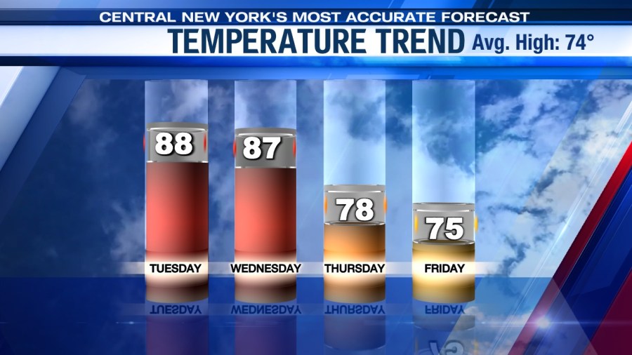
An upper level and surface storm system spin in from the northwest to end the week and unfortunately probably sticks around into the weekend. This system likely produces at least a scattering of showers to round out the week into the weekend with a cooler high in the 70s. Stay tuned for updates.
Check out the latest 7-day forecast.


