
Less sun, but can we get through Sunday dry?
SYRACUSE, NY (WSYR-TV) – It was a gorgeous, summery Saturday to kick off June with highs well into the 70s and low 80s, but can we keep it going into Sunday? Details are below…
Staying nice into Sunday?
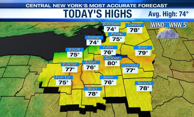
Lots of dry time with breaks of sun at times through midday should help push temperatures up into the upper 70s to around 80 to end the weekend. However, it’s not a completely dry day across the region.

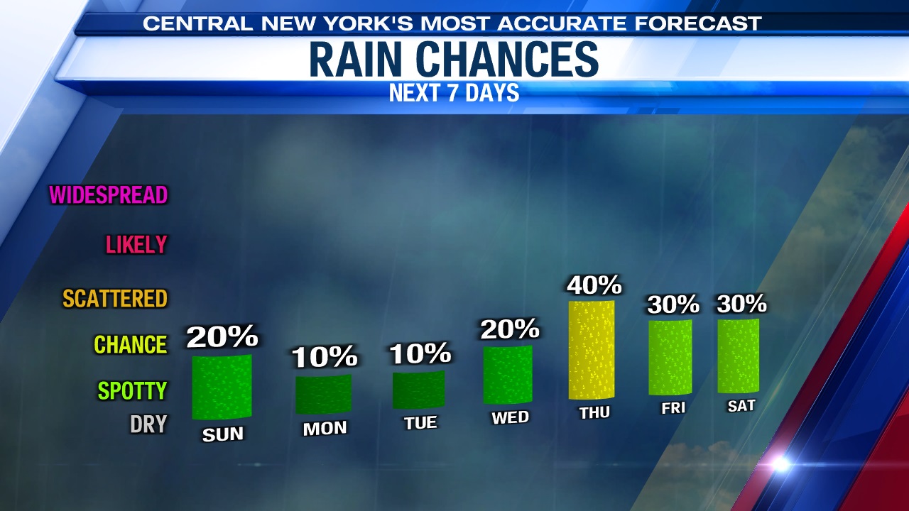
The chance for a few showers arrives later Sunday afternoon and evening. The culprit is an area of low pressure approaching from the southwest. This low will weaken as it runs into drier air over us. Despite the dry air weakening the low, we still think at least a few of these showers survive the trip into Central New York after about 2 p.m. Sunday, initially over the Finger Lakes and then approaching Syracuse by around 5 p.m. before diminishing as we head through the evening.
For more on how the forecast looks for the Syracuse Mets and or washing the car click here.
Warmer days ahead
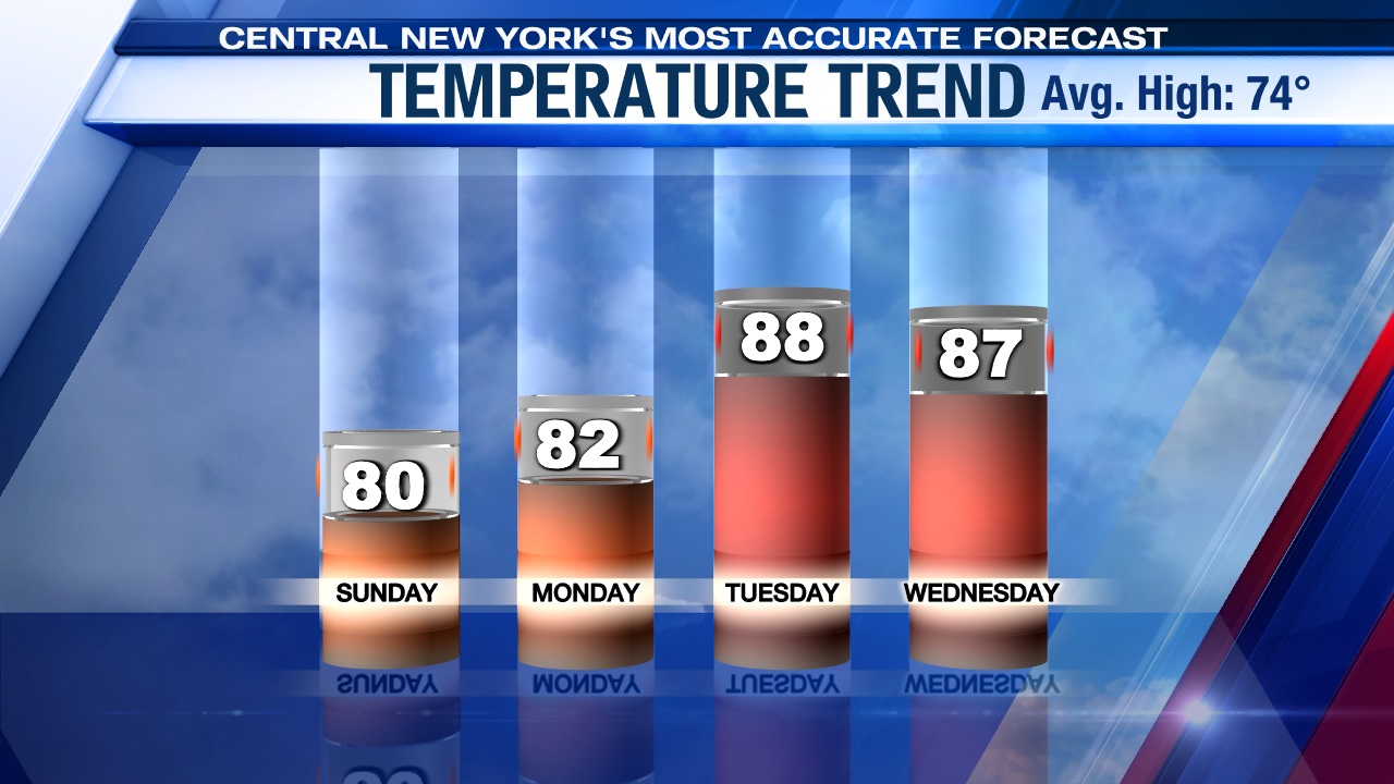
It still looks like we heat up even more in the coming days.
High pressure builds back in with more in the way of sunshine for Monday and Tuesday. That puts our temperatures back into the 80s, and we could even see mid to upper 80s by Tuesday and Wednesday.
With the warmth comes more humidity, which should lead to scattered showers and storms on Wednesday and especially Thursday as a cold front approaches and is slated to move through late Wednesday night/Thursday morning.
Check out the latest 7-day forecast.


