
Less sun, but can we get through Sunday dry?
SYRACUSE, NY (WSYR-TV) – It was a gorgeous, summery Saturday to kick off June with highs well into the 70s and low 80s, but can we keep it going into Sunday? Details are below…
Staying nice into Sunday?
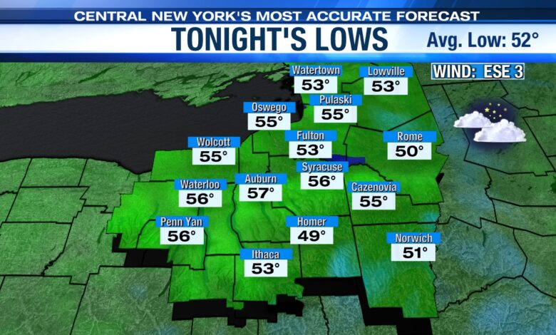
High and mid-level clouds will skirt the sky tonight with lows not as cool as it’s been the last several nights. Lows will be in the mid-50s for the majority.
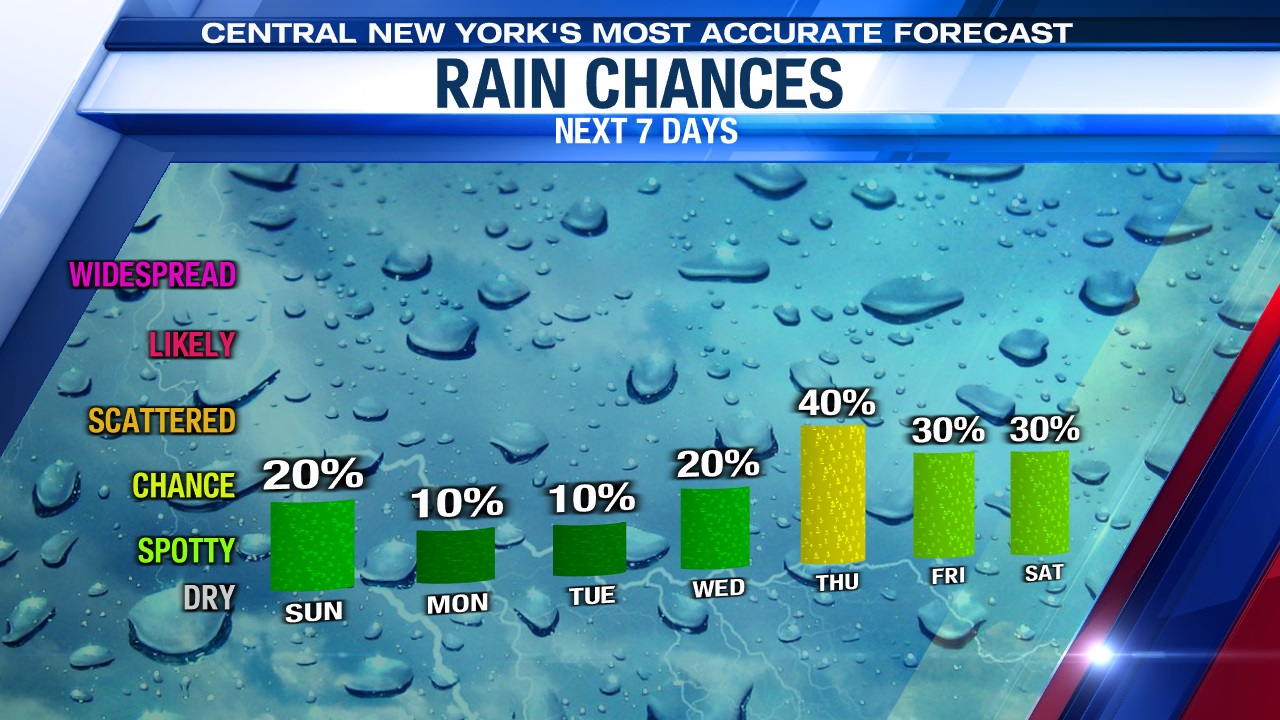
The best chance for showers for the weekend looks to come later Sunday afternoon and evening. The culprit is a weakening area of low pressure coming out of the Southern Plains. This area of low pressure moves northeast with showers and storms but continues to weaken as the system runs into drier air over us as it heads into the Northeast on Sunday. Despite the dry air weakening the low, we still think at least a few of these showers survive the trip into Central New York Sunday afternoon and evening.
For more on how the forecast looks for the Syracuse Mets and or washing the car click here.
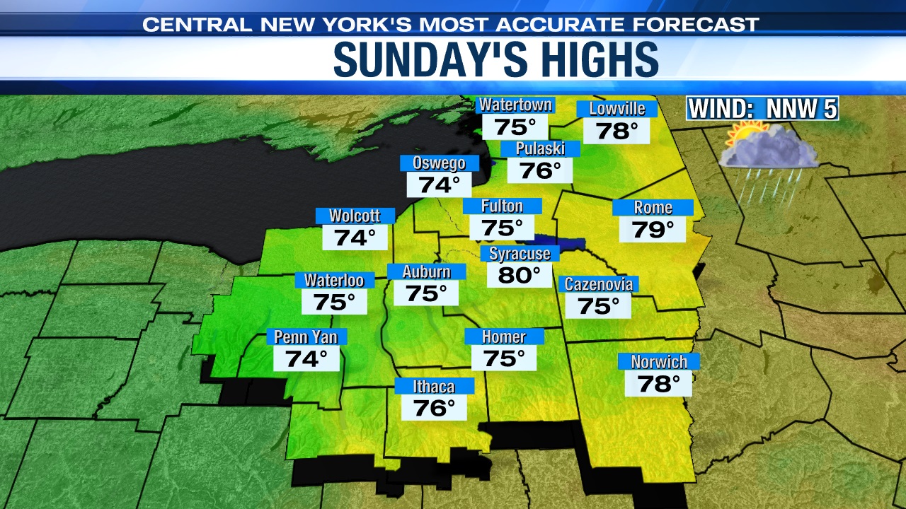
Lots of dry time with breaks of sun at times through lunch time should help push temperatures up into the upper 70s to around 80 to end the weekend.
Even warmer early next week
It still looks like we heat up more so early to mid-next week.
Sunday’s spotty shower maker weakens further and departs off the East Coast. That allows high pressure to build back in with more in the way of sunshine. That puts our temperatures back into the 80s. We could even see mid to upper 80s for a day or two!
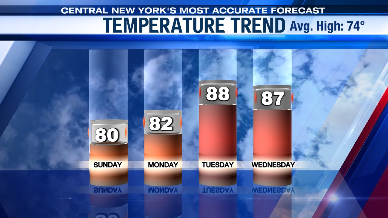
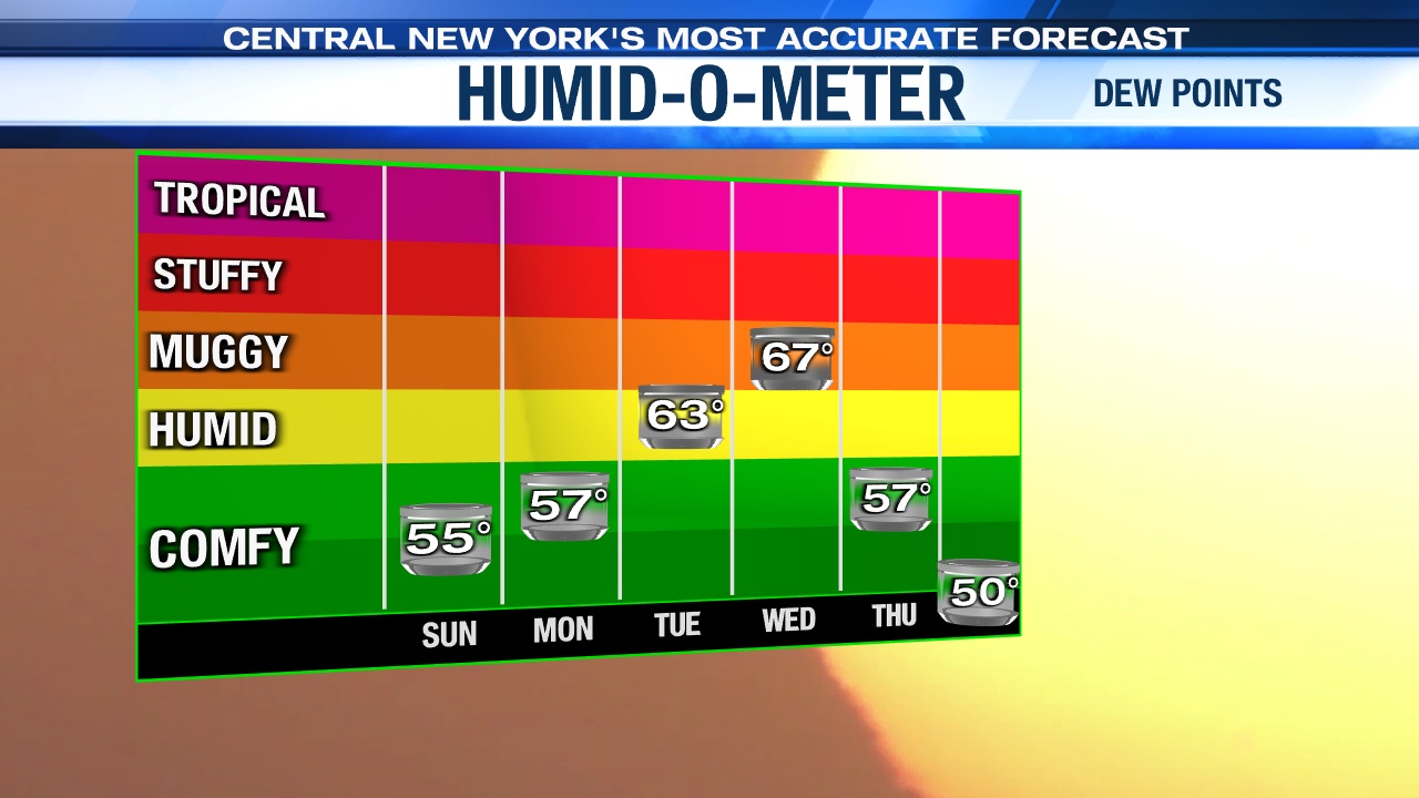
With the warmth comes more humidity which should lead to scattered showers and storms on Wednesday and especially Thursday as a cold front approaches and is slated to move through late Wednesday night/Thursday morning.
Check out the latest 7-day forecast.


