
Does quiet weather last into first weekend of June?
SYRACUSE, NY (WSYR-TV) –Dry and sunny weather continues for central New York. When might some wet weather return? Details are below…
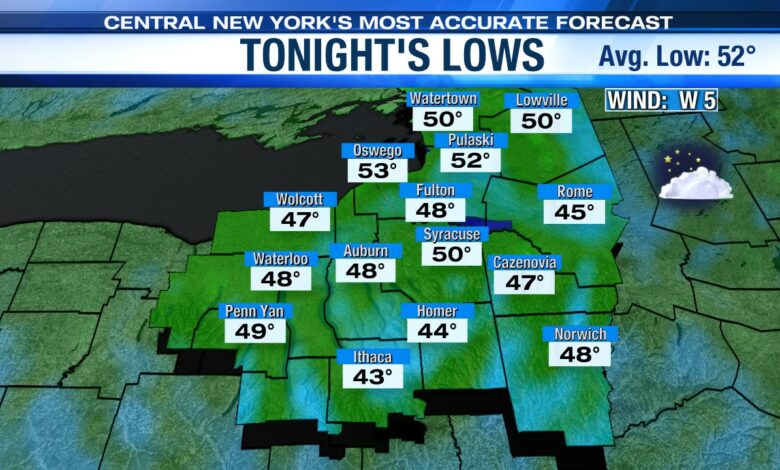
A clear, cool and quiet overnight
It is another clear and cool night across central New York Friday night, although perhaps not as cool as the last several nights. Most spots end up in the mid to upper 40s by sunrise Saturday.
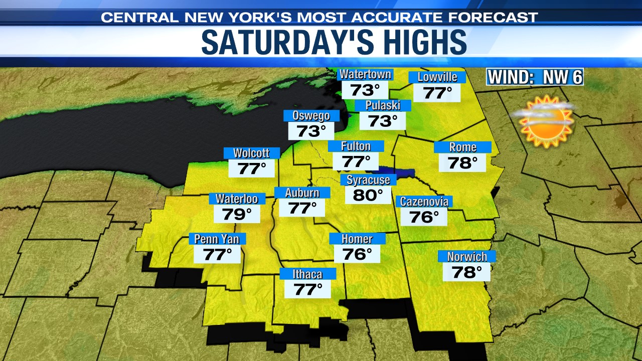
Feeling summery this weekend, but does it stay dry?
The start of the weekend and the month of June looks great under more sun and a warmer high in the upper 70s to near 80! As an extra bonus, the winds will be lighter than the past couple of days.
The best chance for showers for the weekend looks to come on Sunday. The culprit is an area of low pressure coming out of the Southern Plains. This low moves northeast with showers and storms but weakening as it heads into the Ohio Valley and Great Lakes Saturday.
While the dry air over us will further weaken this system, we still think at least a few of these showers survive the trip into central New York Sunday. The latest data points to scattered showers confined to the afternoon and mainly over the Finger Lakes.
Now that the showers appear more scattered Sunday and there could be some breaks to sun from time to time, it looks like we could take a run at 80 degrees to end the weekend.
Even warmer early next week
There are still strong signs that we could heat up even more early to mid-next week.
Sunday’s shower maker weakens further and departs off the East Coast. That allows high pressure to build back in with more in the way of sunshine. That puts our temperatures back into the 80s. We could even see mid to upper 80s for a couple days!
With the warmth comes more humidity which should lead to scattered showers and storms, especially Wednesday and Thursday.
Check out the latest 7-day forecast.


