
Severe storms possible this afternoon
SYRACUSE, NY (WSYR-TV) – Showers and storms are expected this afternoon through early this evening across Central New York. Some of the storms could be severe.
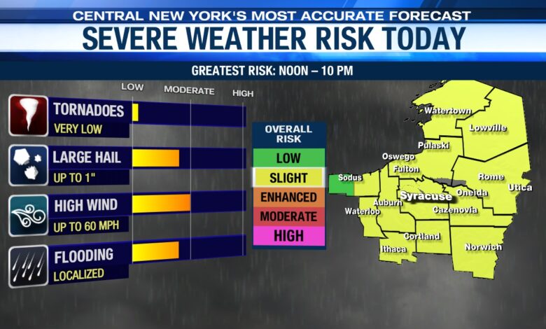
When is the best chance of severe t-storms?
After intervals of hazy sun this morning and temperatures warming well into the 70s to near 80 by lunch time, a line of showers and storms is expected to swing through sometime between about 12 and 3 pm.
After a mid-afternoon lull, another batch of showers and storms tries to develop and slide through CNY with a cold front late this afternoon through early this evening, between about 4 and 9 pm. The severe risk will be lower with this batch, but not zero.
Storms should be out of all of Central New York by around 9 or 10 pm with a lingering shower and some patchy fog possible overnight.
What are the greatest risks with these storms?
The greatest risks with any storms will be damaging winds up to around 60 mph which could knock down trees or tree limbs and cause some power outages, large hail, and especially heavy rain that may lead to localized flash flooding. Remember, if you ever encounter a flooded roadway, turn around and find an alternate route!
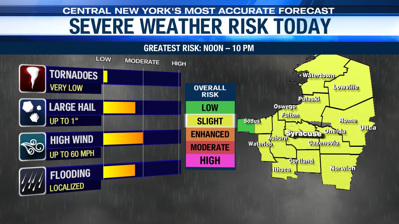
Thankfully, the conditions in the lower atmosphere this afternoon and evening are not incredibly favorable for tornado development, but we’ll keep an eye on things just in case.
What should I do before it gets stormy?
Like in any case where storms are a threat make sure you have batteries for flashlights and fully charge your cell phone, so you have access to the latest weather data when you are away from your TV or computer.
Remember when thunder roars, head indoors. Stay tuned to the NewsChannel 9 Storm Team for updates and any warnings that may be issued.


