
Record heat and strong to severe storms possible Wednesday
SYRACUSE, NY (WSYR-TV) – Can we make it 2 days in a row of 90°? We’ll give it a go before we have a chance for strong to severe thunderstorms later today. Details below…
Keeping it hot one more day
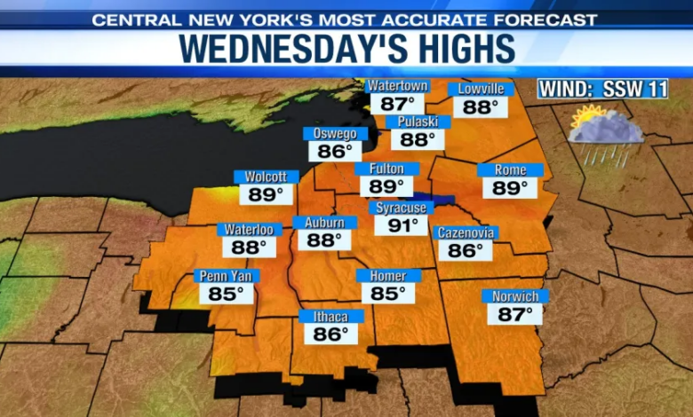
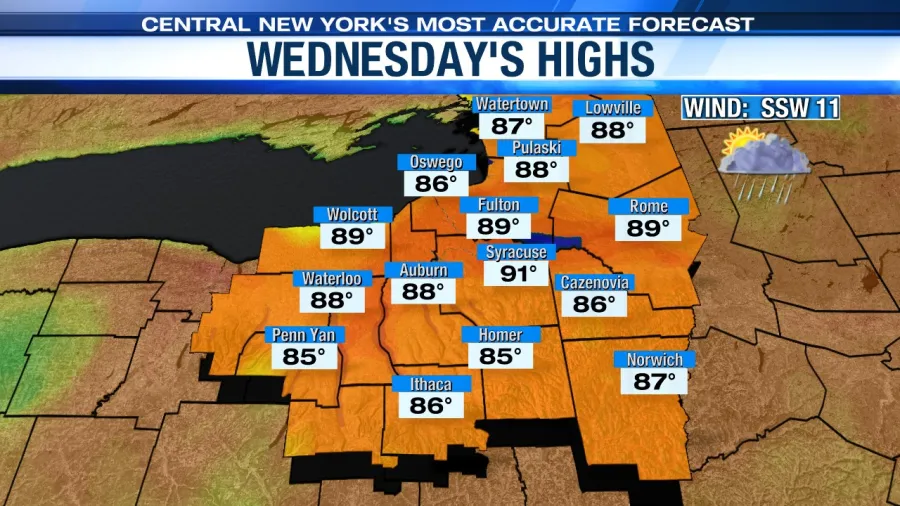
Tuesday was our first 90° day of the year. Can we get our second today? It’s certainly possible. Low 90s are very much in the cards. The record high Wednesday is 92° set way back in 1911.
So stay cool and hydrated, especially if you’re outside today. Click here to find out how it’s looking for a swim and or a mow on Wednesday.
Strong to severe storm threat Wednesday
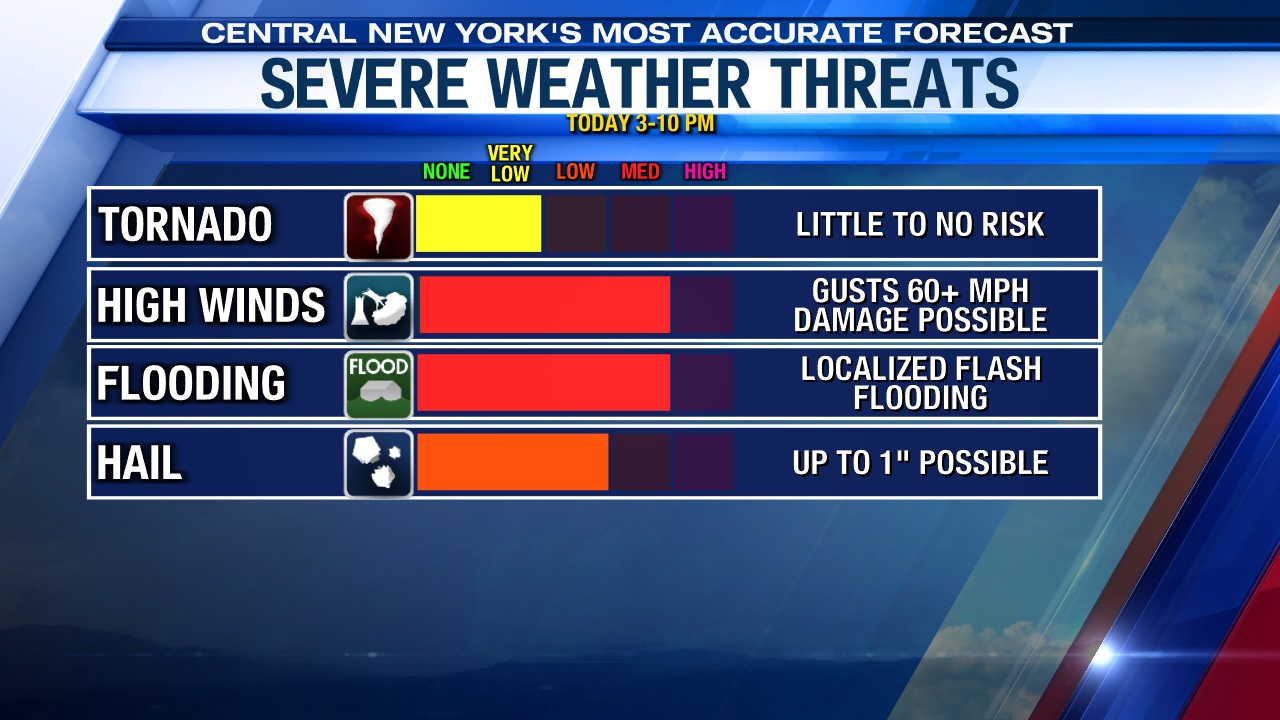
The Storm Prediction Center has parts of CNY under a Slight Risk of severe weather, meaning a level 2 out of 5 threat of strong and severe thunderstorms.
We must be vigilant of storms that could produce gusty damaging winds 50-60 mph, hail, and heavy downpours between 2-10 pm Wednesday. The tornado threat is very low at this time.
Stay safe and weather aware as these storms move through Central New York. Have the Live Doppler 9 app downloaded to your phone so you can be notified of lightning strikes nearby and be instantly alerted of any watches and warnings the National Weather Service may issue.
Relief is just around the corner
In the wake of the Thursday morning cold front passage, it turns cooler and less humid Thursday afternoon into Friday.
Highs should drop back into the mid to upper 70s Thursday with some developing afternoon sunshine after showers and possibly a storm or two kick off the day.
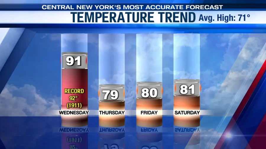
The coolest day of the week comes Friday with plenty of sun, a nice breeze, and temperatures back up around 80 degrees.
Check out the latest 7-day forecast.


