
Best part of weekend ahead!
SYRACUSE, NY (WSYR-TV) – It was a bit of a damp start to the weekend, but improving conditions are expected for the last half of the weekend! Check out the latest details for the rest of the weekend forecast below.
Better half of the weekend on the way
As high pressure begins to build in tonight into Sunday, the end result will be a drier, nicer last half of the weekend after a quiet Saturday night.
Lows tonight drop into the 50s to around 60 with areas of fog developing.
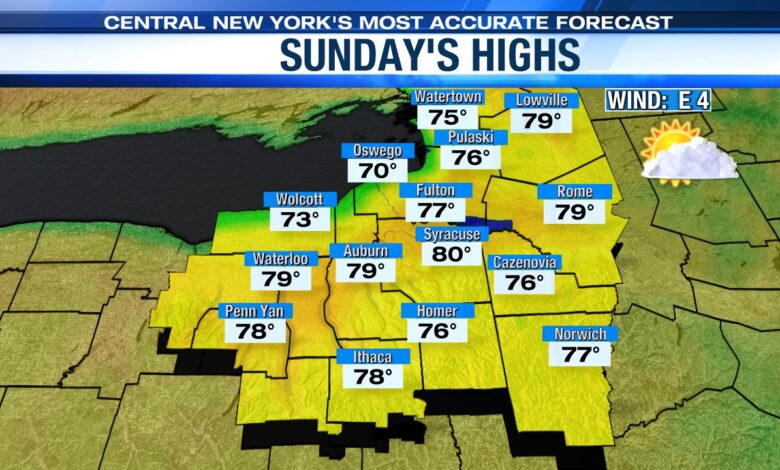
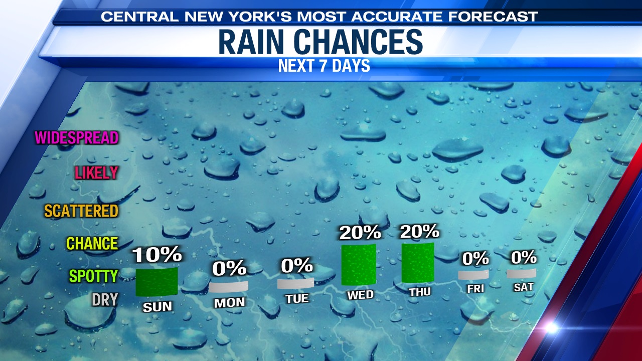
For Sunday, it continues to look dry thanks to high pressure resulting in the best day of the weekend. After some low clouds and fog to start the day, we would expect skies to turn out partly to mostly sunny with a very small chance of a spotty shower during the midday and afternoon. With strong May sun, temperatures should rise to near 80 degrees Sunday afternoon.
A stretch of summery weather next week
High pressure holds into early next week, and so too should the dry weather.
It also looks to be warm through midweek with a good deal of sun and the help of a southwesterly wind (typically a warm wind for Syracuse). This should help push temperatures into the low to mid 80s through Tuesday, and if we stay mainly dry with enough sun Wednesday could warm into the upper 80s to possibly 90 midweek!
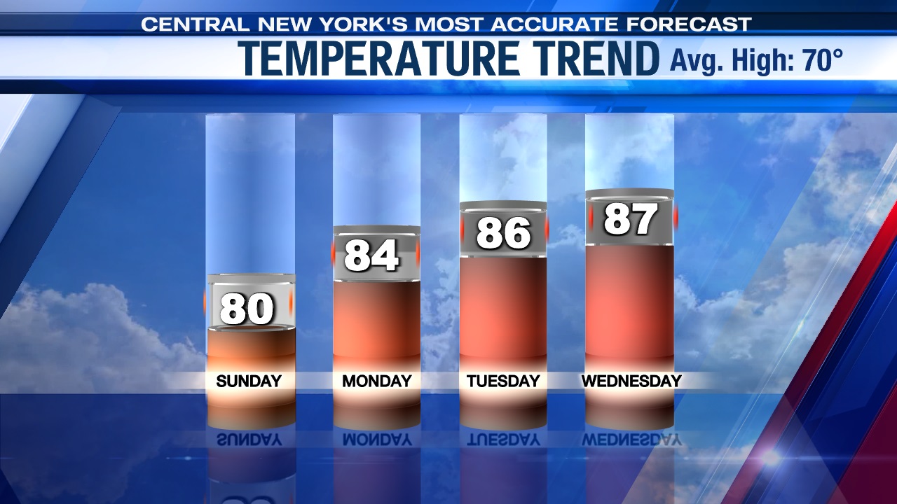
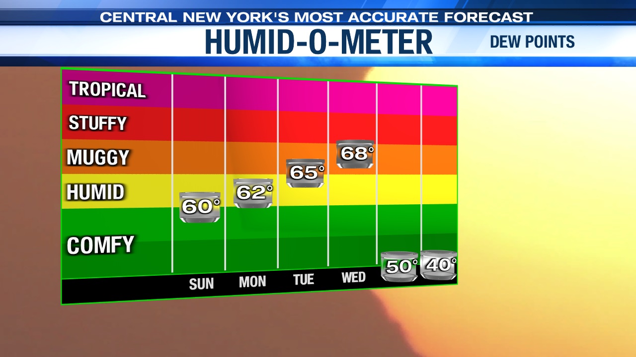
It will be an early taste of summer weather for Central New York! Check out the rising dew points through midweek below too…
Our next chance of rain wouldn’t come until late Wednesday afternoon at the earliest as a cold front approaches. That front causes some showers and storms for us when it reaches our area, especially later Wednesday night into Thursday morning.
Check out the latest 7-day forecast.


