
Slow start to weekend weather in CNY, but be patient..
SYRACUSE, NY (WSYR-TV) –While showers are set to return to central New York Friday night they will move out Saturday. Check out the latest details on the weekend forecast below.
Wet weather overnight
Showers will continue on and off for the rest of the night across as a frontal system approaches from the west.
With the cloud cover we expect a mild night with lows in the upper 50s to near 60 for most.
A split weekend
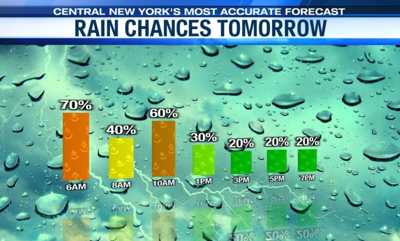
The front that brought us some showers on Friday night is falling apart over us Saturday. With the front still close by (although weakened) we are going to keep some showers in for Saturday, especially in the morning, along with a good deal of clouds.
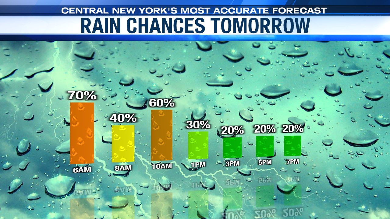
As high pressure begins to build in, we would expect a drier afternoon with sunshine gradually mixing in with the clouds. For some spots, in particular south of Syracuse, you may have to wait until early in the evening to see some clearing.
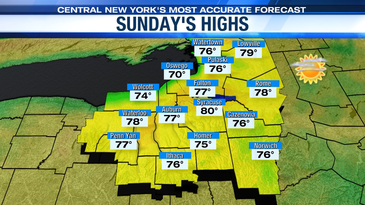
For Sunday, it continues to look dry thanks to high pressure, so it is likely the best day of the weekend. After some low clouds and fog to start the day, we would expect skies to turn out mostly sunny. With strong May sun temperatures appear headed to near 80 degrees.
A touch of summer next week
High pressure holds into early next week so too should the dry weather.
It also looks to be warm through midweek with all the sun and the help of a southwesterly wind (typically a warm wind for Syracuse) This should help push temperatures into the low to mid 80s through the middle of next week. It will be an early taste of summer weather for central New York!
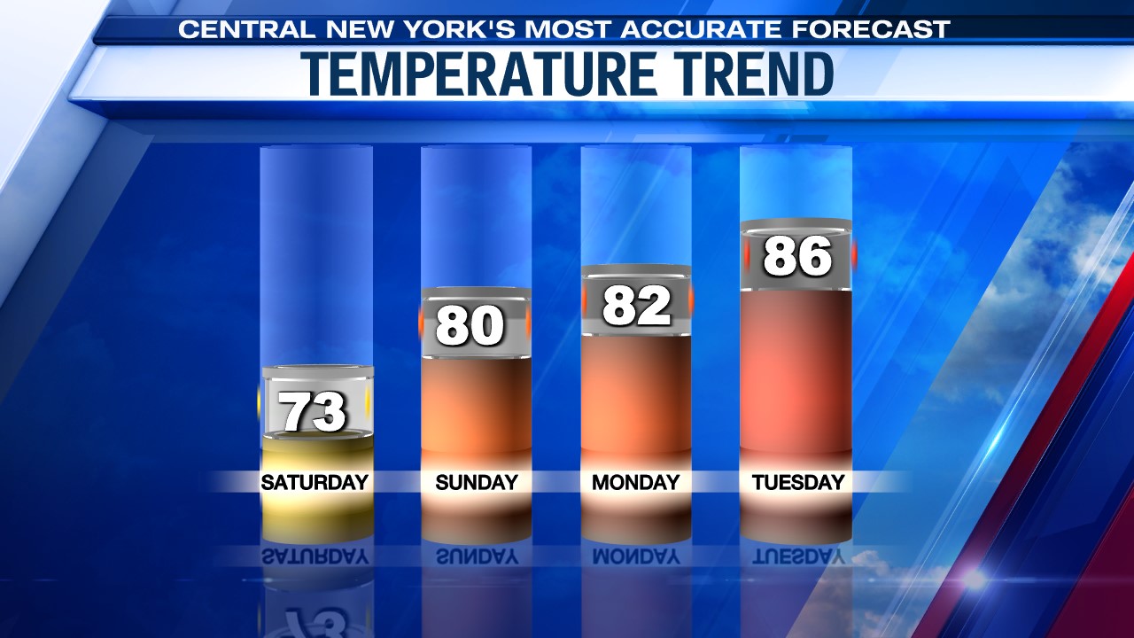
Our next chance of rain wouldn’t come until Wednesday afternoon at the earliest as a cold front approaches. That front causes some showers and storms for us whenever it reaches central New York.
Check out the latest 7-day forecast


