
When is CNY’s best chance for dry weather this weekend?
SYRACUSE, NY (WSYR-TV) – It’ll be a wet first weekend of May, but drier weather is on the way for next week. How long will we stay dry? Details below…
Rain threat returns this weekend
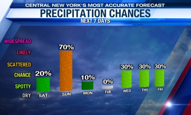
The next weather maker unfortunately is slated to arrive in central New York on Saturday with some showers ahead of a weakening frontal system. The day, however, will not be a total washout. After a few showers in the morning expect plenty of rain-free time in the afternoon. It’s still a good idea to have the umbrella on hand.
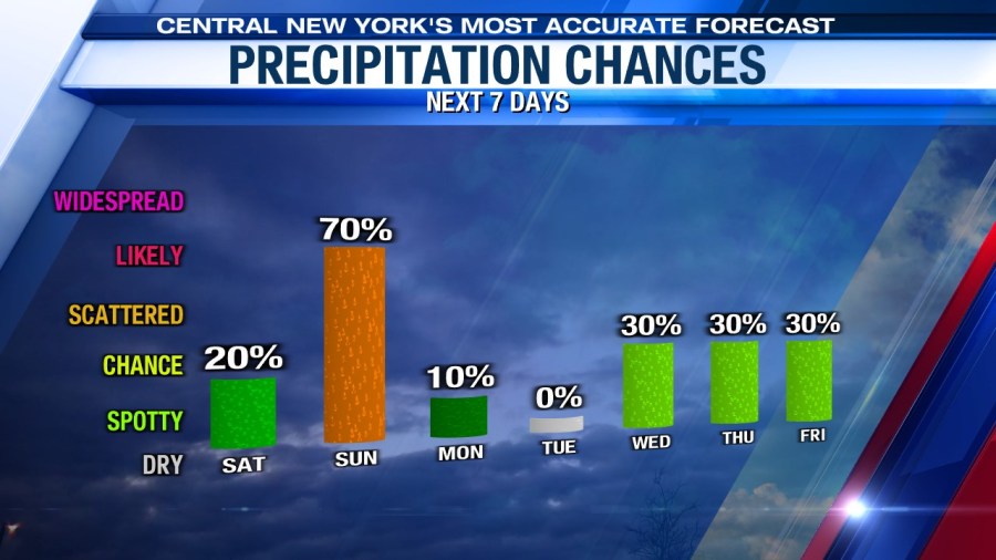
Sunday is looking to be the wetter of the two weekend days as an area of low pressure and cold front approach from the west. Expect showers and some pockets of steadier rain to be with us, so plan accordingly for the Mountain Goat race!
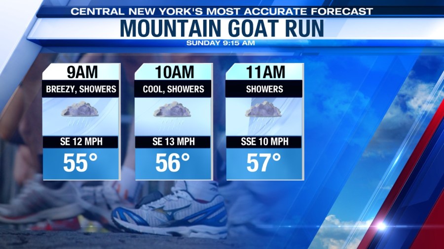
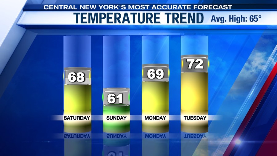
It’s a breezy and cooler weekend too thanks to more clouds and the showers. Highs on Saturday should make the mid to perhaps upper 60s, and probably low 60s on Sunday for Cinco De Mayo.
Sun to start next week
An area of high pressure builds into the Great Lakes region pushing the low pressure out of central New York. After a cloudy start it turns out sunny in the afternoon. Monday is going to be noticeably warmer than Sunday with highs expected to be near 70.
That area of high pressure begins to weaken early Tuesday, but central New York is still dry with a mix of sun and clouds. Temperatures on Tuesday are expected to be slightly warmer than Monday with highs in the low 70s.
Mild and stormy Wednesday
Low pressure takes the spot of the high pressure over the Great Lakes late Tuesday, early Wednesday morning. Scattered showers are expected in the morning giving way to a mix of sun and clouds around midday as the warm front moves to our north.
More showers return in the afternoon Wednesday and there could be a few thunderstorms. Highs on Wednesday should be mild near the mid-70s.
Check out the latest 7-day forecast.


