
Showers and a few feisty storms Tuesday
SYRACUSE, NY (WSYR-TV) – Stays mild, but have the umbrella ready to go late tonight into Tuesday. Any severe storm threat? Details are below…
Unsettled into Tuesday
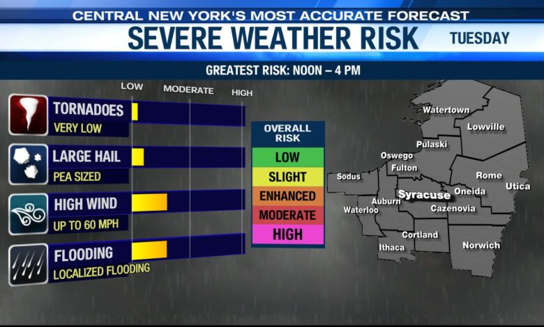
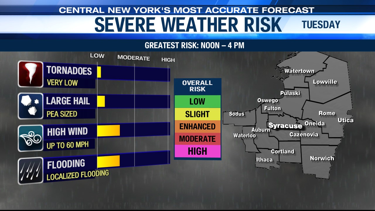
A cold front and area of low pressure in the Great Lakes region moves into central New York Tuesday. Ahead of the front, there will be a few showers and possibly a storm or two overnight, and better odds of more numerous showers and storms Tuesday afternoon. A few of the storms could have gusty, damaging winds to go along with some hail and heavy downpours.
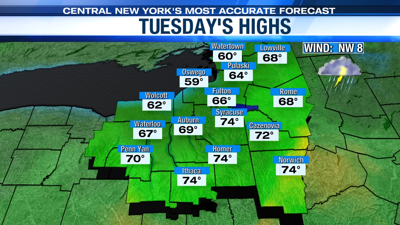
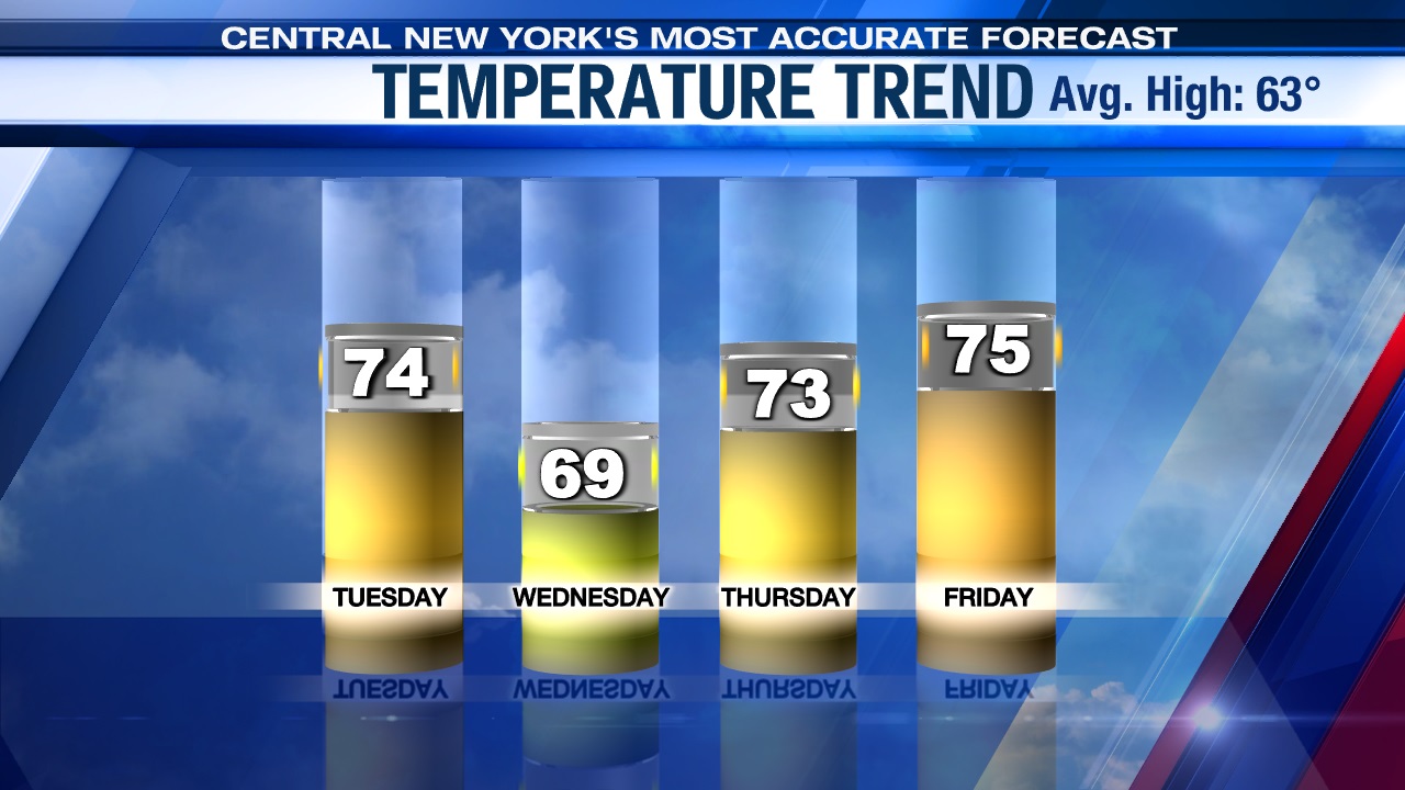
Lows drop into the mid-50s tonight, and highs reach the low to mid-70s on Tuesday.
Cooler, but still nice midweek
In the wake of Tuesday’s cold front, clouds and a touch of drizzle start Wednesday, but we turn drier as the day progresses with some sun developing for the afternoon. Highs are cooler, but still above average, as we feel the upper 60s to around 70.
Even nicer and warmer late week!
Other than a little disturbance swinging across northern and NY Wednesday night/Thursday morning that may trigger a few showers well north and east of Syracuse, it’s sunny and comfortably warm Thursday and Friday with high pressure in charge.
The sun may fade behind increasing clouds later Friday afternoon with a very slight chance of a shower towards sunset. We think the next weather maker likely holds off on impacting CNY not until Saturday, but we’ll keep an eye on this.
Highs Thursday should climb into the low to mid 70s, while we feel a breeze and the mid-70s to end the week with humidity levels remaining in check.
Check out the latest 7-day forecast.


