
Damp start, but nicer finish to Monday
SYRACUSE, NY (WSYR-TV) – We stay warmer than average into the start of the new week, but do we need to keep the umbrellas handy, and any shot of 80-degree temperatures first part of week?? Details are below…
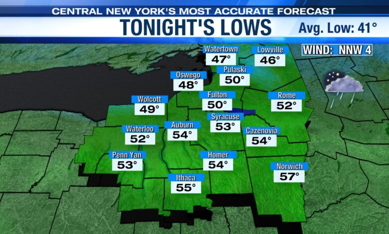
A few more showers overnight
Mostly cloudy and mild with a passing shower or two and or a bit of drizzle. It turns less humid during the night too with lows in the low to mid 50s. Also, watch out for some patchy dense fog to develop overnight.
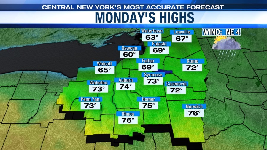
Not quite as warm Monday
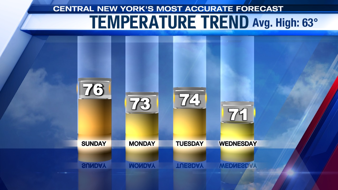
We were hopeful for an 80-degree day on Monday, but the latest model guidance has a cold front coming out of the north from southern Ontario tonight into Monday. The best chance for temperatures reaching 80 now looks to be in Pennsylvania or maybe the Southern Tier of New York. Yes, still warm/mild here Monday, but not the mid summery warmth that we thought we’d feel for the first time in 2024.
A few morning showers will give way to a mix of sun and clouds. Even though cooler air will be coming out of the north, the developing afternoon sun still helps us warm into the low to mid 70s to start the week, while cooler 60s are felt east of Lake Ontario.
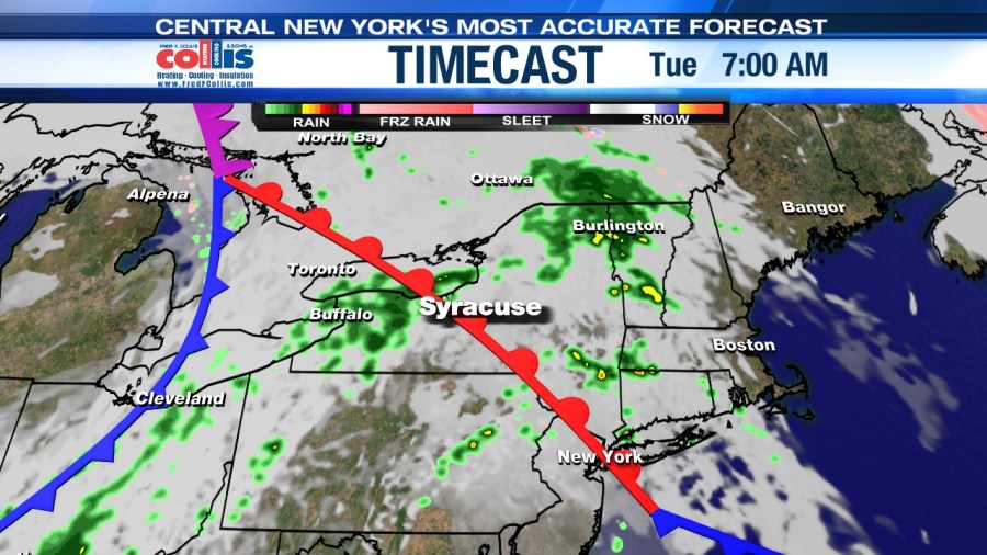
Unsettled on Tuesday
A cold front and area of low pressure in the Great Lakes region moves into central New York Tuesday and produces some showers and storms during the late morning and afternoon. Highs will reach the low to mid-70s.
Cooler, but still nice midweek
In the wake of Tuesday’s cold front, clouds and a touch of drizzle start Wednesday, but we turn drier as the day progresses with some sun developing for the afternoon. Highs are cooler, but still above average, as we feel the upper 60s to around 70.
We slowly turn milder the last half of the week with some more sun too!
Check out the latest 7-day forecast.


