
Warming up to begin the weekend
SYRACUSE, NY (WSYR-TV) – As the last weekend of April begins, temperatures are going to rise, and keep rising. But will we be dry? Details are below…
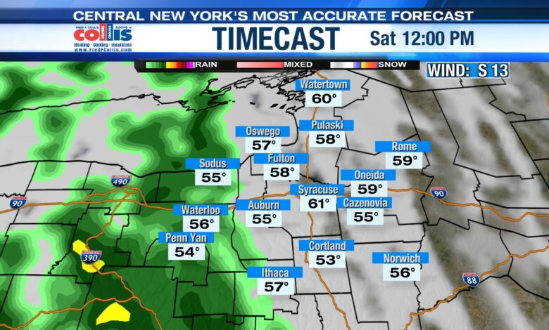
Do we stay dry for the last Saturday of April?
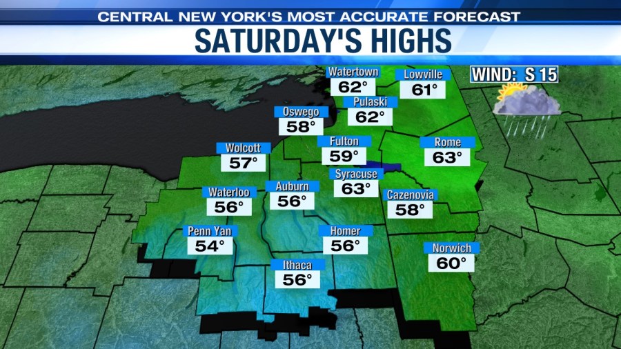
Temperatures are finally going to start going up as we approach the last weekend of April! Saturday starts out with a mix of sun and clouds, and highs around the low to mid 60s. In the afternoon, a warm front moves in out of the southwest bringing steady rain.
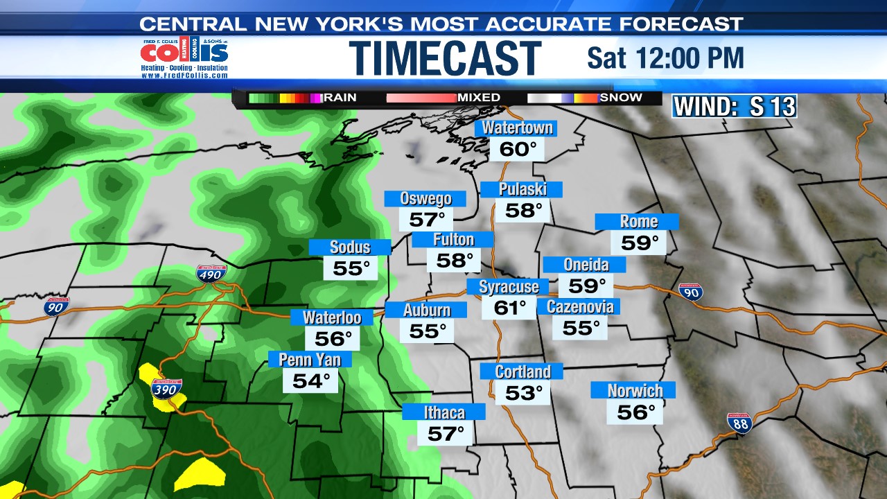
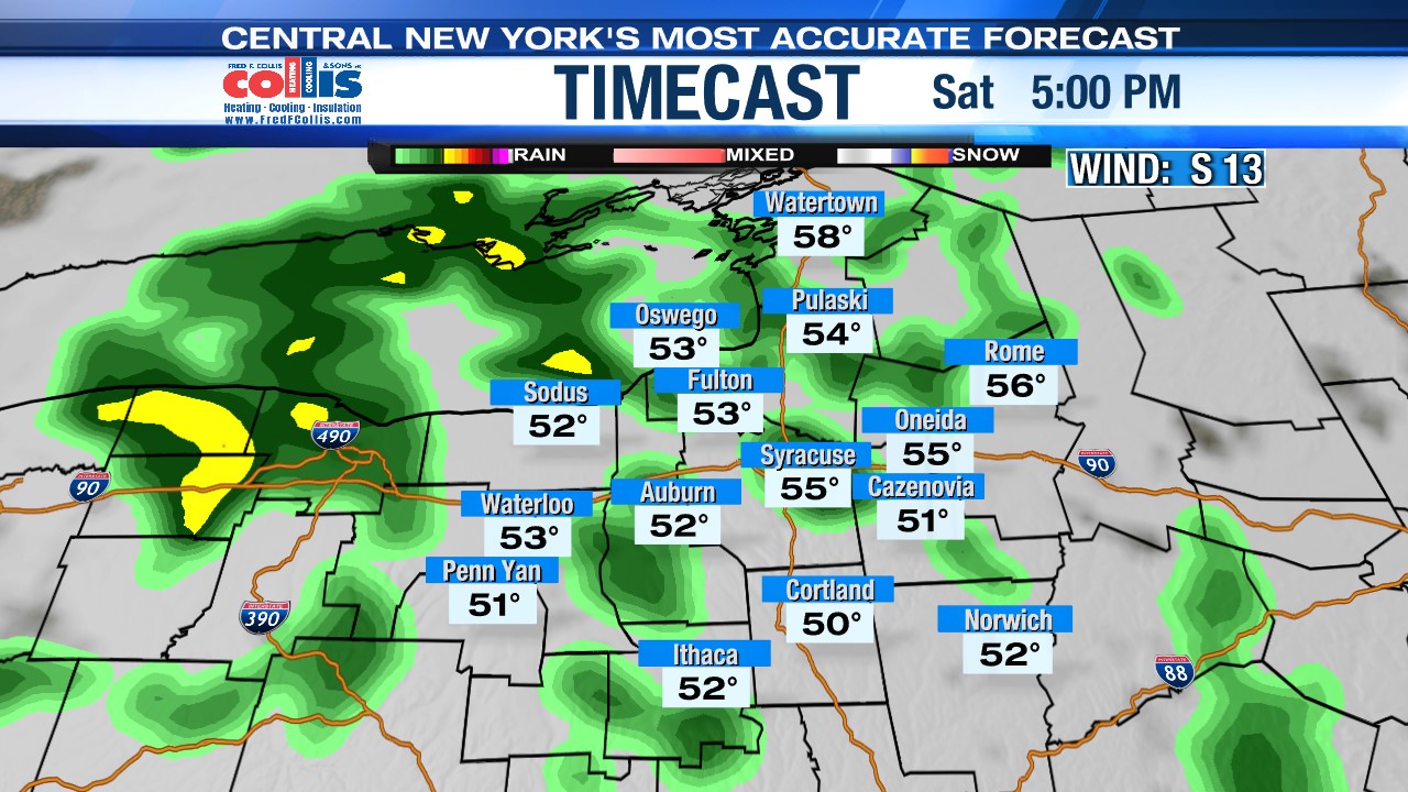
The temperature falls as rain cools us down into the mid to upper 50s setting us up for a mild Saturday night with lows around 50.
Warm and humid on Sunday
It looks even warmer with more dry time than not on Sunday as the warm front moves to our north. Highs Sunday in the mid to upper 70s.
Sunday morning starts with a mix of sun and clouds before our first chance of a shower near noon. Sunday afternoon looks to be our best chance for thunderstorm activity. For the first time this spring you’ll also notice an increase in the humidity.
A very noticeable difference compared to Saturday, but wait until you feel what the start of next week has in store…
Even warmer on Monday!
As we get closer to the start of May, temperatures are going to keep rising with the high on Monday nearing 80! Along with the warm temperatures, that’ll help fuel some thundershower activity near the Finger Lakes during the afternoon.
Check out the latest 7-day forecast.


