
Mainly clear & cool tonight
SYRACUSE, NY (WSYR-TV) – While sun and mild temperatures make Tuesday feel like spring, rain returns midweek, but does it last through the rest of the week? Details below…
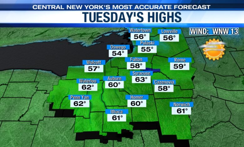
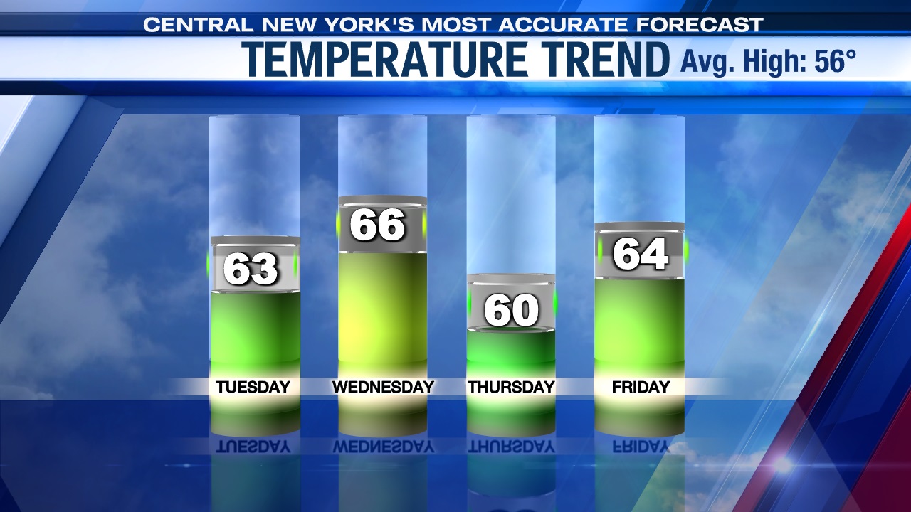
Spring-like Tuesday
High pressure builds in out of the west overnight Monday into Tuesday setting central New York up for the pick day of the week Tuesday.
We start in the 30s to low 40s Tuesday, but lots of mid-April sunshine pushes high temperatures into the low to mid 60s which will make Tuesday pleasant and comfortable.
Rain chances return midweek
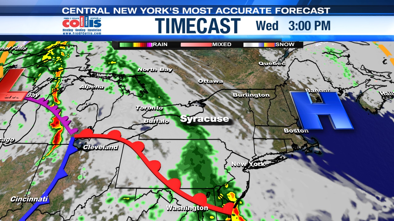
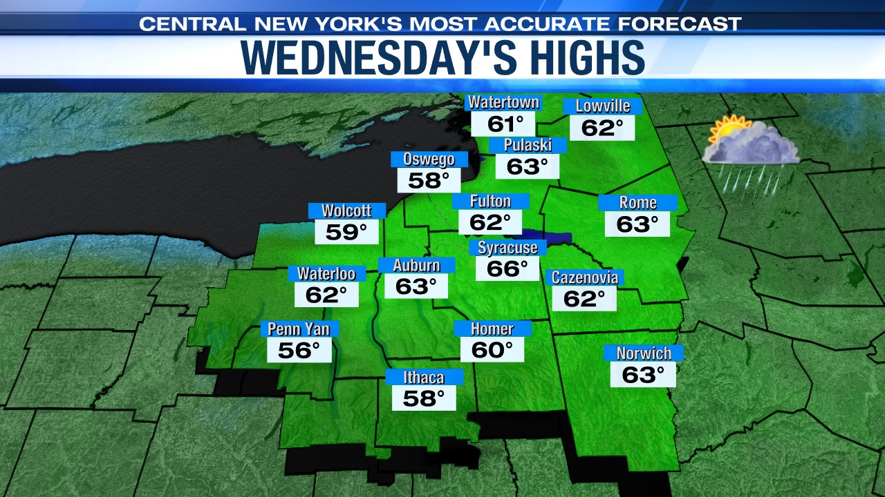
Wednesday starts cool, possibly a bit frosty for some, and sunny but turns cloudier during the afternoon with a bit of rain trying to build in from the west after 3 or 4 pm in advance of a weakening storm system.
Highs Wednesday before the rain arrives should make the mid-60s.
Wet, breezy Thursday
Overnight Wednesday into Thursday, a weakening area of low-pressure and its occluded front slides in from the Great Lakes region which produces a showery, and dampest day of the week Thursday.
Thanks to all the clouds and showers on Thursday, highs will struggle to get out of the 50s.
Any better come Friday?
At this point, it does look drier with even maybe some sun at times on Friday, but during the afternoon an approaching cold front possibly triggers a few showers during the afternoon.
Thanks to a drier Friday with at least some breaks of sun, we think readings climb back into the mid-60s to round out the week.
While Friday is in the mid-60s, will this mild air stick around into the weekend?
Check out the latest 7 day forecast.


