
Some showers/storms heading into midweek
SYRACUSE, NY (WSYR-TV) – Coming off the excitement of the total eclipse, we do have something to be happy about in Tuesday’s weather. It was the warmest day of the year so far, and we may flirt with a record high. Details are below…
Record warmth Tuesday
After most reached the 60s on Monday, high temperatures climbed all the way into the 70s Tuesday with plenty of sunshine! By the way, Syracuse reached 78° breaking the old record high is 77° set back in 1945.
Keep in mind, the average high is in the low 50s for this point in the month of April.
Rain chances return
It’s not a washout and it stays mild.
First, out ahead of an approaching cold front, a few showers and even t-storms move through from Syracuse north during the overnight.
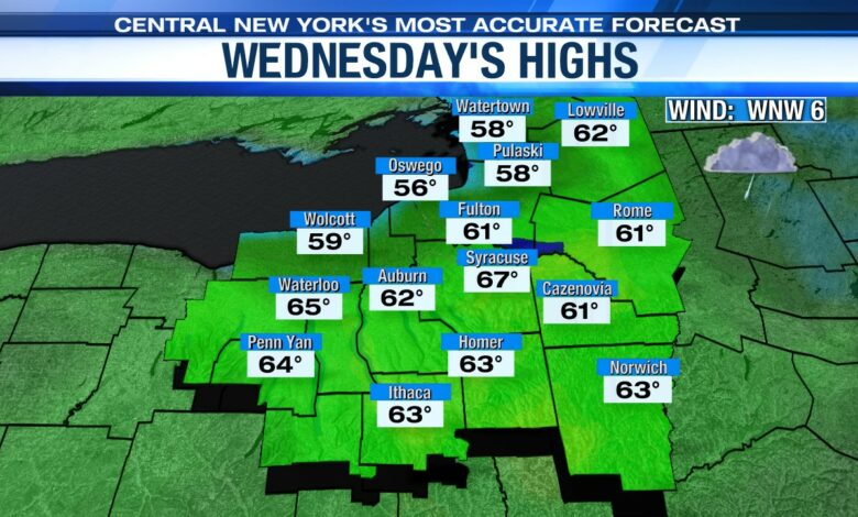
This weakening cold front slides though Wednesday with scattered showers and perhaps some thunder, especially from Syracuse east. A record high is not likely on Wednesday but we stay mild for early April with mid-60s.
The cold front swings through midday Wednesday so we think any showers or even thunderstorms would shift well east of Syracuse by the evening commute.
Gusty winds return
Gusty southerly winds kick up for Thursday. South southeast winds could gust to 30 mph. You can expect scattered showers and highs well into the 60s to possibly low 70s with enough dry time.
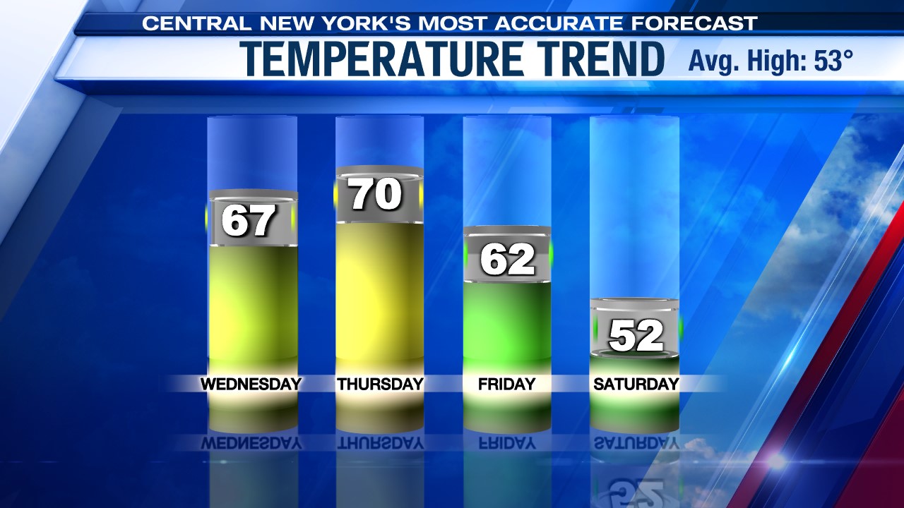
We cool back down with wind and some rain sticking around late in the week into the start of the weekend too.
Stay tuned for updates.


