
A bit more winter weather to deal with in CNY
SYRACUSE, NY (WSYR-TV) — Our dreary weather pattern continued Thursday. When will we dry out and warm up again? Find out below…
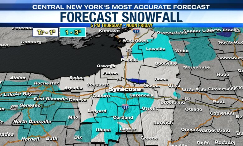
A bit more snow late week
An additional coating to an inch of snow is possible for many spots Thursday night into the start of Friday mainly on grassy surfaces. 1 to 3 inches is possible across higher terrain areas like the hills south of Syracuse and the Tug Hill Plateau.

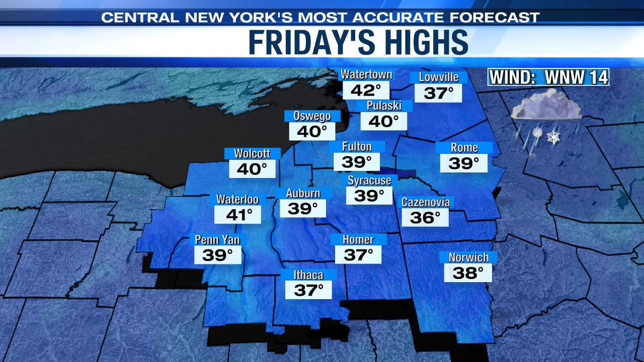
Occasional snow and rain showers continue on Friday, but no significant/impactful snow is anticipated due to marginally cold temperatures, generally above freezing, and generally lighter snow too. The snow melts quickly on the roads
It doesn’t feel much like April on Friday. For many, temperatures fail to get out of the 30s as we end the week.
Turning drier this weekend
A few rain and snow showers will linger into Saturday as an area of low pressure remains stalled out to our east over the Gulf of Maine. As this low begins to finally pull away Saturday night into Sunday, drier weather will arrive.
Along with some sunshine returning on Sunday, highs climb to more seasonable levels in the low to mid 50s.
Hopefully the skies remain favorable for Monday and the solar eclipse. Click here to get the latest Storm Team Forecast.


