Snow showers, few squalls taper after 9 or 10
SYRACUSE, NY (WSYR-TV) – Spring is about to officially start at 11:06 tonight, but Old Man Winter has other ideas. Details below…
Chilly, more snow on the way
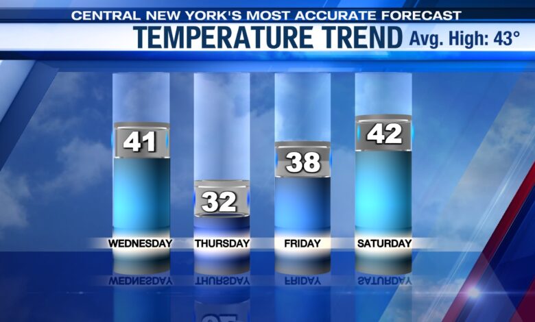
More unseasonably chilly air and at times snowy weather continues across settles CNY this week.
High temperatures the rest of the week will only be in the 30s to near 40 along with wind chills in the 20s and at times teens. We bottom out temperature wise on Thursday when highs struggle to reach freezing!
Where’s the snow heaviest?
The focal point for lake effect snow through the first part of Wednesday will be east of Lake Ontario, particularly for the Tug Hill Plateau.
Snow showers with pockets of heavier snow is expected this evening for much of CNY, including Syracuse before tapering to scattered lighter snow showers/flurries for the late evening and overnight.
Roads could get a little slick and sloppy this evening across CNY before improving for the late evening and overnight. Meanwhile, we do think roads are going to be slick/sloppy east of Lake Ontario, especially around the Tug Hill, through much of tonight.
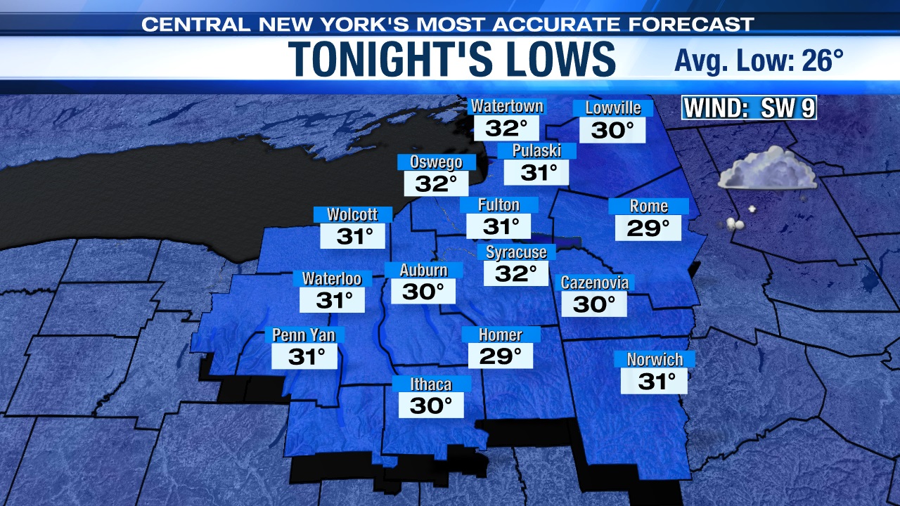
Lows tonight drop into the upper 20s to low 30s.
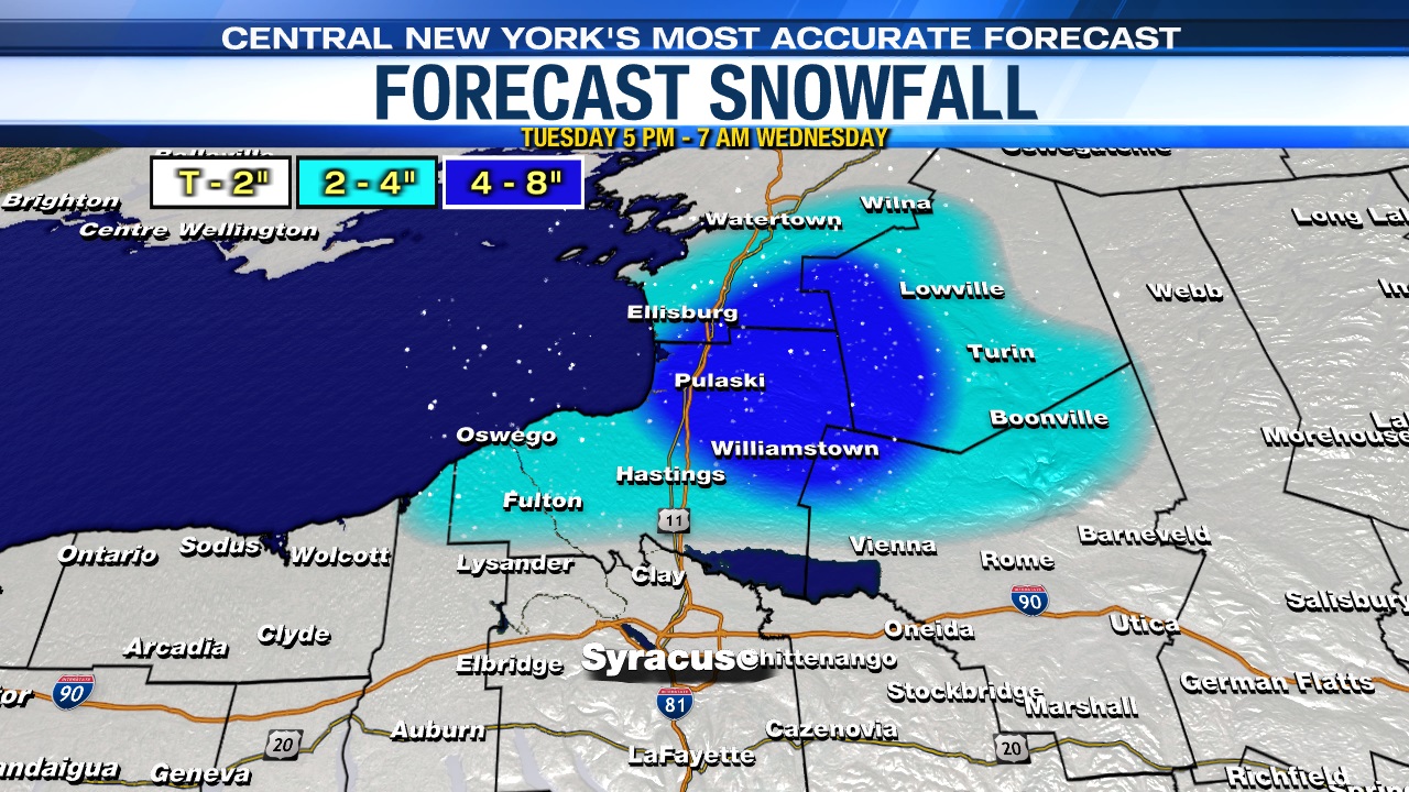
How much snow falls through tonight?
The most persistent snow will remain over the Tug Hill through the start of Wednesday where another 4 to 8 inches is expected, while most of CNY picks up another coating to 2 inches, including Syracuse.
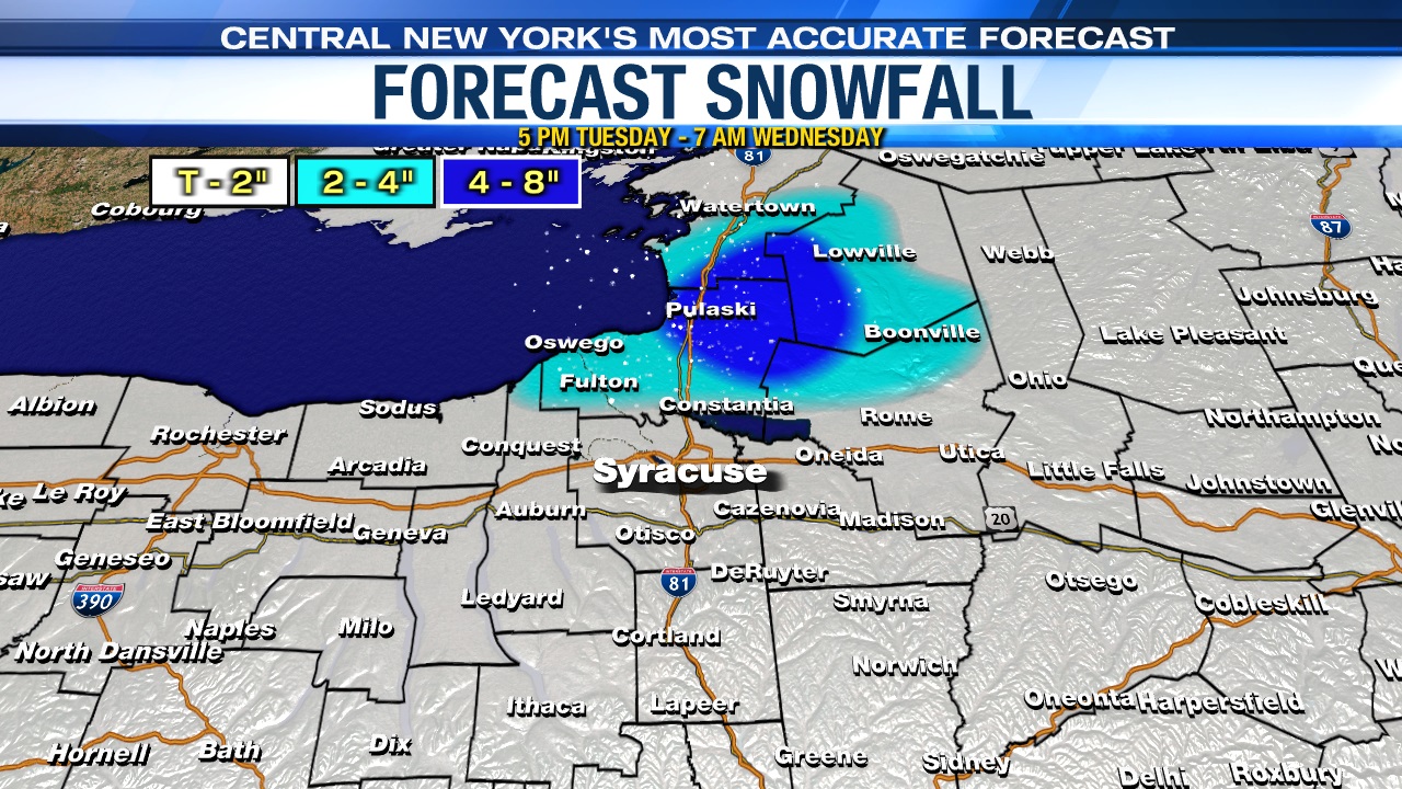
Parts of Oswego, southern Jefferson and northern Oneida counties away from the Tug Hill could get 2 to 4 inches, and a few spots over the hills south of Syracuse could get slightly more than 2 inches too.
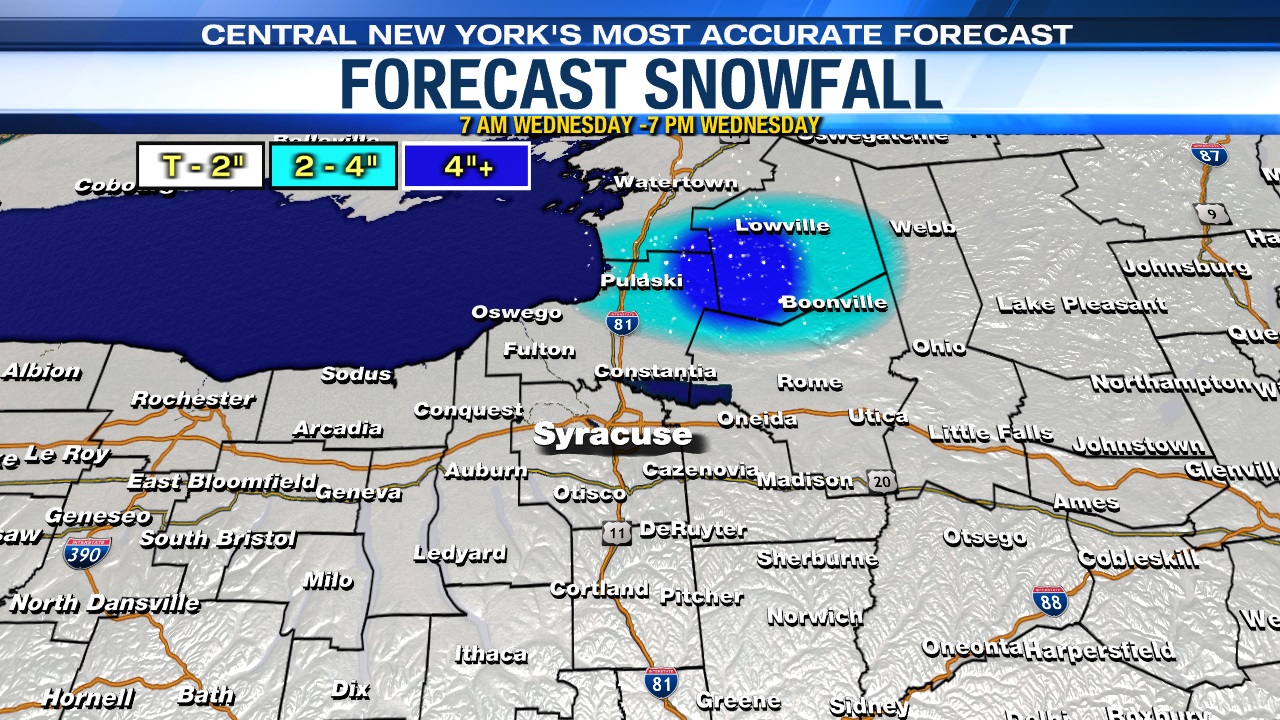
Stays wintry through midweek…
A burst of snow comes through midday/early afternoon Wednesday followed by scattered snow showers/squalls into the start of Wednesday night. An additional coating to an inch or two falls for most Wednesday, but upwards 2 to 4” + is possible east of Lake Ontario.
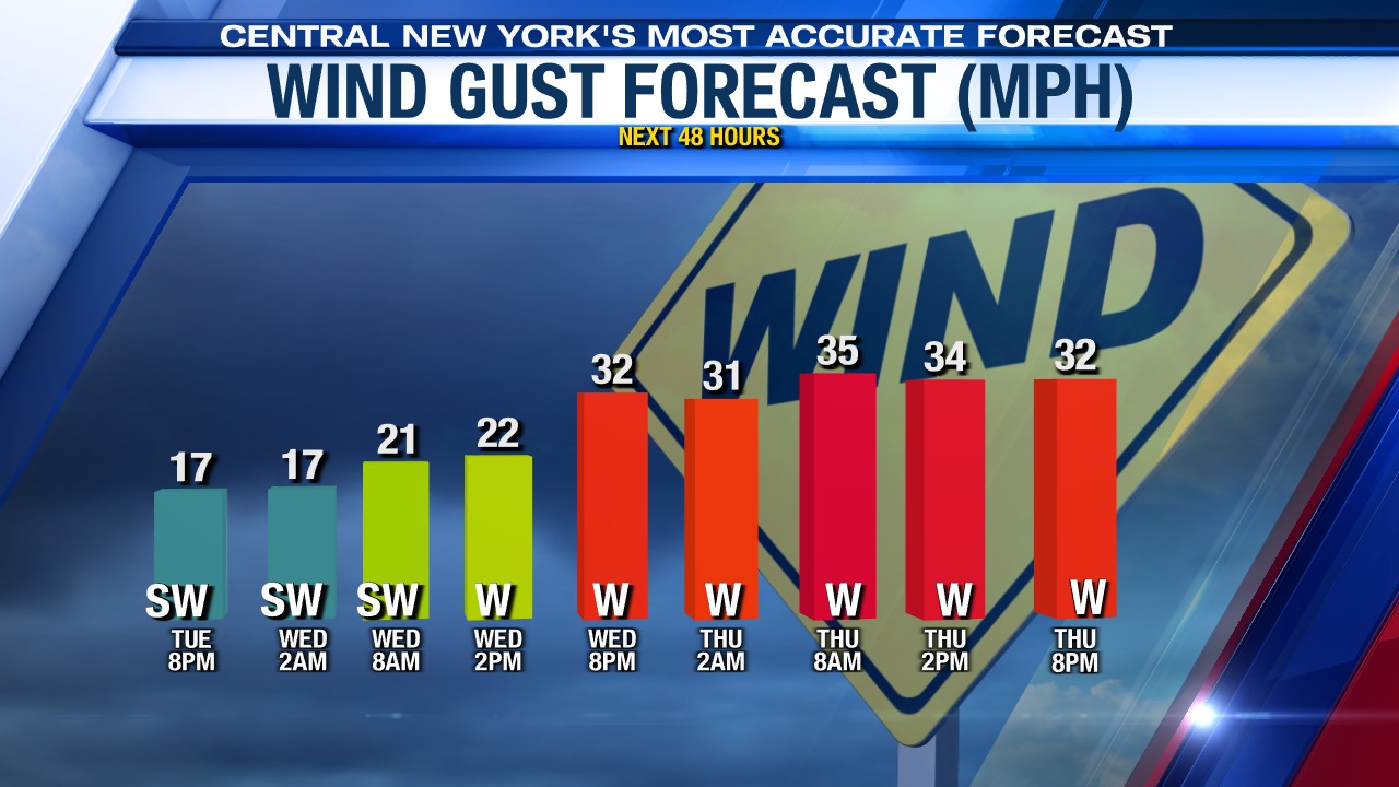
Winds also crank up Wednesday during the day gusting to between 30 and 40 mph which continues into Thursday too.
Additional accumulations are likely Wednesday night into the start of Thursday southeast of Lake Ontario, probably including Syracuse, as the air over us gets even colder.
Oh, and some wintry weather possible to start the weekend
While this is all happening midweek, we aren’t losing focus on Friday night into the start Saturday.
Low pressure is moving up the coast Friday night but there are plenty of question marks as of Tuesday night as to how quickly this storm strengthens and how cold it will be which likely determines how much snow falls in central New York.
Stay tuned for updates.