Winter trying to hold on..
SYRACUSE, NY (WSYR-TV) – Well… false spring was nice while it was here. Now we’re slipping back to some wintry weather with colder air and occasional accumulating snow this week. Details below…
Cold, more snow on the way
Hope you didn’t put away the winter coats, snowbrushes, gloves, and boots. We’ll need them again this week. A stretch of chilly and at times snowy weather settles back over CNY this week.
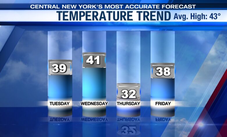
High temperatures this week will only be in the 30s to near 40 all week long with wind chills in the 20s and at times teens. It appears we bottom out temperature wise on Thursday when highs struggle to reach freezing!
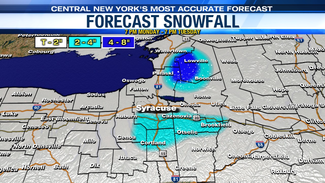
Where’s the heaviest snow?
The focal point for lake effect snow through Tuesday will be east of Lake Ontario, particularly for the Tug Hill Plateau. This is where a Winter Weather Advisory is in effect for the counties east of Lake Ontario through 5 a.m. on Tuesday with more winter alerts expected across CNY, possibly including Syracuse this week.
Overnight into Tuesday occasional snow showers and a few squalls will be fair game across the rest of the area, especially over the eastern Finger Lakes/Syracuse area points north and east.
How much snow falls?
Again, while snow showers are possible for many spots Monday night into Tuesday, the most persistent snow will remain over the Tug Hill through Tuesday. Total snow accumulations will be on the order of 4 to 8 inches, while amounts of a coating to an inch or two will be found elsewhere, including Syracuse. There could be slightly higher totals in spots over the hills southeast of Syracuse too.
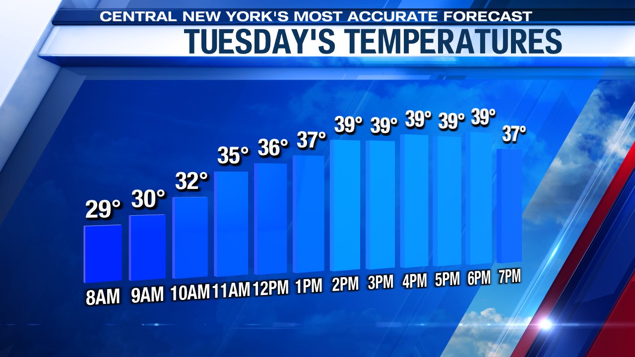
The untreated roads could be a bit slick and sloppy in the morning as temperatures are below freezing. However, temperatures go above freezing and stay there in the afternoon. What does that mean? Even though there are more snow showers around Tuesday afternoon, the impacts on travel would be minimal as the snow ends up melting on contact with the roads.
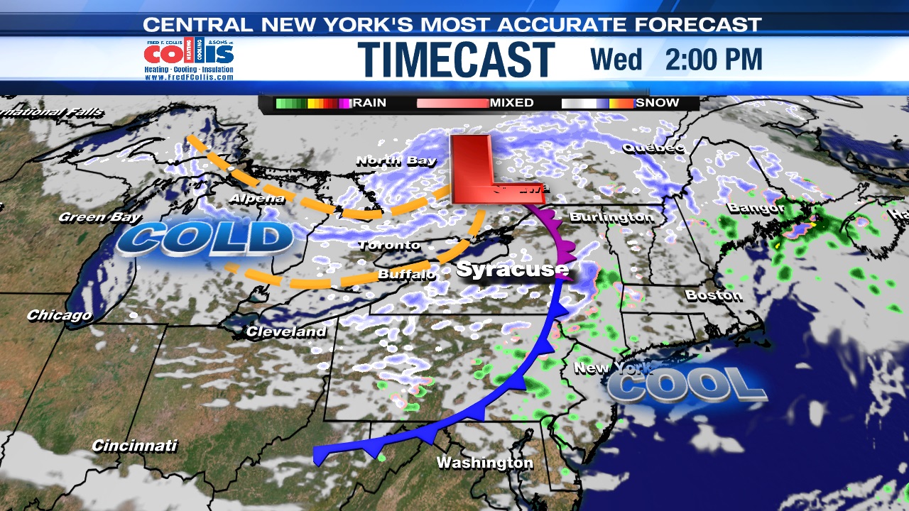
Stays wintry through midweek…
Occasional snow showers and areas of lake snow with additional accumulations expected Wednesday into Wednesday night as the air over us gets even colder even though spring officially starts at 11:06 p.m. Tuesday.
Oh, and some wintry weather possible to start the weekend
While this is all happening midweek, we aren’t losing focus on Friday night into Saturday.
Low pressure is moving up the coast Friday night but there are plenty of question marks as of Monday night as to how quickly this storm strengthens and how cold it will be which likely determines how much snow falls in central New York.
Stay tuned for updates.