Here comes the rain again…

SYRACUSE, N.Y. (WSYR-TV) – Temperatures continue to decrease a bit heading into Wednesday, but the odds of rain will be going up. Details are below…
Turns cooler and damp midweek
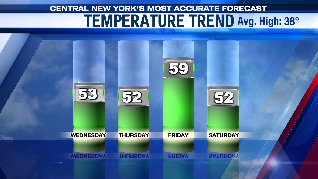
After a cooler, damp for some Tuesday, it looks even cooler Wednesday, but our rain chances will increase.
After midnight a cold front closing in on CNY from the west will trigger a better chance of scattered showers overnight. Lows drop into the mid-40s tonight.
Lighter rain showers Wednesday morning should become a steadier rain for the late morning and afternoon as low pressure moves up along the slow moving cold front sliding through CNY Wednesday.
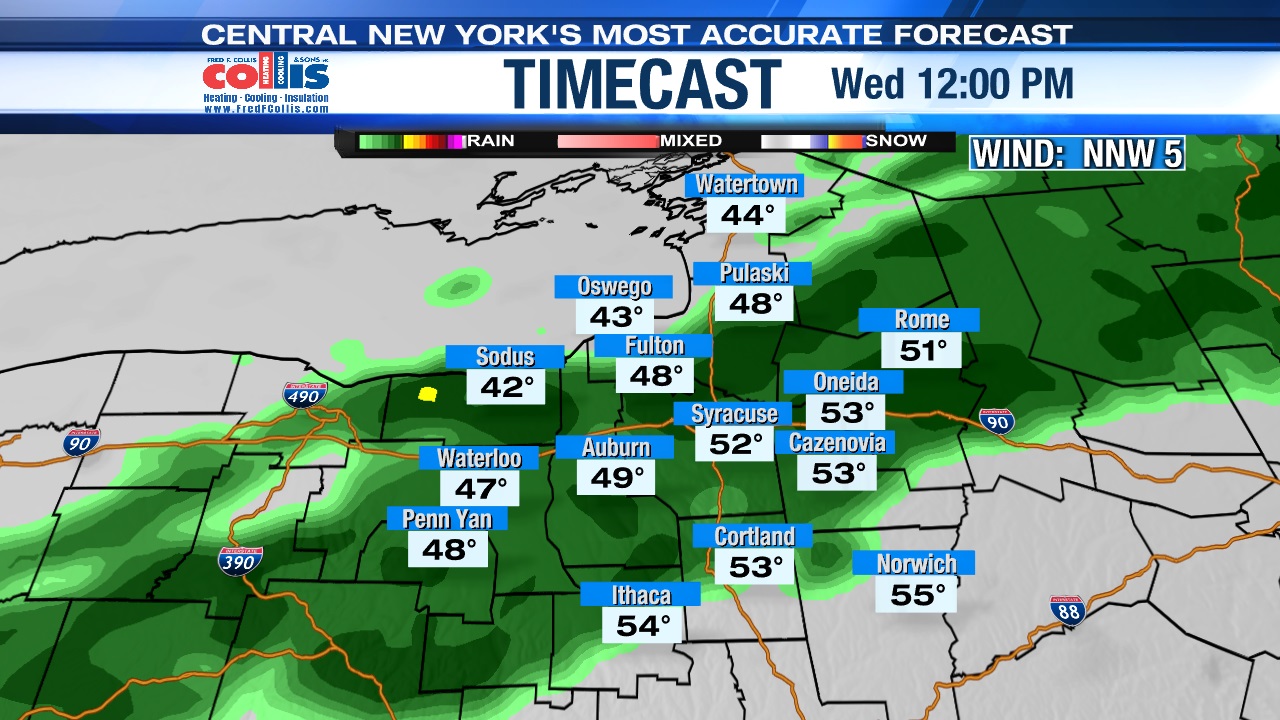
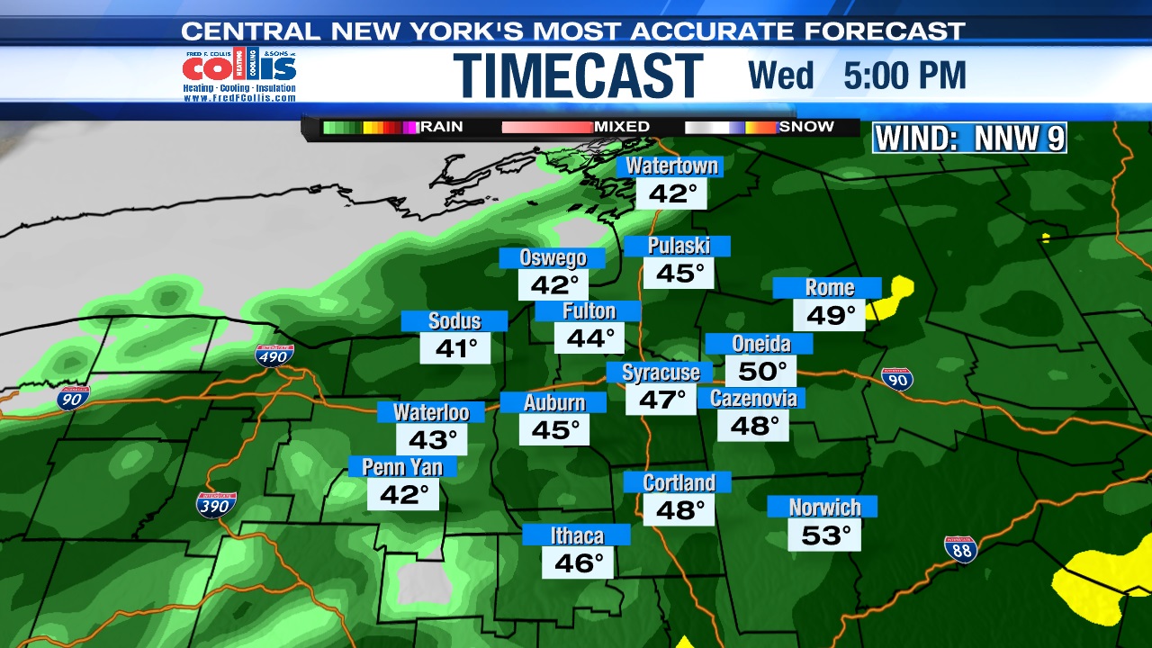
Temperatures will cool back to within a few degrees of 50 much of Wednesday with the coolest readings to the north and west of Syracuse and warmest to the south and east, or opposite of what happened Tuesday.
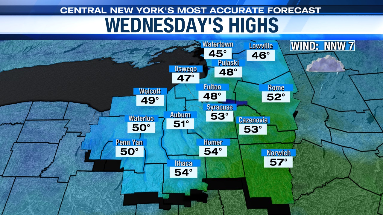
Note, that yes, it’s going to be cooler Wednesday, but for early March we are still going to be 10 to 15 degrees warmer than average.
Drying out to end the week
The front and wave of low pressure providing us the rain and cooler air Wednesday moves farther to the south and east Wednesday night into Thursday allowing high pressure to build in from Canada. This is the center of a dry air mass so we would expect increasing sunshine Thursday after a cloudier start as we again rise into the low 50s.
Friday looks great with more sunshine expected thanks to the above mentioned area of high-pressure remaining in control as it stays unseasonably mild. Highs to end the week are well into the 50s with light winds.
March returns over the weekend
Unfortunately, the nice weather we see to end the week doesn’t last into the weekend as a complex storm system comes our way from the middle of the country.
We initially start the weekend with some wind and rain showers but then cool enough Sunday for any rain showers to change some snow showers.
High temperatures go from the low 50s Saturday to within a few degrees of 40 Sunday. Stay tuned for updates on the chilly changes.