Brighter with record warmth Monday
SYRACUSE, N.Y. (WSYR-TV) – Sunday was a drier day, but most of CNY just couldn’t shake the cloud cover. Can we get some sun back out for Monday? Details are below…
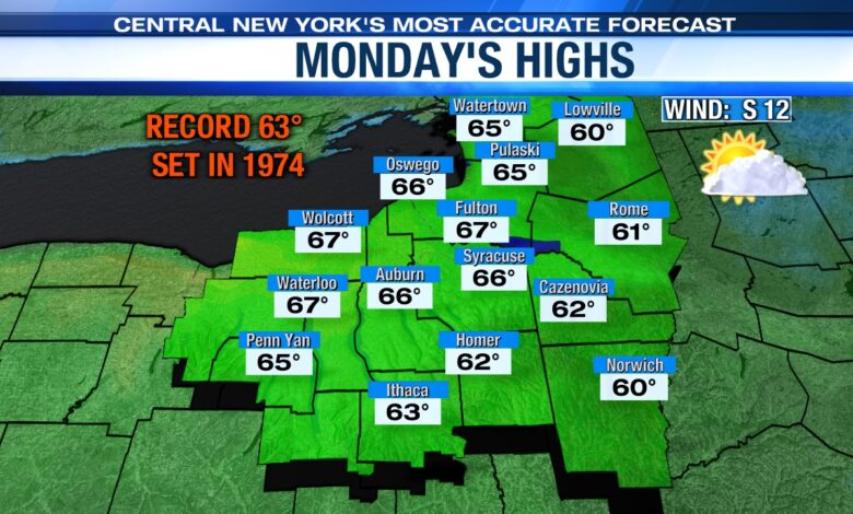
Looking at more record warmth!
We’re dealing with a little bit of patchy valley fog to being the day Monday, but we should see some more sun breaking through the clouds as the day progresses.
With some sun returning Monday and a steady southerly breeze, we should have no trouble warming well into the 60s. The record high for Monday is 63 set in 1974, and we have a good shot of breaking that record with mid to perhaps upper 60s.

Turns cooler and damp midweek
It stays very mild Monday night as clouds thicken, and the wind picks up. Lows won’t drop any lower than the upper 40s to around 50 for many!
The clouds moving in Monday night are ahead of a small wave of low pressure sliding up the East Coast. That will be close enough to us to produce more clouds on Tuesday and possibly some showers, especially east of Syracuse.

Thanks to the clouds and possibly a bit of rain, it’s cooler, but still a very mild Tuesday with highs in the upper 50s to around 60.
We expect a cold front to move in from the west on Wednesday with a better chance of some rain. Temperatures will cool back into the low to mid 50s.