That was fast: Winter weather about to depart
SYRACUSE, N.Y. (WSYR-TV) – After a snowy start to Thursday for many, the lake effect snow today will be replaced by milder weather and sun on Friday. Details below…
Lake effect snow winds down, finally!
Lake effect snow north of Syracuse finally tapers after midnight. Little if any additional accumulation is expected.
For the rest of central New York, the skies are clear overnight.
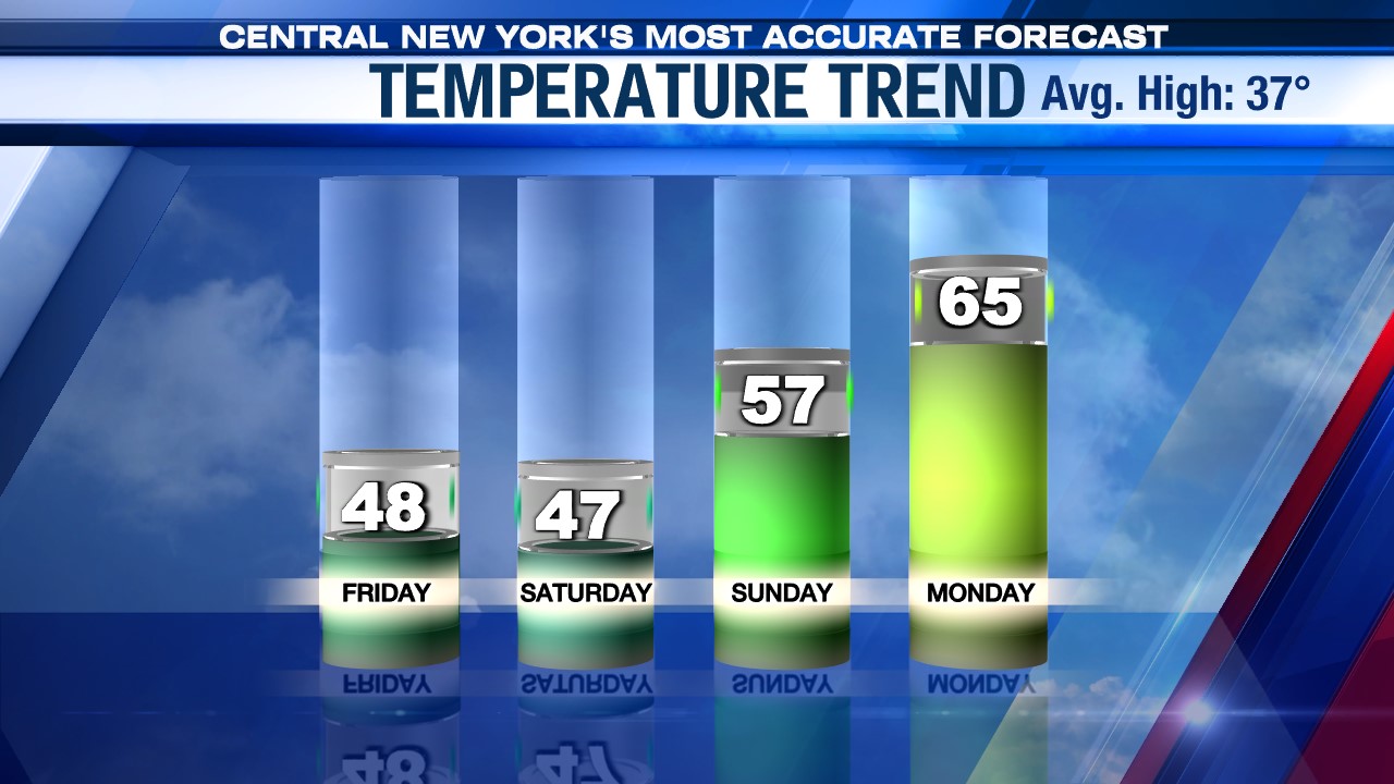
A return to spring weather Friday
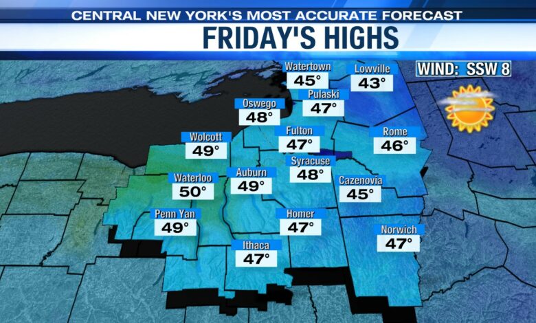
Our return to winter weather only lasts a day, as temperatures begin a warming trend on Friday.
Along with mostly sunny skies, expect unseasonably warm high temperatures in the upper 40s. By the end of the weekend, highs will even reach back into the 50s.
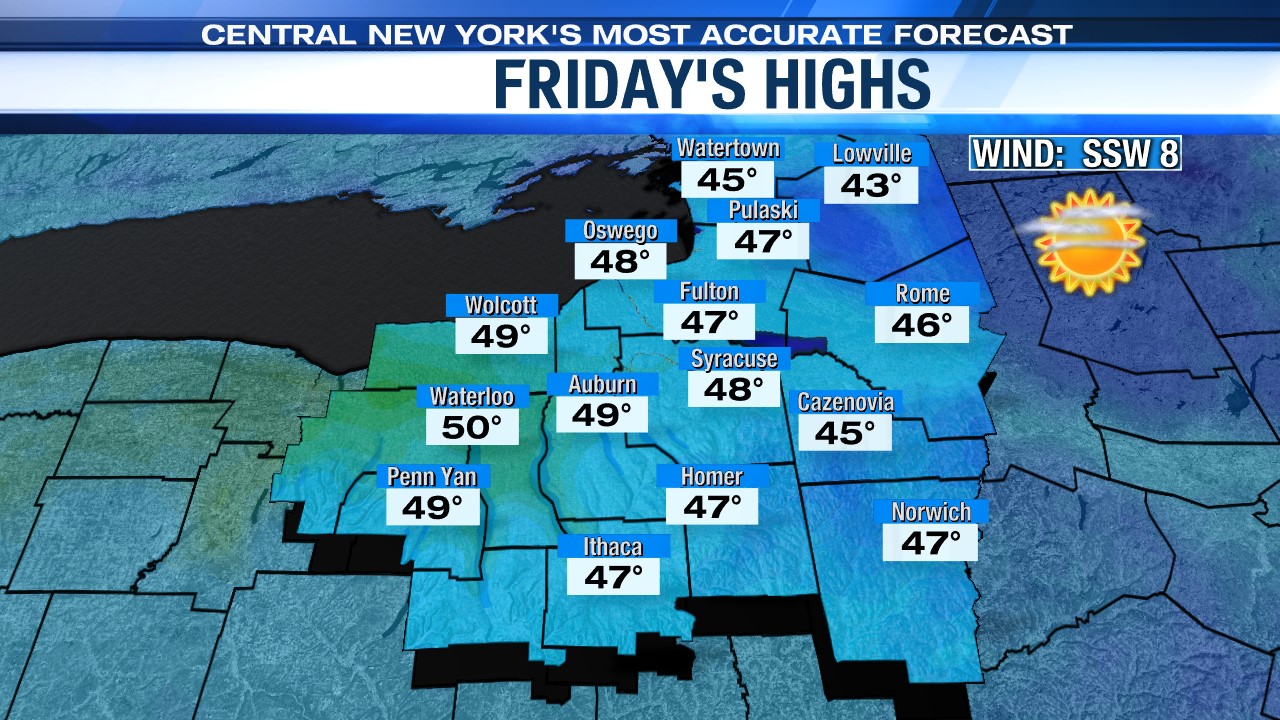
With all the sun and the fresh snowpack, it will be particularly bright day so have your shades ready and if you are heading out for a walk would suggest putting some sunscreen on your face to avoid getting a sunburn (no joke)
Wet start to weekend
Clouds quickly move in from the south Friday night as high pressure moves out to sea and our winds go into the south.
Precipitation is right on the heels of the clouds, and we would expect some rain in central New York before daybreak Saturday. It may even be cool enough in higher elevations east of Syracuse so the precipitation could start as some wet snow or freezing rain.
Precipitation continues Saturday but with temperatures in the 40s it looks like just some light rain during the daylight.
It is drier on Sunday. After a cloudy start there should be some sun in the afternoon. We are back into the 50s with even warmer weather in store for early next week!