Mostly cloudy and milder Saturday
SYRACUSE, NY (WSYR-TV) – Even though the first day of Spring isn’t until Sunday, March 20, it will definitely feel like it this weekend!
SATURDAY: Temperatures are chilly to start our Saturday morning, but we look to climb into the low 40s for high temperatures today which is above the average of 38° for this time of the year.
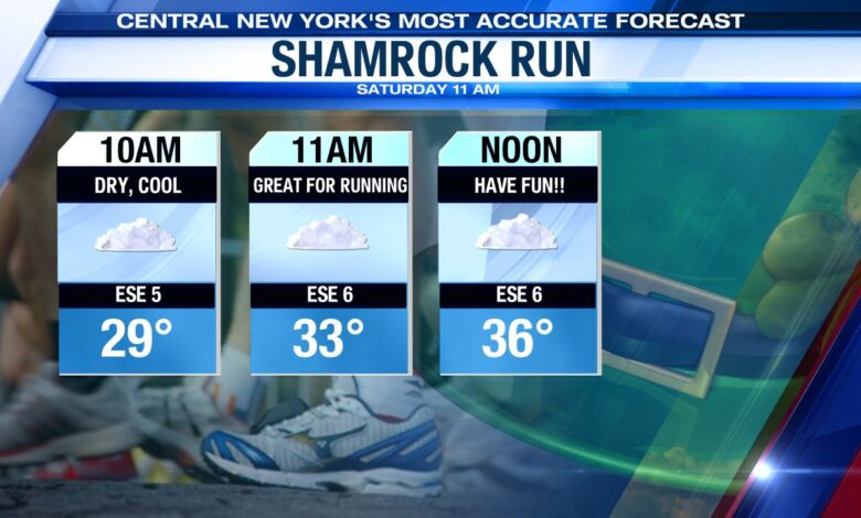
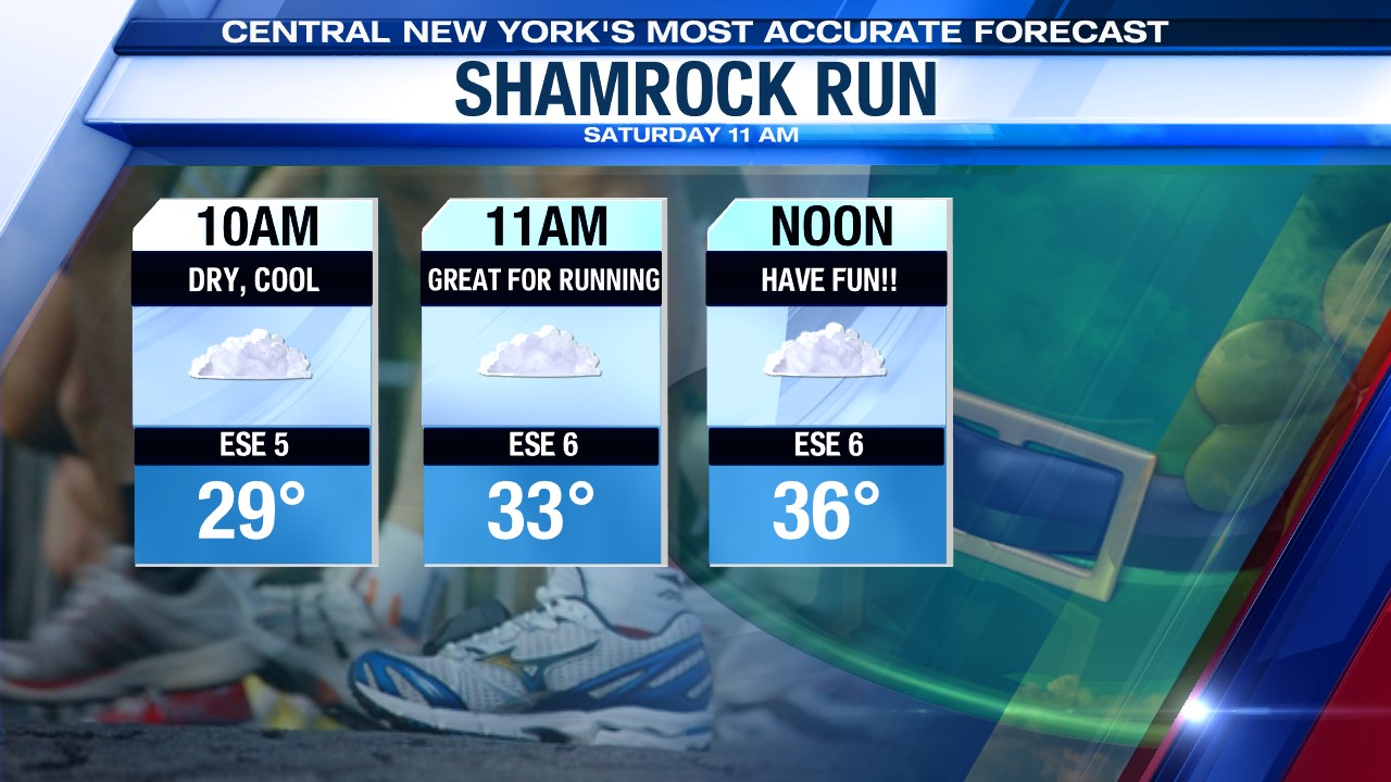
Skies will remain dry for the Shamrock Run Saturday morning, but there is the chance for a stray shower or two by the evening.
SATURDAY NIGHT:
Overnight, sky conditions look to stay dry and rather cloudy, but the winds will be on the increase from the south at 8-16 mph. these conditions will keep our low temperatures very mild around 40! Towards daybreak, we will see a few isolated showers across the Finger lakes and north of Syracuse.
SUNDAY:
Sunday is much warmer! We’re even on record watch Sunday as highs soar well into the 60s. The record high Sunday is 67° set back in 1946 in Syracuse. With enough dry time, we may give that record a run for its money!
The warmth doesn’t come without some sacrifice. Expect a round of steady rain first thing in the morning. There should be enough breaks in the rain midday to enjoy the warmth. A second round of showers with some thunder swings through Central New York in the afternoon.
With the rain on the snowmelt due to the milder temperatures, area rivers and streams will begin to rise Sunday. A few could come close to flood stage overnight Sunday.
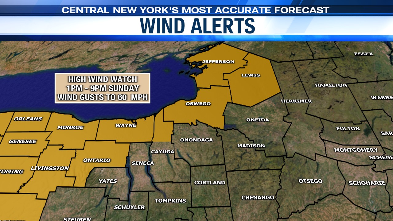
It is on the windy side Sunday with gusts out of the southwest 25-35 mph with gusts approaching 60 mph! The National Weather Service has issued High Wind Watches for Oswego and northern Cayuga counties from Sunday from 1PM until 9PM Sunday.
Don’t expect the spring-like warmth to stick around. It turns cooler again by the start of next week.