Quiet now but heavy snow on the way
SYRACUSE, NY (WSYR-TV) – After a spring feel in the air the first part of this week, the winter chill has returned setting the stage for a significant snowfall and possibly an icy mix for parts of Central New York too.
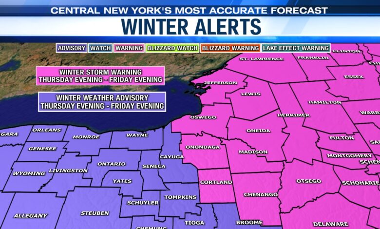
Winter Storm Warnings and Advisories have been issued for Thursday night through Friday due to the likelihood of significant wintry precipitation.
Ingredients for late week storm…
A cold area of Canadian high pressure supplies the cold air for the last half of this week. The energy source expected to trigger the storm is moving across the Southern Plains and into the Deep South Thursday.
Low pressure at the surface spins up across the Deep South Thursday and heads north up along a stationary front positioned across Pennsylvania/Northern Mid-Atlantic states Thursday night into Friday. This sets the stage for a messy end to the week across Central New York with a significant snowfall possible.
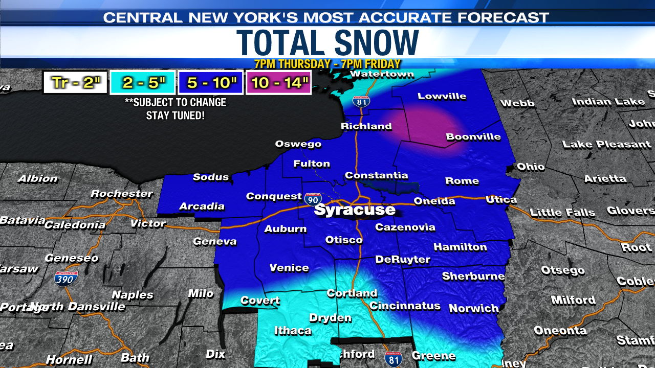
Here is our latest snowfall forecast (no changes from our morning update):
What we know…
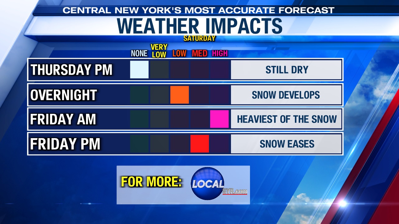
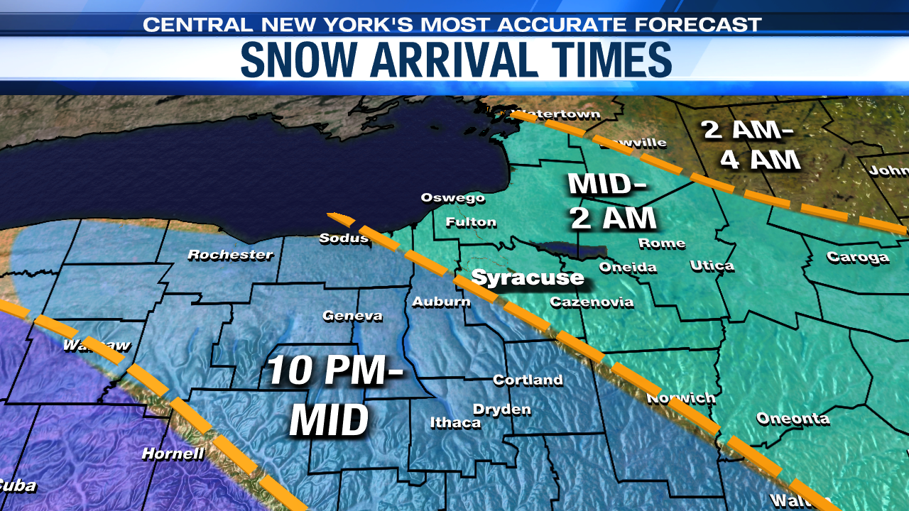
- Snow develops 10 p.m. to 1 a.m. from southwest to northeast.
- Snow becomes heavy overnight Thursday through sunrise Friday.
- There will be 3 to 6 inches of snow daybreak Friday.
- Best chance for sleet mixing with snow is sunrise Friday into mid-morning.
- The morning through lunchtime hours is expected to be the messiest/slickest for travel.
- Accumulating snow winds down quickly mid to late Friday afternoon.
Below are the biggest travel impacts we think occur with this storm…
What we are still fine tuning…
- How far north sleet extends Friday morning.
Who sees the most snow, and who sees more icy mix across CNY with this storm:
As of Thursday afternoon, we believe most, if not all the precipitation with this storm falls as snow north of the Thruway, while areas from Syracuse south have the best chance of seeing some sleet and a little freezing rain. This is still the trickiest part of the forecast as the computer models we use are still in disagreement.
How do different types of winter precipitation form?
This storm is a fast mover so by mid-afternoon the threat for accumulating snow is diminishing fast. In addition, temperatures should get close to freezing. For those two reasons alone, we should see an improvement in road conditions for the evening commute.
Northwesterly winds in the wake of the storm does open the door for a limited amount of lake effect snow Friday night into Saturday. There could be an additional light accumulation of snow from Syracuse west into the Finger Lakes.
Stay tuned to the NewsChannel 9 Storm Team for more updates on this storm heading into Thursday.