Tumbling temps Wednesday
SYRACUSE, NY (WSYR-TV) – Still feels like spring, but not for much longer.
At a glance:
- Winter chill returns Wednesday 40s drop to the 20s by late afternoon
- Rain showers transition to lake effect snow showers
- Thursday a quiet, colder day
- Watching for a more significant snow by Thursday night/Friday
WEDNESDAY:
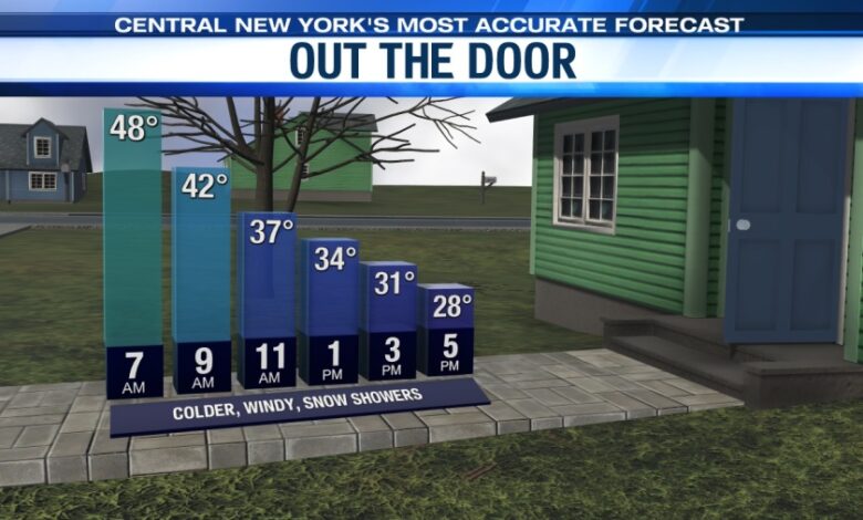
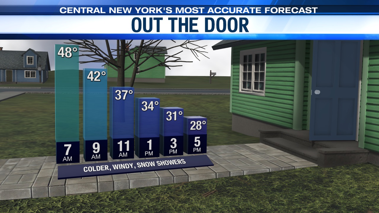
Don’t be fooled by the mild start to Wednesday, because after starting in the 40s to near 50 around daybreak, temperatures free fall back through the 40s and into the 30s and upper 20s by sunset.
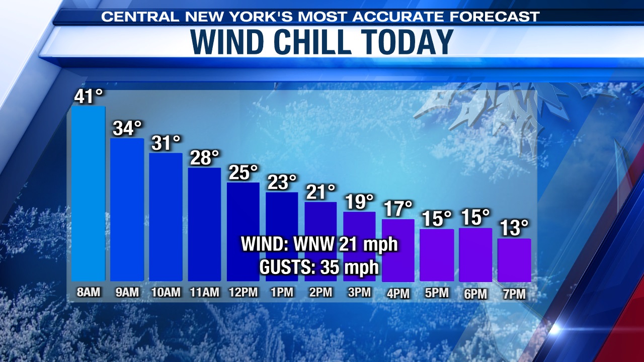
A gusty west-northwest wind also picks up, producing wind chills in the teens and low 20s during the afternoon!
Our advice to all heading to work early in the morning is to make sure you bring your winter jacket/coat because you’ll certainly need it by the time you come home later Wednesday!
Any scattered rain showers to start Wednesday change to snow showers with maybe a coating to an inch in some spots by day’s end.
WEDNESDAY NIGHT:
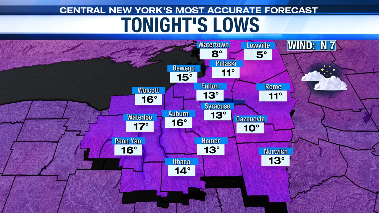
Evening snow flurries taper with some clearing later Wednesday night. Lows drop to within a few degrees of 10.
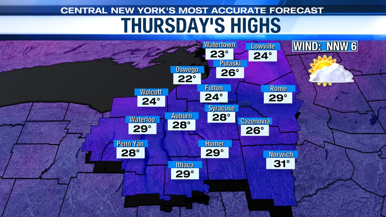
THURSDAY:
High pressure to the north provides a dry, but chilly Thursday with some sun. Highs struggle to get out of the 20s.
LATE WEEK:
We are still watching a moisture laden storm that could very well deposit several inches of snow and possibly a wintry mix, especially south of Syracuse, depending on the storm track late Thursday night into Friday. (A Winter Storm Watch goes into effect for most of Central New York Thursday lasting into Friday.)