Flooding potential later this week?
SYRACUSE, NY (WSYR-TV)
Our snowpack around CNY is shrinking, and it’s about to shrink even more as a storm system brings more warmth and rain towards the middle of the week.
What we have:
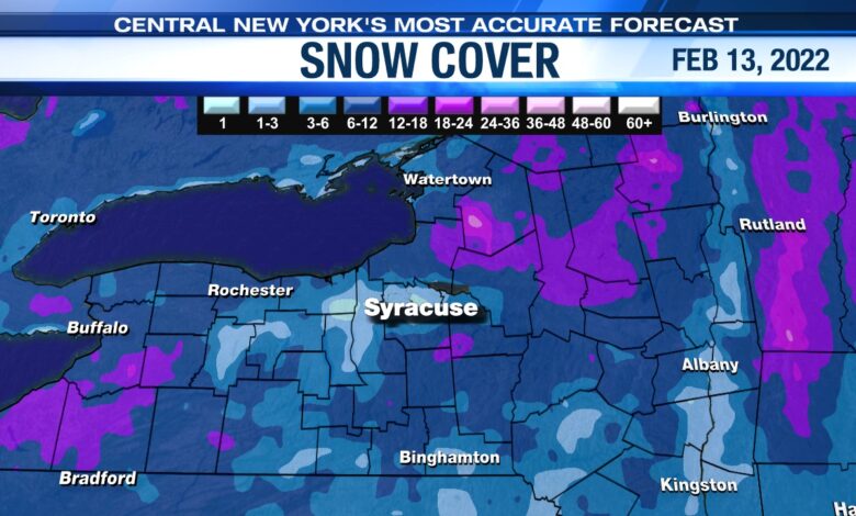
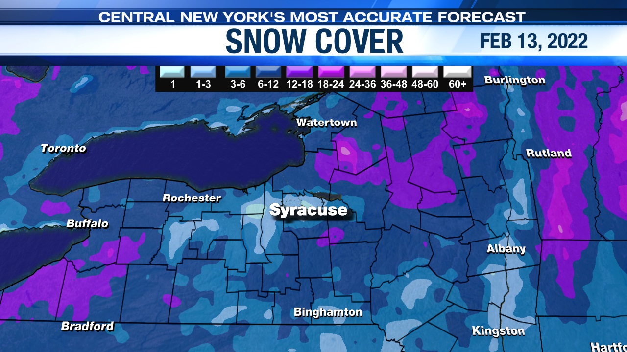
As of Super Bowl weekend, the snow depth at the Syracuse airport was 5”. The Tug Hill and the higher elevations south of Syracuse have a foot plus. This snow contains 1-2” worth of water.
Factor that in with the ice that has formed on local lakes and streams, and we could be dealing with at least minor flooding by the end of the week.
What we’re watching:
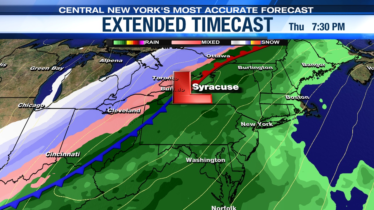
Thursday’s system is likely going to bring moisture up from the Gulf of Mexico. This means warmth, higher dew points and a gusty southerly breeze.
By Thursday afternoon, we have the likelihood of widespread rain. A strong cold front will change this to some snow by late Thursday night/predawn hours Friday but most of the precipitation will fall in the form of rain.
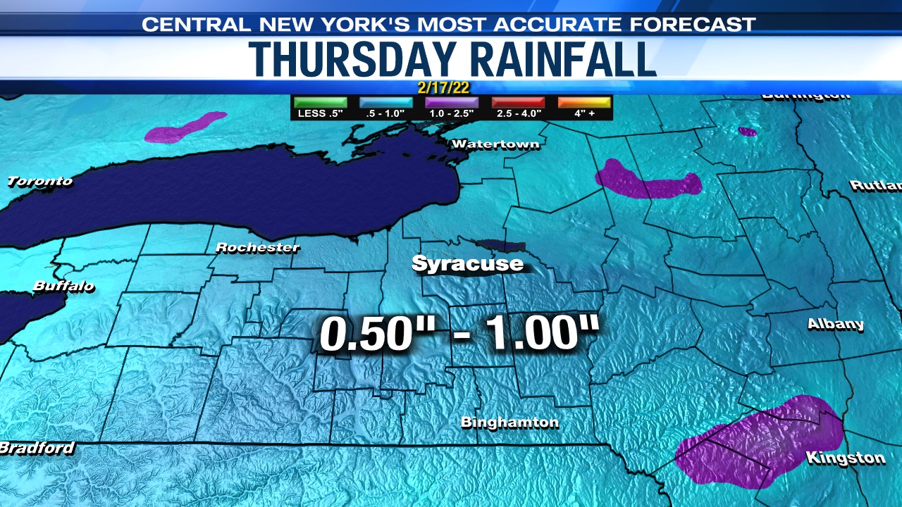
A widespread 0.50-1.0” of rain is possible with some areas seeing a little bit more.
Our concern is rising water levels (from rain and snowmelt) and the potential for ice jams leading to flooding.
What do we do?
Keep monitoring the forecast. We will continue to monitor river levels, snowmelt, and rain amounts.