WATCH: A little snow & cold for now

SYRACUSE, NY (WSYR-TV) – Mother Nature is going to be a bit cold hearted for the start of the week and Valentine’s Day, but thankfully the midwinter chill won’t be lasting too long.
This cold is a far cry from what Los Angeles feels for the big game!
TONIGHT:
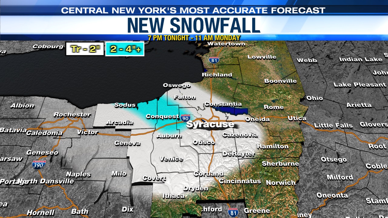
A bit of lake effect snow shower activity will come off the southeast end of Lake Ontario tonight into the start of Monday. We’re expecting this limited lake effect to occur from about Syracuse west bound across the Finger Lakes.
There could be a coating to an inch or two of snow through Monday morning near and west of Syracuse, and possibly a bit more in the most persistent snows northwest of Syracuse up towards the Lake Ontario shoreline.
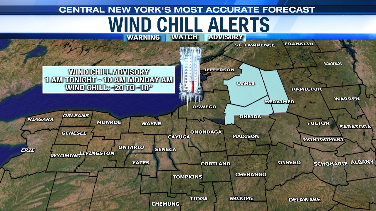
Lows drop into the single digits above zero for most tonight, but between -10 and 0 north and east of Syracuse away from the lake clouds. Wind chills range from -10 to 0 for most, including Syracuse overnight, but -20 to -10 up around the Tug Hill and Adirondacks! This is why there’s a Wind Chill Advisory in effect up around the Tug Hill into the start of Monday as you can see below…
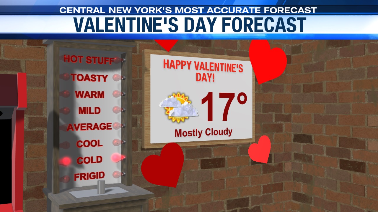
MONDAY (VALENTINE’S DAY) – MONDAY NIGHT:
Other than a little lake snow near and west of Syracuse to start Monday, it’s a quiet and cold Valentine’s Day with intervals of sun. There probably will be some slick spots for the Monday morning commute near and west of Syracuse due to the limited lake snow. So, you may want to give yourself a few extra minutes to get into work/school.
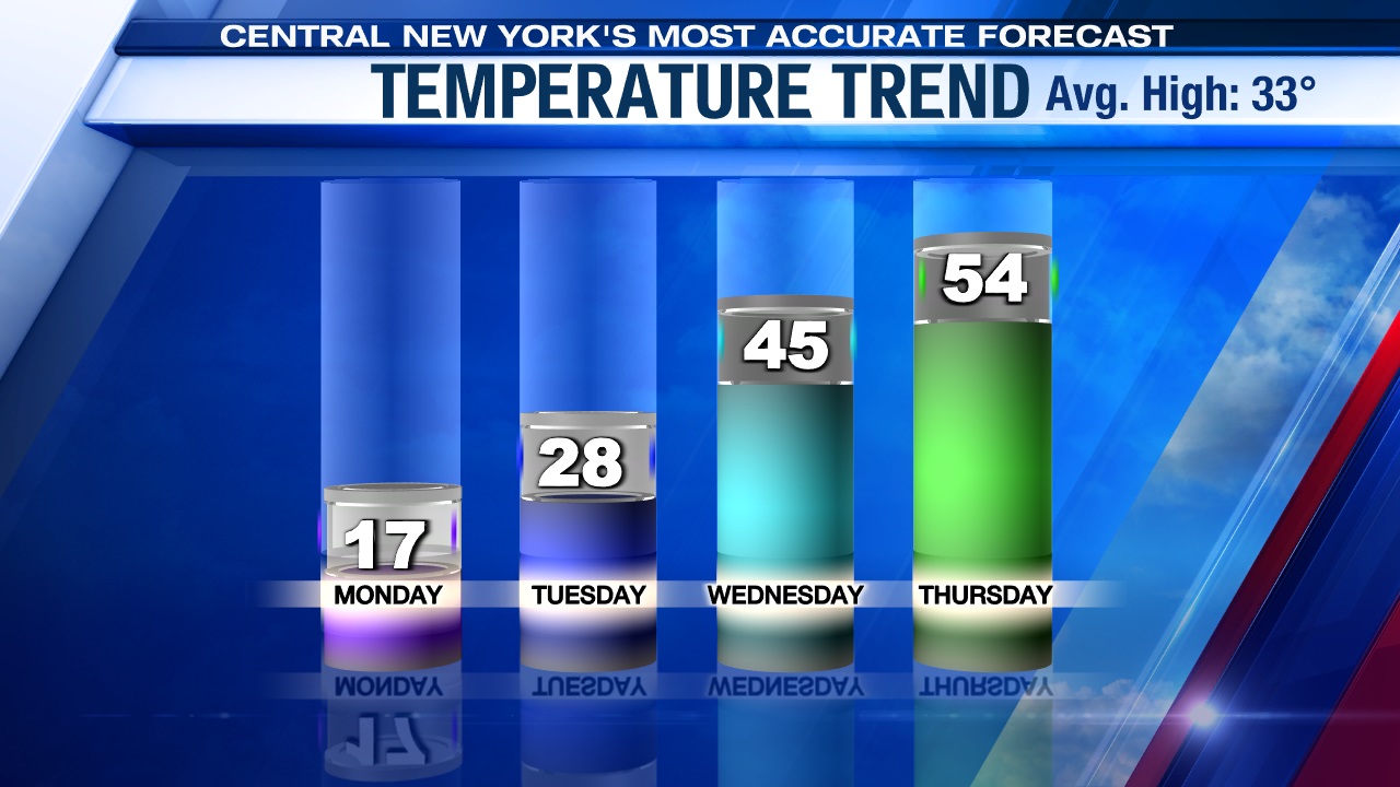
Temperatures struggle to get much higher than 15, and a brisk west-northwest wind between 10 and 15 mph will make it feel more like -10 to 0 much of Monday. Brrr…If you have lunch or dinner plans with your Valentine be sure to bundle up!
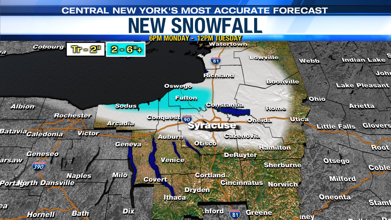
Also, we are watching the potential for a more significant band of lake snow to develop Monday night and continue into Tuesday near and especially just north of Syracuse into Southern Oswego, Northern Cayuga and Northern Wayne counties.
A coating to an inch or two of snow is possible in the Syracuse area to Oneida Lake, but upwards of 5 or 6 inches if not a bit more could fall in the most persistent snows north of Syracuse during this time frame.
Lows Monday night drop into the single digits to around 10 with wind chills staying between -10 and 0.
The air begins to moderate Tuesday, and we really warm up more so midweek! Stay tuned for updates.