
Quiet tonight & even milder air on the way
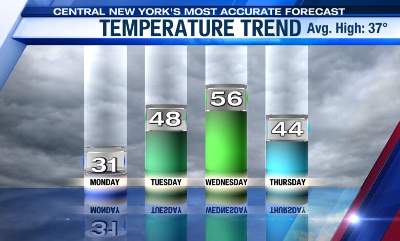
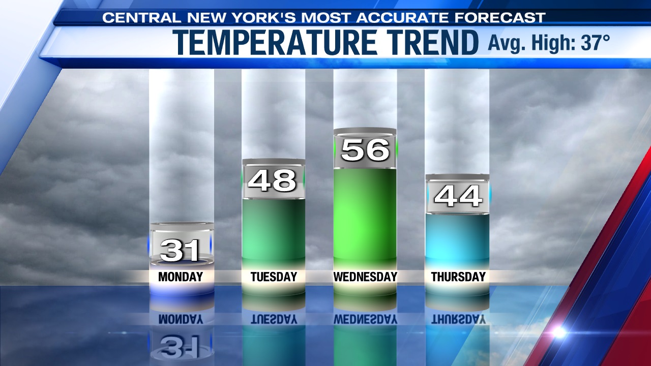
SYRACUSE, N.Y. (WSYR-TV) – We’ll flip flop between winter and spring this week. The week started off with a chill still in the air, but the chill eases more so Tuesday and we’ll feel our first 50+° day of the year for middle part of the week. How long does it last? Spoiler alert… not long.
Chilly, but not bad tonight
Temperatures initially dip into the upper teens to mid 20s this evening, but should slowly rise overnight and be up closer to 30 by daybreak Tuesday with a partly to mostly cloudy sky.
Spring, is that you??
If you are looking for more spring-like conditions, look no further than the middle of this week!
We are on our way out of the freezer with highs rising well into the 40s Tuesday, and then we climb into the 50s for the first time this year on Wednesday!
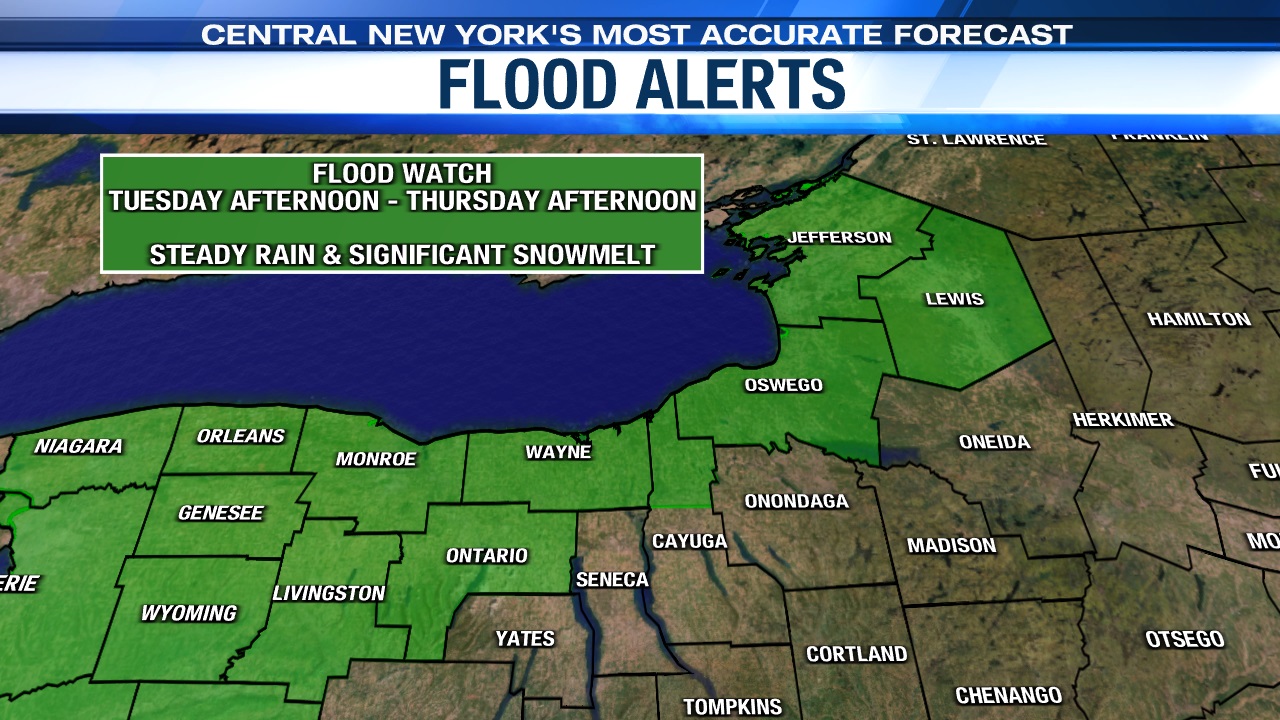
Flood concerns
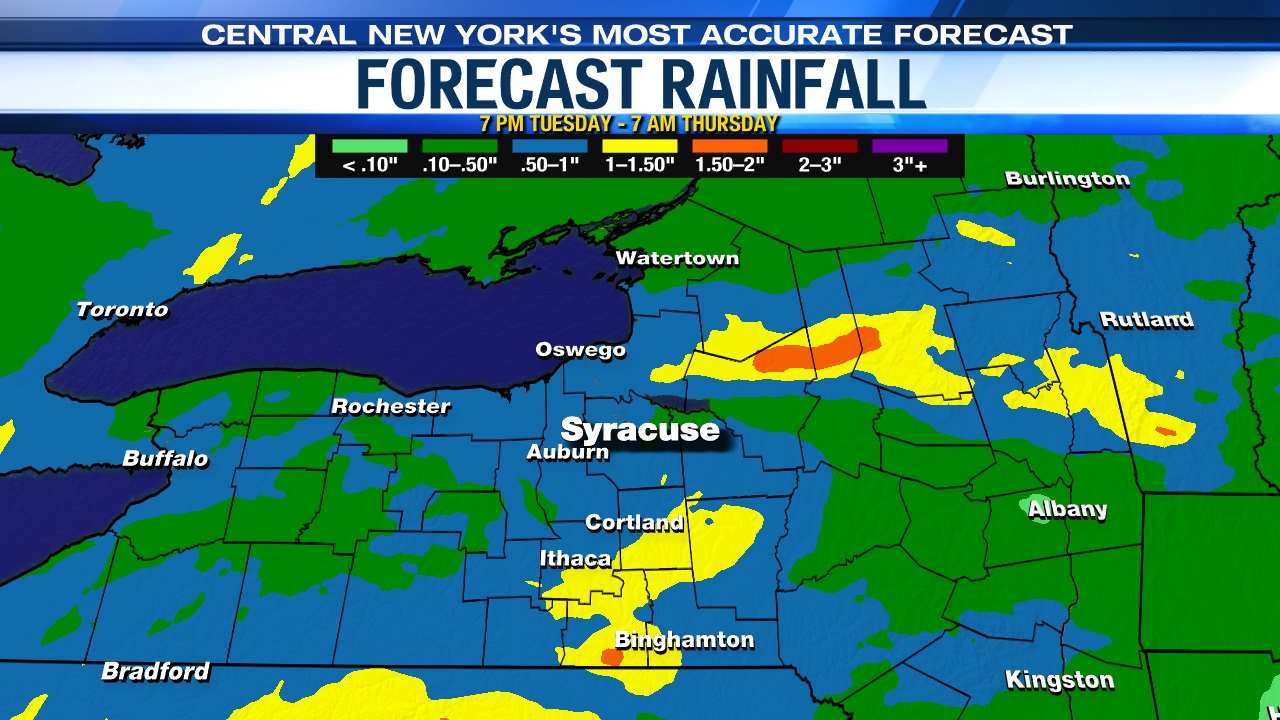
Warmer temperatures midweek will feel nice, but unfortunately be accompanied by some rain too late Tuesday night into Wednesday, which will combine to produce an increased risk for flooding, especially ice jam flooding in spots.
There is a Flood Watch for counties that border Lake Ontario beginning Tuesday afternoon through Thursday afternoon. Rapid snowmelt from the warmer temperatures combined with an average of a half inch to an inch of rainfall could lead to a significant rise to rivers, streams, and creeks and POSSIBLY cause flooding. The National Weather Service is cautioning that flood concerns are particularly elevated in areas that are prone to ice jam flooding.
Stay tuned for updates and check out the 7-day forecast.


