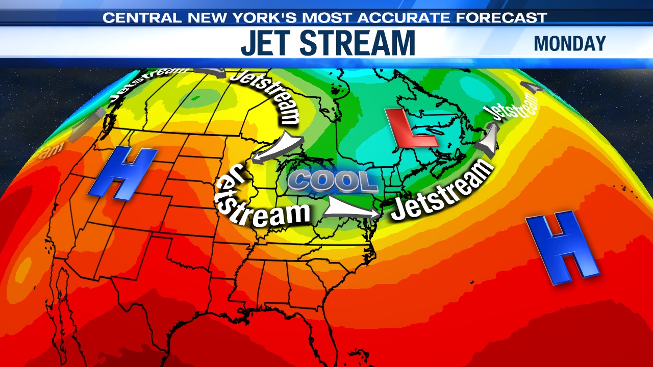
Why the cool and at times unsettled pattern ahead?
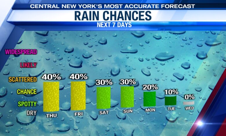
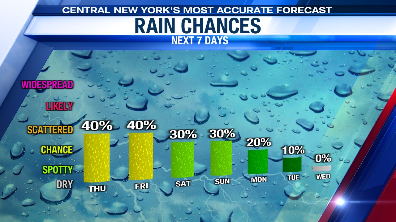
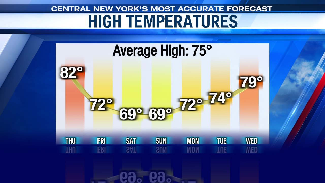
After near 90 degree heat Tuesday and Wednesday in Syracuse, we are going to be cooling down significantly to round out the week through the second weekend of June and start of next week. We also will be at risk of seeing scattered showers each day through the weekend with shower chances decreasing early next week. The chances of rain being less than 40% over the weekend into Monday highlights that each day should have a decent amount of dry time, especially Monday with only a 20% chance of rain.
High temperatures Friday through early next week will struggle to get out of the 60s before we rebound well into the 70s to possibly 80 come the middle of next week.
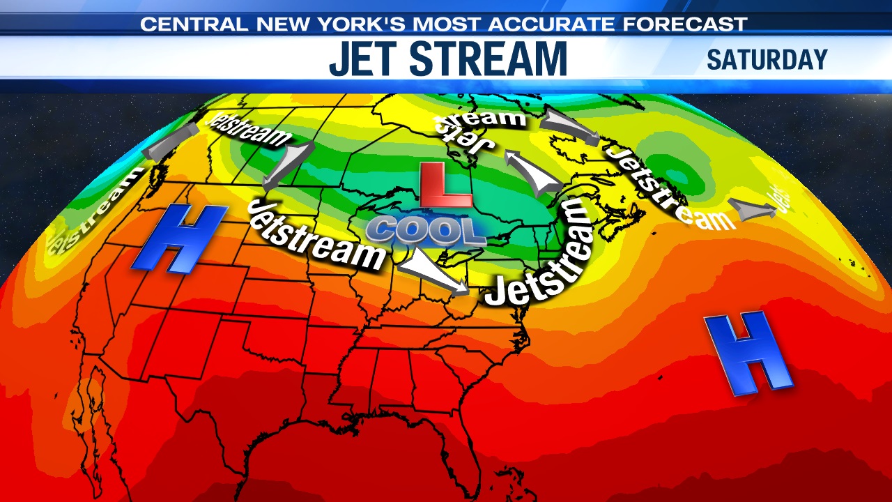
Why so cool and showery over the coming days? Hint. The thermostat of the atmosphere is up where the planes fly. Yes, you can thank the jet stream for the cooler/somewhat unsettled change in the weather across the Great Lakes and Northeast. Each day there’ll be scattered showers developing, especially after 10 am but it does NOT appear that any one day Friday through the start of next week will be a washout.
So don’t go canceling your outdoor plans, but be sure to have rain gear handy and you may want to wait for another weekend for those pool/beach plans since it will be on the cool side. We should heat up some to seasonable levels, if not above normal briefly mid to late next week but could cool right back down next weekend. Stay tuned for updates.