Showers and storms taper this evening
SYRACUSE, NY (WSYR-TV) – While there was some dry time and even sunshine at times over the weekend, it still wasn’t totally rain-free. Do our rain chances go down into the new week, or should we keep the umbrellas handy? Find out below…
Showers and storms taper
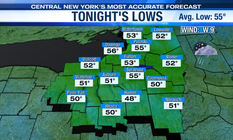
Lingering showers and storms will taper off Sunday evening, allowing for mainly dry conditions overnight.
Skies will remain mostly cloudy, and there could be some patchy fog. Lows will be cool, ranging from the upper-40s to mid-50s.

Drier, but not totally dry Monday
Clouds will have the upper hand on Monday, so don’t count on seeing much in the way of sunshine. While the day won’t be a washout, we will still be on the lookout for a few spotty showers and sprinkles especially late morning through early afternoon.
Highs on Monday will be unseasonably cool, only reaching the mid-60s at best. Some spots may even have a hard time making it out of the 50s.
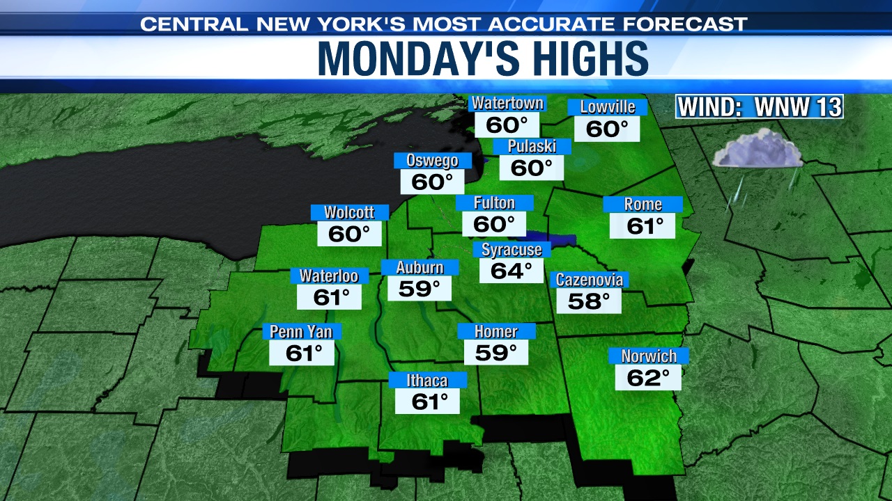
There will still be a breeze to contend with on Monday as well, but it shouldn’t be as gusty as it was over the weekend.
Check out Monday’s park planner and lawn mowing forecast here.
Brighter days ahead
Beyond Monday, our weather turns mainly dry on Tuesday. Clouds look stubborn to start the day, but we should see at least some sunshine develop as we go through the afternoon. Highs will be warmer, around 70. Keep in mind, this is still below our average high for this time of year which is in the mid-70s.
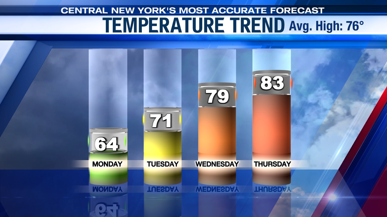
More sunshine is in store as a warming temperature trend continues on Wednesday and Thursday.
Check out the latest 7-day forecast.