
Picture perfect Friday then it is downhill from there
SYRACUSE, NY (WSYR-TV) – After a cloudy and damp start to the day, the weather turned pleasant for the last half of Thursday. Find out how nice late this week ends up below…
Looks great late week!
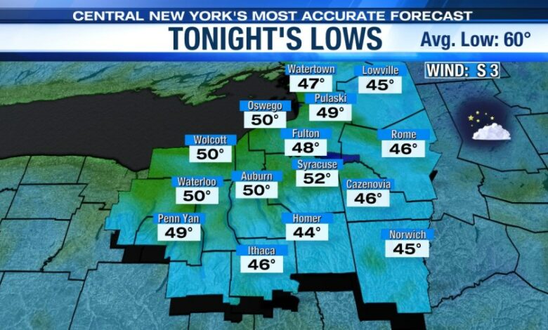
It’s a cool Thursday night under a mainly clear sky with little wind after sunset. Lows drop to within a few degrees of 50 thanks to high pressure settling in during the night. There could even be some low to mid 40s in some of the normally cool outlying areas!
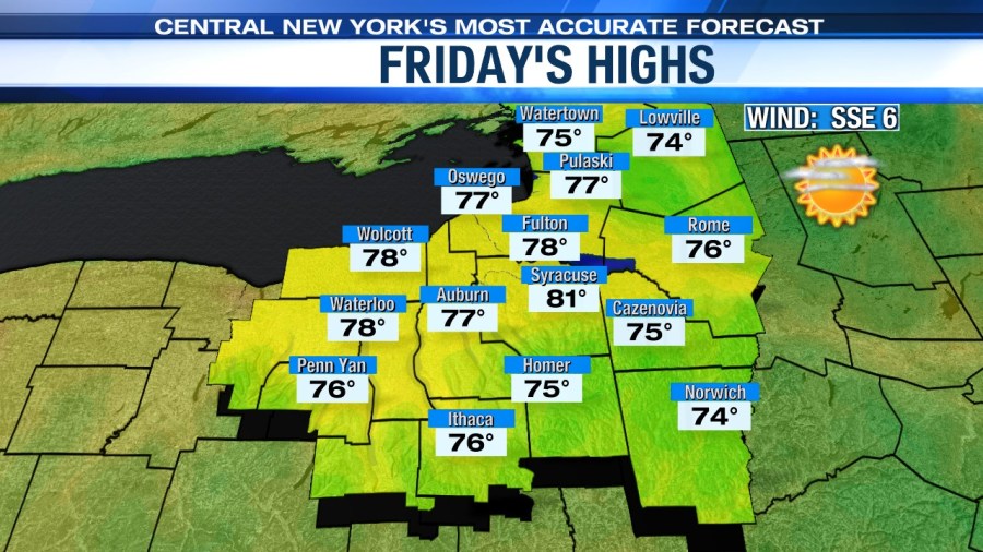
Come Friday, we have wall to wall sun and rise nicely because of the abundant late June sun to around 80! We think it is a real Top 5 day here in central New York.
Really pleasant early summer weather and nice for any festivities taking place late in the week like Jazz Fest and or the Willie Nelson show at the Amp in Syracuse! Enjoy CNY! 😊
Unfortunately, this weekend
It won’t be nearly as nice as the end of this week. Mugginess is returning on Saturday with a gusty southerly wind ushering in the higher humidity.
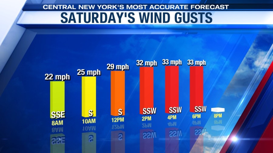
That increase in humidity is going to raise our shower and storm threat for Saturday. It is important to keep in mind that even though the showers and a few storms will be scattered, they won’t be limited to just the afternoon or evening. There could even be some storms with gusty, damaging winds and hail by late afternoon.
So be sure to be prepared to have backup indoor plans Saturday and or rain gear if you are taking part in outdoor activities on Saturday.
A cold front comes through late Saturday night/Sunday morning, but showers linger into Sunday before we should turn drier as Sunday afternoon progresses.
Highs over the weekend to round out the month of June should reach the low 80s with humidity slowly coming down Sunday.
Check out the latest 7-day forecast.


