Perfect night ahead for CNY!
SYRACUSE, NY (WSYR-TV) – Boy what a relief it was on Monday from all the heat and humidity the past week! How long does the comfortable air stick around for? Find out below…
Heating back up some Tuesday, but will there be any issues if you are boating and or hanging poolside? Find out here.
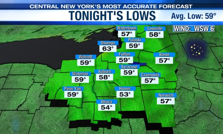
Nice n’ comfy again tonight
High pressure settling in from the west is clearing the sky out nicely tonight with a comfortable low in the 50s to near 60 for all. Areas of fog develop mainly northeast of Syracuse overnight too.
Heat to temporarily return midweek
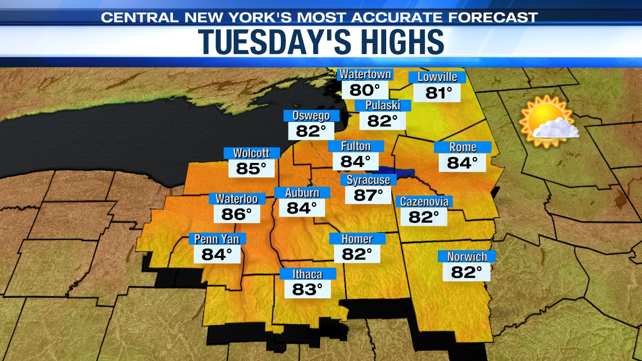
The cooler start to the week won’t last as high pressure slides east of the region producing a southwest flow delivering warmer, but not muggier air Tuesday.
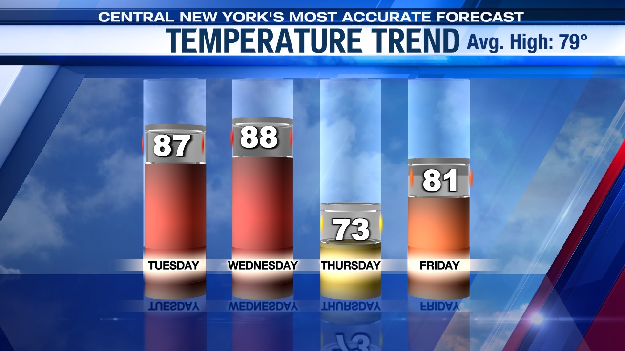
Look for high temperatures to climb back into the mid-80s on Tuesday under sunshine fading behind more clouds during the afternoon in advance of a warm front.
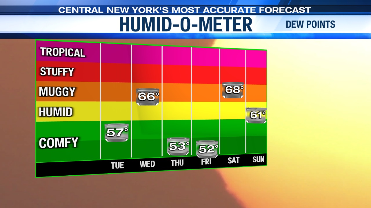
Humidity & storm chances return
We warm well into the 80s once again on Wednesday but it turns more humid with a steady southwesterly breeze ahead of a new cold front Wednesday. That should lead to another round of scattered showers and t-storms mainly during the afternoon which may get in the way of the James Taylor show at the Amp Wednesday evening.
Looks great late week!
Unlike last week, however, the heat and humidity does not stick and behind Wednesday night’s cold front we return to drier and cooler weather with highs in the 70s once again for Thursday and around 80 on Friday.
Really pleasant early summer weather and nice for any festivities taking place late in the week like Jazz Fest and or the Willie Nelson show at the Amp in Syracuse!
Check out the latest 7-day forecast.