Our weather improving this evening
SYRACUSE, NY (WSYR-TV) – The hot and soupy weather of the last few days is exiting soon. Cooler, less humid, but unsettled weather is on the way. Details below…
Drying out this evening
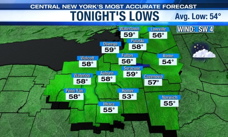
Behind the Thursday afternoon cold front passage, temperatures cool out of the 80s and back into the low to mid 70s by Thursday evening with lower humidity and some sun to round out the day. The threat of any additional showers through the evening is low.
Does the weather cooperate for anyone that has plans to attend Greek Fest or mowing??? Click here to see.
Cooler, less humid and showery late week
An upper level and surface storm system spin in from the northwest to end the week and unfortunately probably sticks around into the weekend. This system likely produces at least a scattering of showers to round out the week into the weekend.
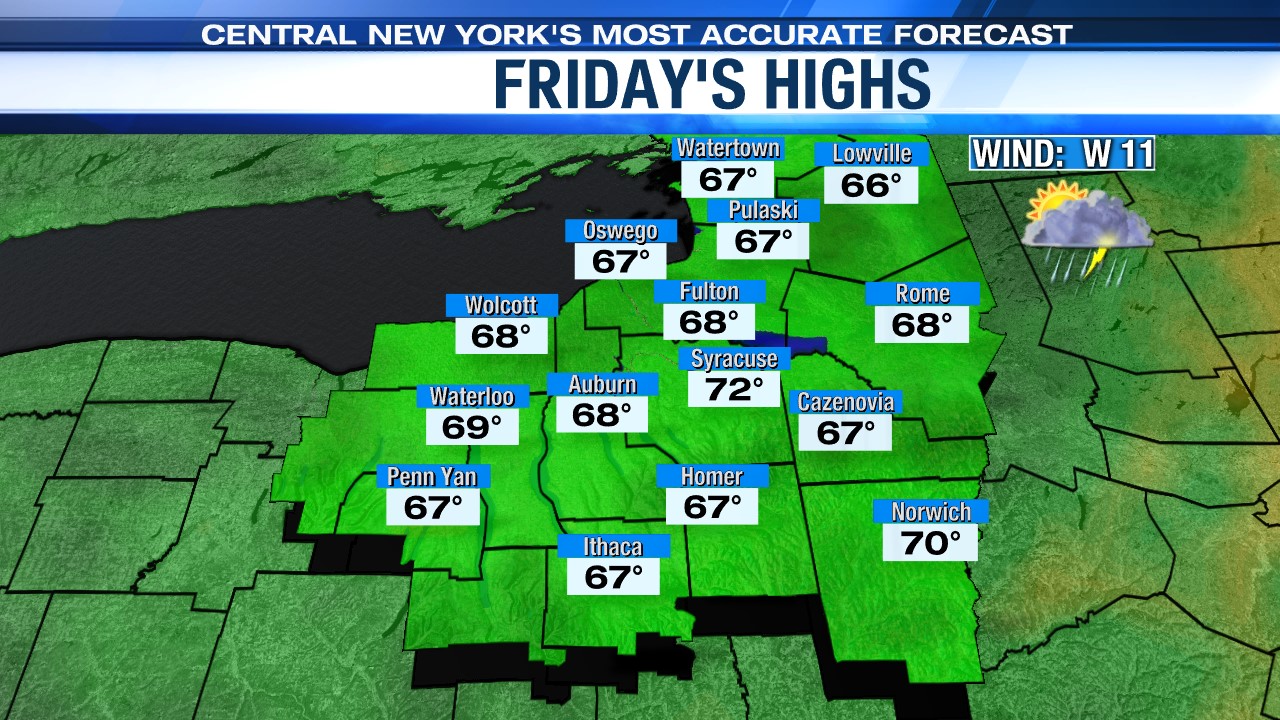
The most likely time for showers and perhaps a rumble of thunder on Friday is between 10 am and 5 pm. The showers should then diminish Friday evening.
No 80-degree weather on Friday with temperatures ending up in the upper 60s to low 70s for most.
Will wet weather get in the way of weekend plans?
One hopeful sign for the weekend is the new data we’ve looked at is suggesting there will be less showers around Saturday, so it is looking to be the better of the two weekend days. That’s certainly good news for those headed to Greek Fest or the Taste of Syracuse or anyone with outdoor plans.
We’ll likely struggle to get much past 70 degrees over the weekend.
One additional note for the weekend: a gusty breeze past 25 mph at times both days out of the west northwest Saturday then west on Sunday. That will put a bit of a chop on area waterways, especially Lake Ontario and Oneida Lake.
Why so cool and somewhat unsettled for the end of the week and beyond? Find out here.
Check out the latest 7-day forecast.