Not all of CNY gets wet Wednesday
SYRACUSE, NY (WSYR-TV) – A few showers and possibly a storm scoots through tonight, but can we get through Wednesday mainly dry? Find out below…
Thinking about hanging poolside Wednesday, and or heading to the Amp to watch James Taylor perform Wednesday night. Click here for the latest.
Warm midweek, but…
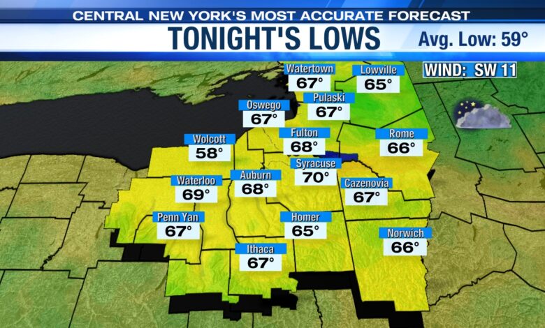
A warm front has brought clouds into the region for tonight and will produce a few scattered showers and possibly a t-storm. Much of tonight is dry though.
In the wake of the warm front this evening, it’s pretty warm, breezy and turning muggier tonight with lows only dropping to within a few degrees of 70.
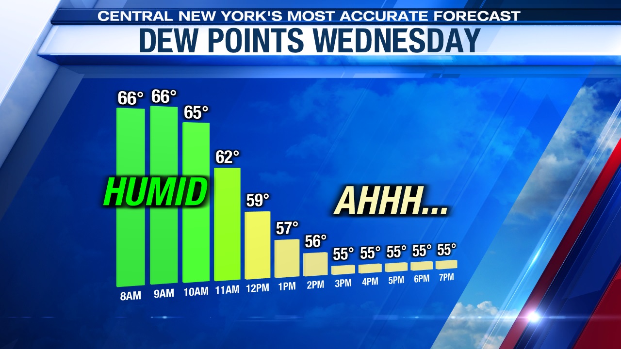
Higher humidity leaves as fast as it returns
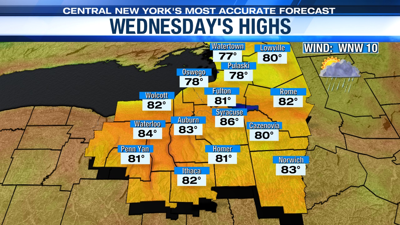
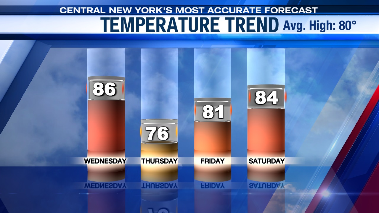
We warm well into the 80s once again on Wednesday and the day starts muggy but during the midday and afternoon the humidity is going to drop behind a midday cold front passage.
Rain chances going up, but when?
An area of low pressure developing along the cold front to the south across Pennsylvania will try to throw some rain showers into CNY, especially Syracuse south bound after about 5 or 6 pm. There may even be an embedded t-storm across the Southern Finger Lakes Wednesday evening, but most of the storms look to remain south of CNY.
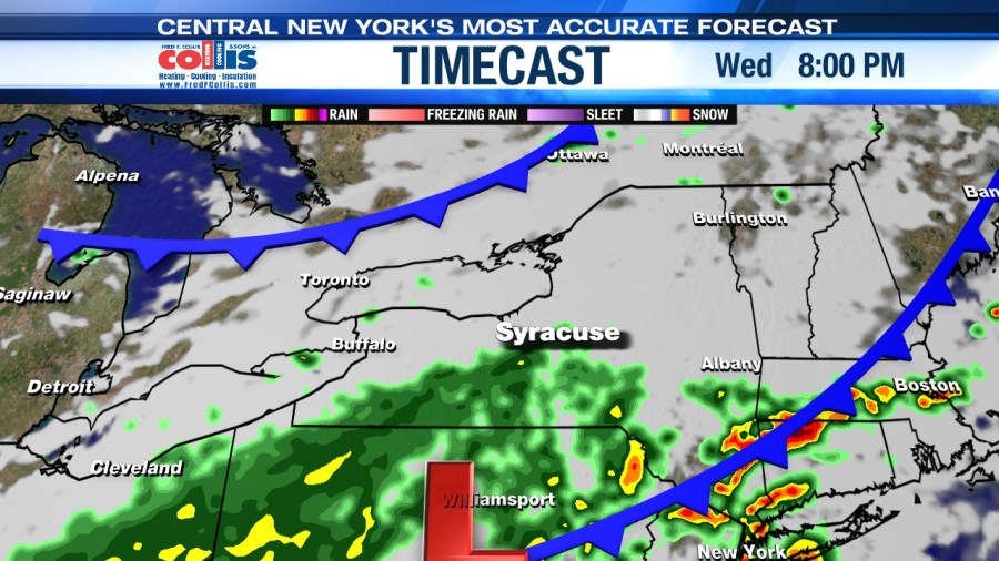
Heading to the 8 pm James Taylor show at the Amp Wednesday evening? Yes, it appears there could be some rain showers around Wednesday evening, so you’ll want to be sure to bring the rain gear if you are attending.
Looks great late week!
Behind Wednesday’s cold front and area of low pressure we return to drier and cooler weather with highs in the 70s once again for Thursday and up around 80 on Friday with sun developing Thursday and lots of sun Friday!
Really pleasant early summer weather and nice for any festivities taking place late in the week like Jazz Fest and or the Willie Nelson show at the Amp in Syracuse! Enjoy CNY! 😊
Check out the latest 7-day forecast.