Line of storms overnight gives way to a quieter Sunday
SYRACUSE, NY (WSYR-TV) – Sunday is much drier than Saturday, but a few showers and a t-storm or two is still possible. Find out how much nicer Sunday is going to be below…
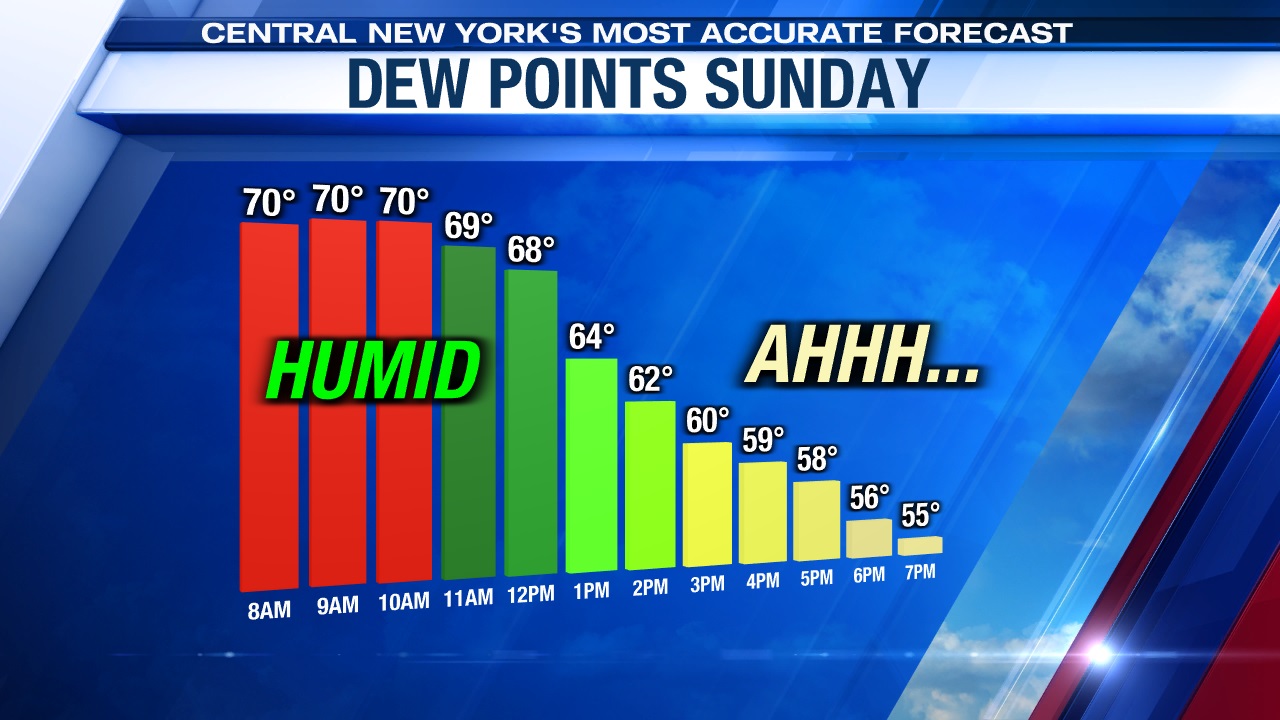
Very muggy now, but not much longer
It’s a breezy, warm and muggy night out there with a line of showers and storms late Saturday evening east of Lake Ontario dropping southeast overnight with a trough of low pressure. The storms will contain very heavy rain, gusty winds and maybe even a bit of hail.
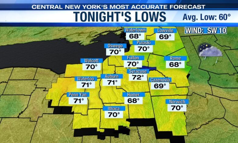
Lows will only drop into the low to mid 70s.
Sunday is looking better…
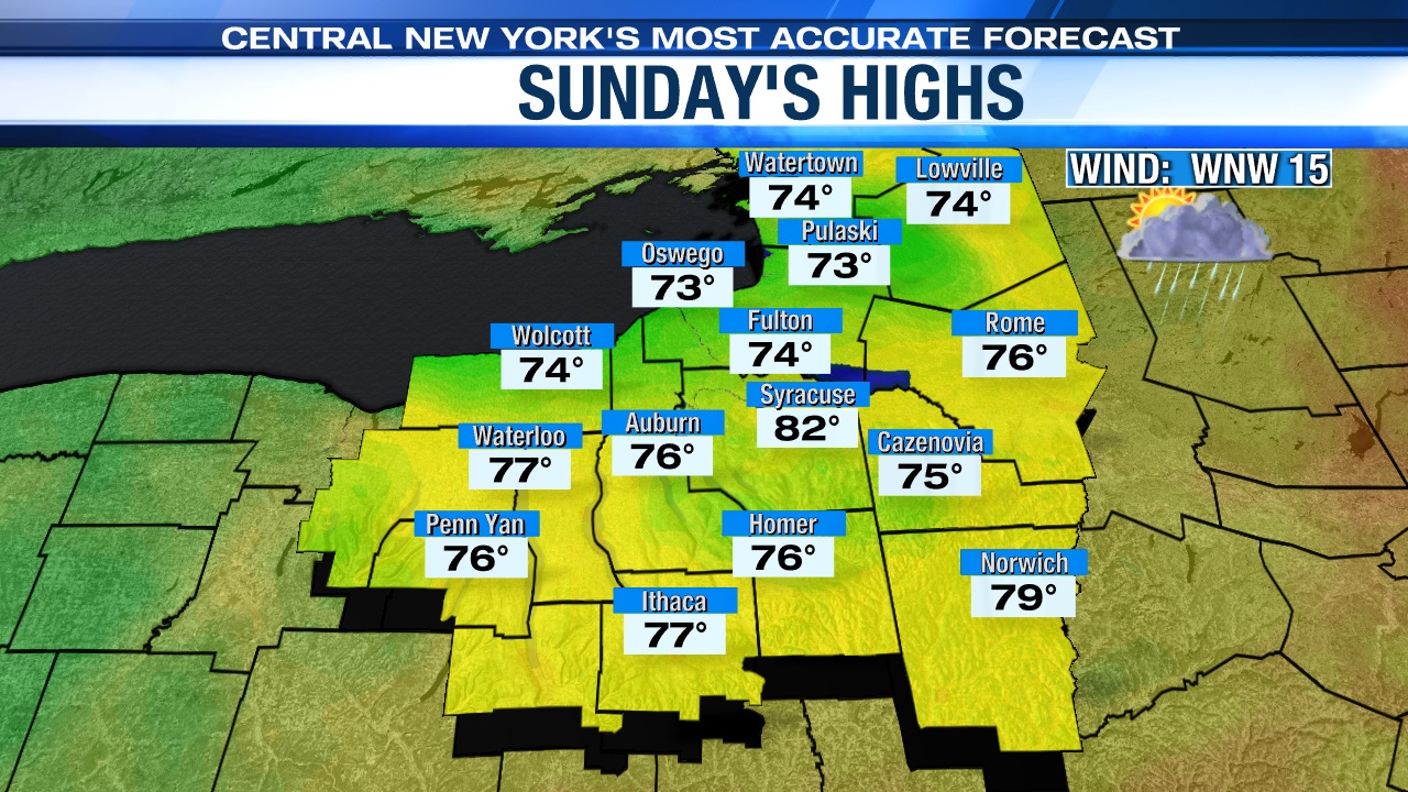
A cold front comes through later Sunday morning with a few showers and possibly a t-storm through midday followed by a windy, brighter and less humid afternoon.
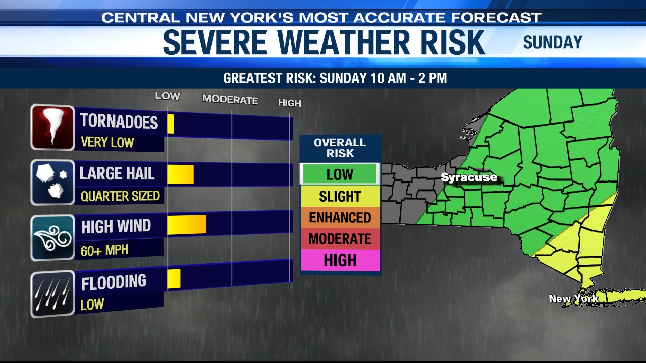
There’s also a very low chance that an isolated strong to severe t-storm during the later morning and early afternoon, especially south and east of Syracuse. The main threats will be damaging winds and large hail, but again the chances of severe weather is very low here in CNY Sunday.
We think more breaks of sunshine should help us get into the low 80s during the midday/early afternoon before readings cool into and through the 70s during the afternoon.
Sunday evening, a weak trough of low pressure is expected to swing through from north to south with a few more showers but is departing overnight Sunday night.
Lows drop into the 50s Sunday night, which makes for a good night to have the windows open when sleeping.
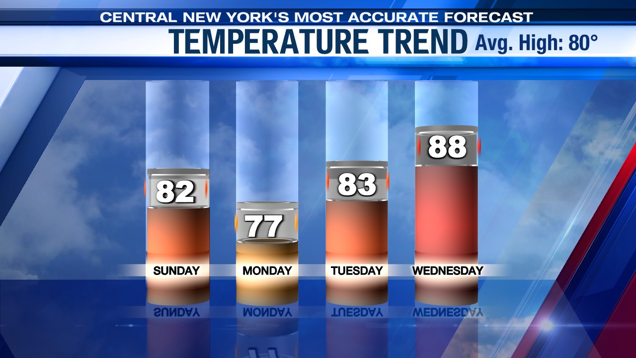
Great start to week!
High pressure builds in to start the week with sunshine and slightly cooler than average temperatures and a nice northwest breeze.
Highs to start the short work week for many will warm into the mid-70s, followed by another winner Tuesday with highs within a few degrees of 80 after starting the day in the low to mid 50s.
Check out the latest 7-day forecast.