Improving weather for Sunday
SYRACUSE, NY (WSYR-TV) – Sunday is much drier than Saturday, but a few showers and a t-storm or two is still possible. Find out how much nicer Sunday is going to be below…
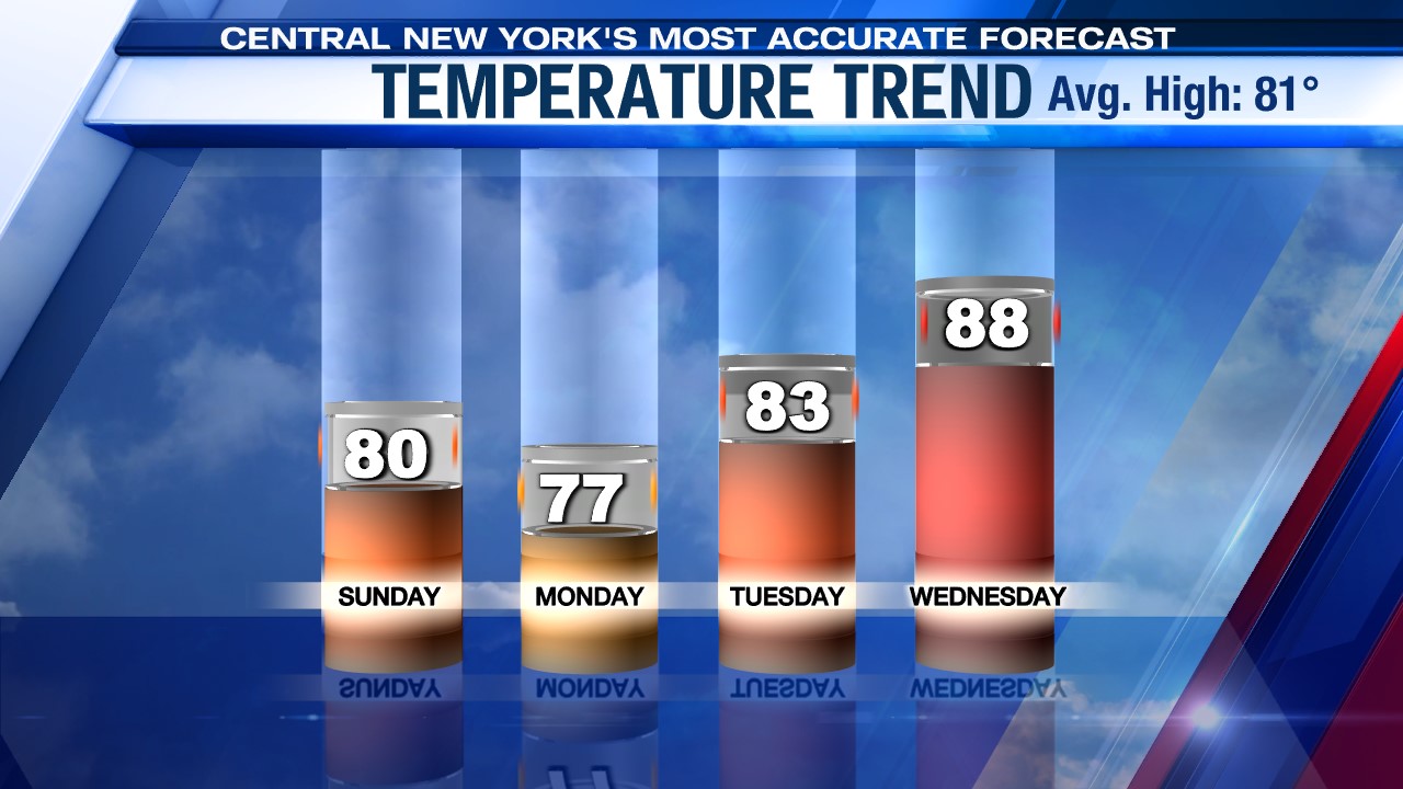
Sunday looks better..
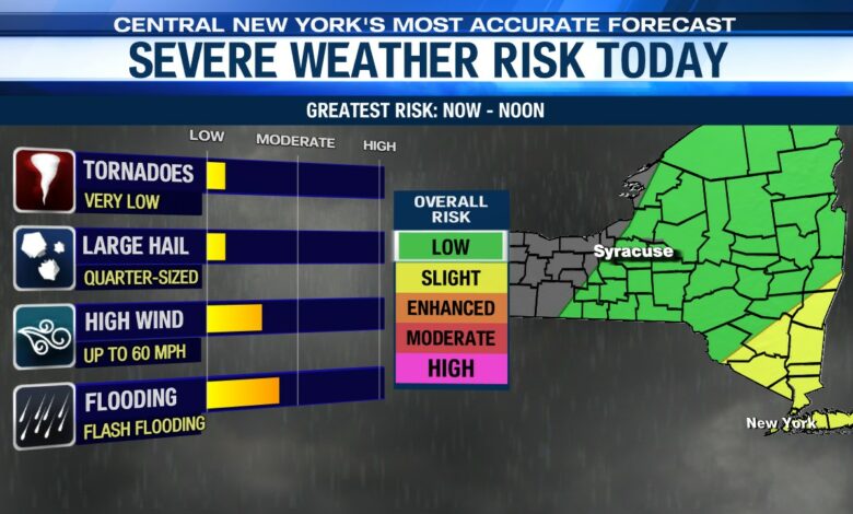
A cold front comes through later Sunday morning with a few showers and possibly a t-storm t
There’s also a very low chance that any t-storm that forms this morning and early afternoon, especially south and east of Syracuse, could be strong to severe. The main threats would be damaging winds and large hail, but again the chance of severe weather is very low here in CNY Sunday.
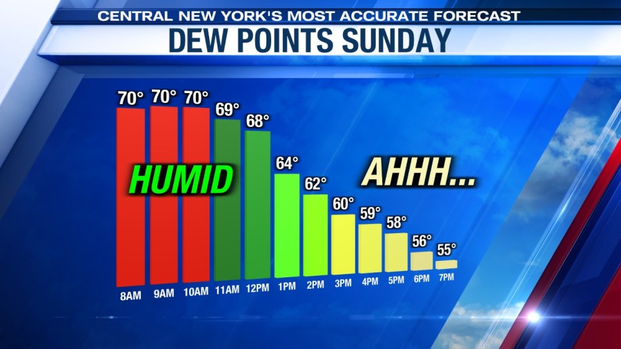
We can expect a windy, brighter and less humid afternoon.
Thinking about playing a round or trying to get out on the boat/jet ski. Click here for the latest outlook for these activities Sunday.
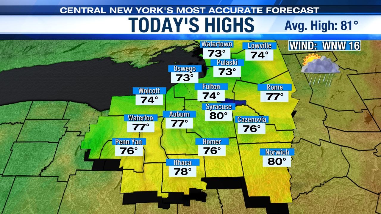
We think more breaks of sunshine should help us get close to 80 during the midday before readings cool into and through the 70s during the afternoon.
Sunday evening, a weak trough of low pressure is expected to swing through from north to south with a few more showers but is departing overnight Sunday night.
Lows drop into the 50s Sunday night, which makes for a good night to have the windows open when sleeping.
Great start to the week!
High pressure builds in to start the week with sunshine and slightly cooler than average temperatures and a nice northwest breeze.
Highs to start the short work week for many will warm into the mid-70s, followed by another winner Tuesday with highs within a few degrees of 80 after starting the day in the low to mid 50s.
Check out the latest 7-day forecast.