
Dodging some raindrops this weekend
SYRACUSE, NY (WSYR-TV) – Can you feel the difference? We’re out of the sweatbox, but it’s not completely dry out there either. Details below…
Showers ease this evening
Showers and t-storms continue on and off through the early evening Friday in central New York. However, as we cool the coverage of showers will diminish after 7 pm so your late evening plans are more than likely going to be dry.
Overnight it is mostly cloudy and seasonably cool with mid 50s for most.
Will wet weather get in the way of weekend plans?
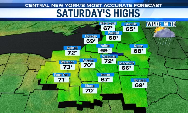
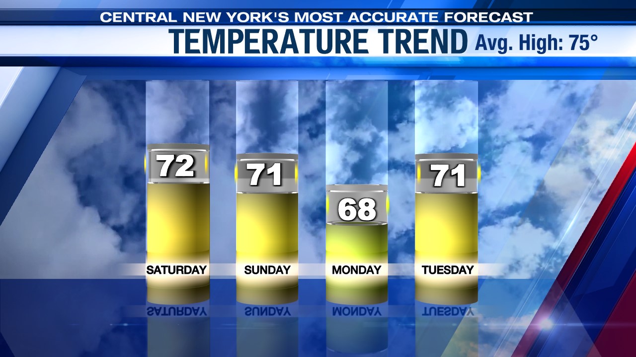
One hopeful sign for the weekend continues to be the trend that Saturday is the drier of the two weekend days.
Outside some showers in the morning (mainly north of Syracuse) the day looks to be dry. There should be some sun in the afternoon, too! That is certainly good news for those headed to Greek Fest or the Taste of Syracuse or anyone with outdoor plans.
The wetter part of the weekend would be Saturday night while you are sleeping. Low pressure tracking over us brings us some steady rain after midnight that tapers to a couple hours after sunrise Sunday. We should get a dry break in the middle of the day with some sun pushing temperatures rising into the low 70s. That would be enough to spark a few new showers in mid to late afternoon.
Wind a factor for a few days
One additional note for the weekend: a gusty breeze past 25 mph is expected both days out of the west northwest Saturday then west on Sunday. That will put a bit of a chop on area waterways, especially Lake Ontario and Oneida Lake. In fact, there is already a Small Craft Advisory out for the east end of Lake Ontario for Saturday.
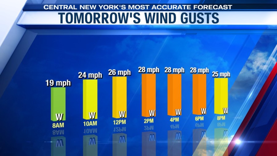
While the winds are strongest over the weekend, they are still gusty even into Monday.
Why so cool and somewhat unsettled for the weekend? Find out here.
Check out the latest 7-day forecast.


