Damp for many now but a treat is in store for Monday!
SYRACUSE, NY (WSYR-TV) – After some light showers and areas of drizzle sweep through CNY tonight, we are in store for some gorgeous weather to start the week! Find out below how nice…
A more comfortable night for sleeping…
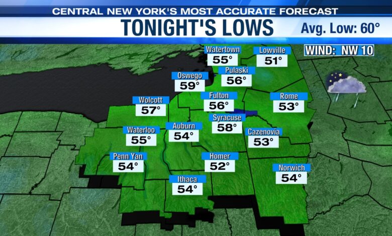
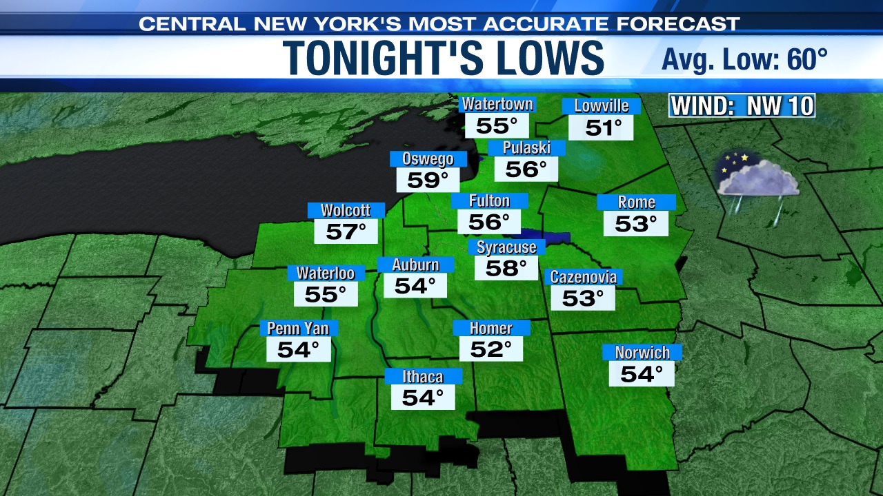
Sunday evening, a weak trough of low pressure is expected to swing through from north to south with a few more showers but is departing overnight.
Lows drop into the 50s overnight with a cool 5 to 15 mph northwest breeze, which makes for a good night to have the windows cracked open when sleeping.
Top 10 start to the week!
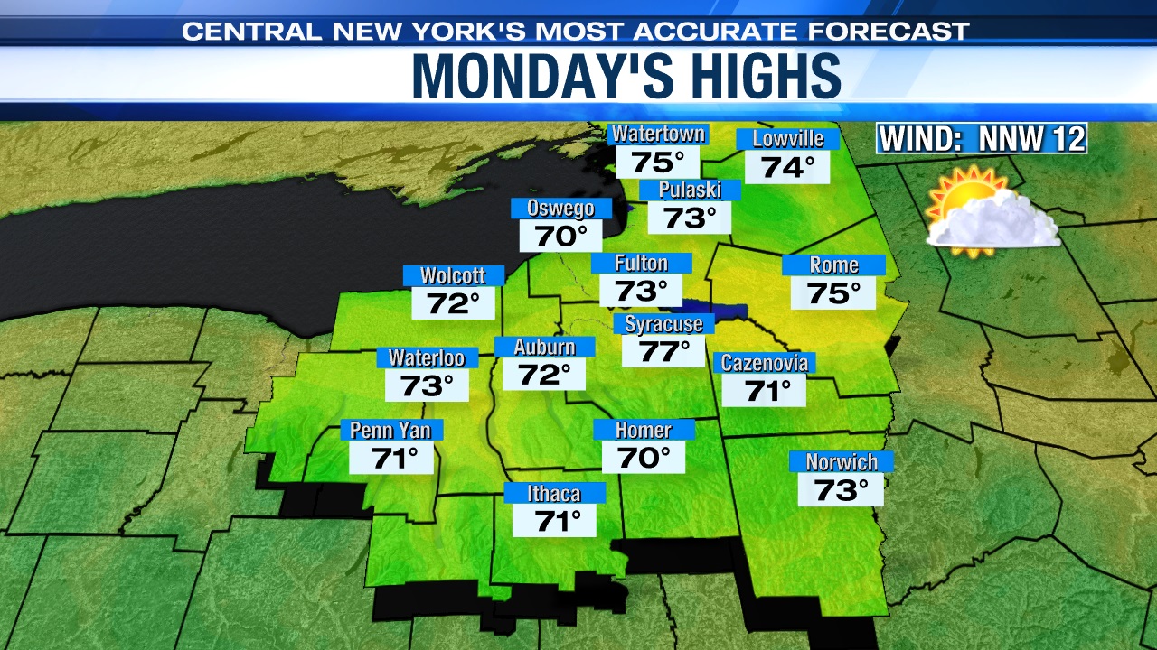
High pressure builds in to start the week with more sunshine, slightly cooler than average temperatures and a nice northwest breeze.
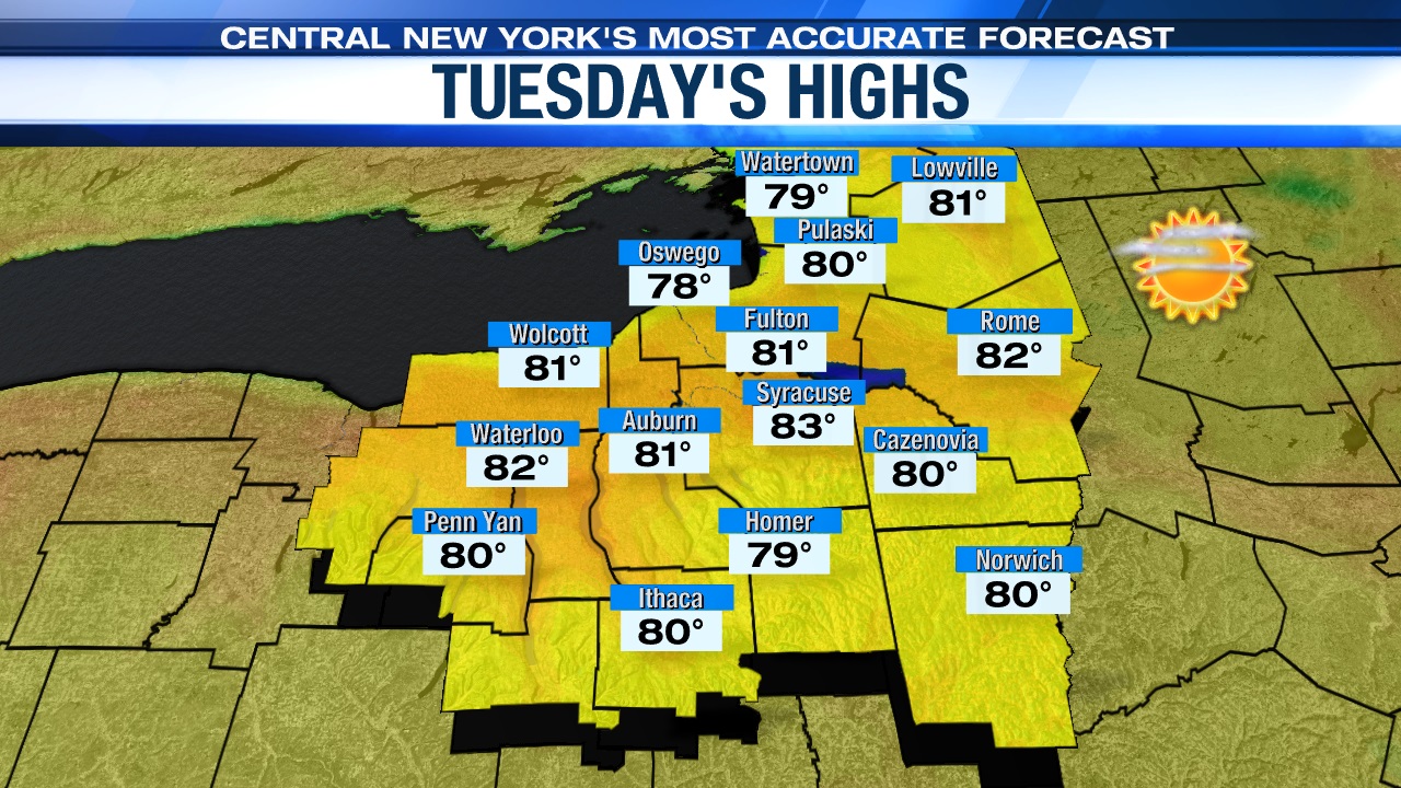
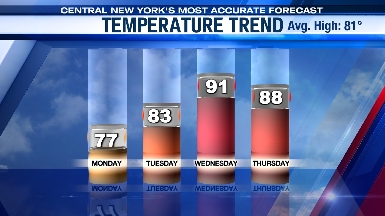
Highs to start the short work week for many will be in the mid-70s, followed by another winner Tuesday with highs in the low 80s after starting the day in the low to mid 50s.
Heating up midweek and for the 4th, but any rain?
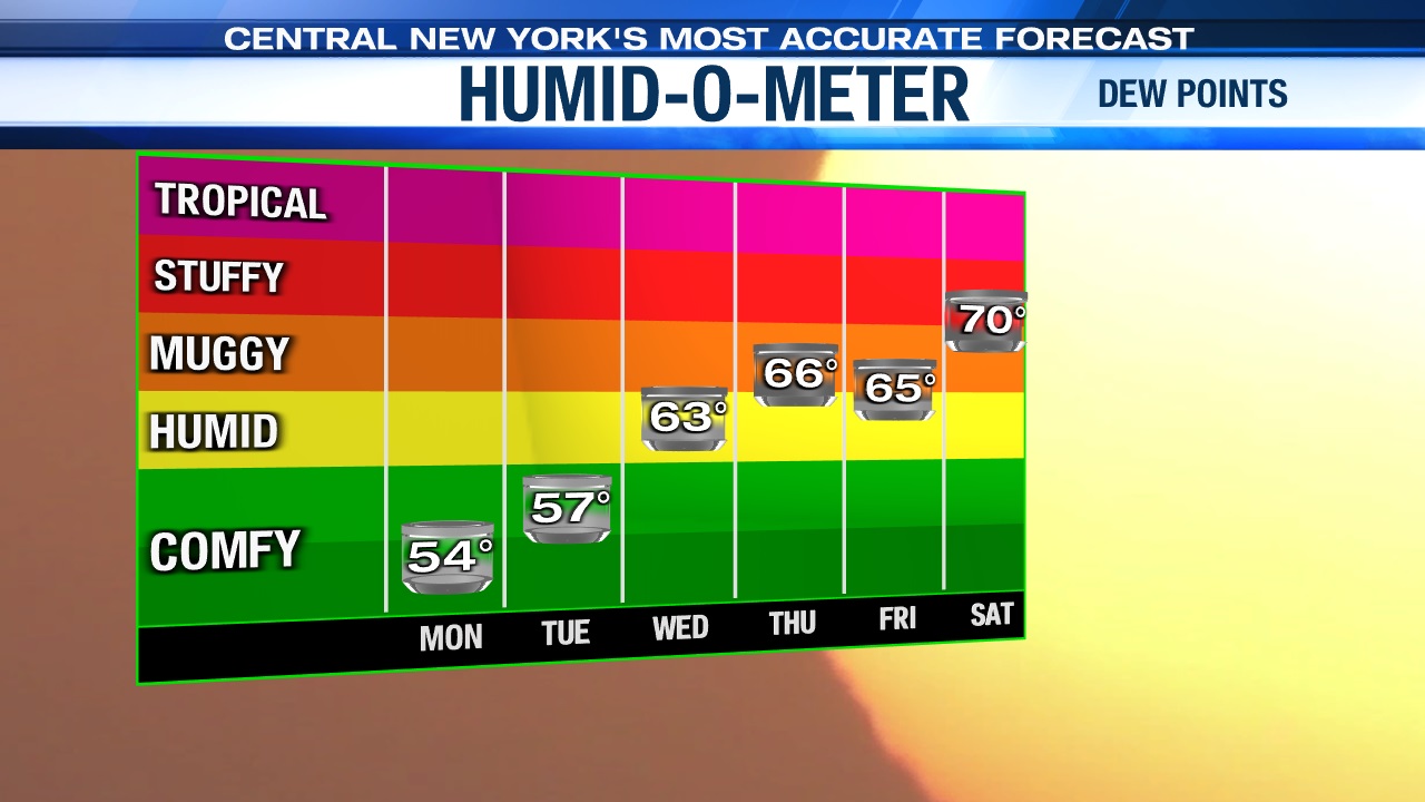
Temperatures under some more sun and a gusty southwest warming wind will rise well into the 80s to low 90s with humidity levels slowly coming up Wednesday afternoon too.
Also, as a weakening cold front approaches we could see a shower/storm or two develop towards sunset Wednesday. The front comes through Wednesday night/early Thursday with a few showers and storms but doesn’t cool us off much for the 4th or beyond.
Rain chances for the long holiday weekend, including the 4th are looking very low with the exception possibly being Saturday when we could see a scattering of showers and storms thanks to another cold front.
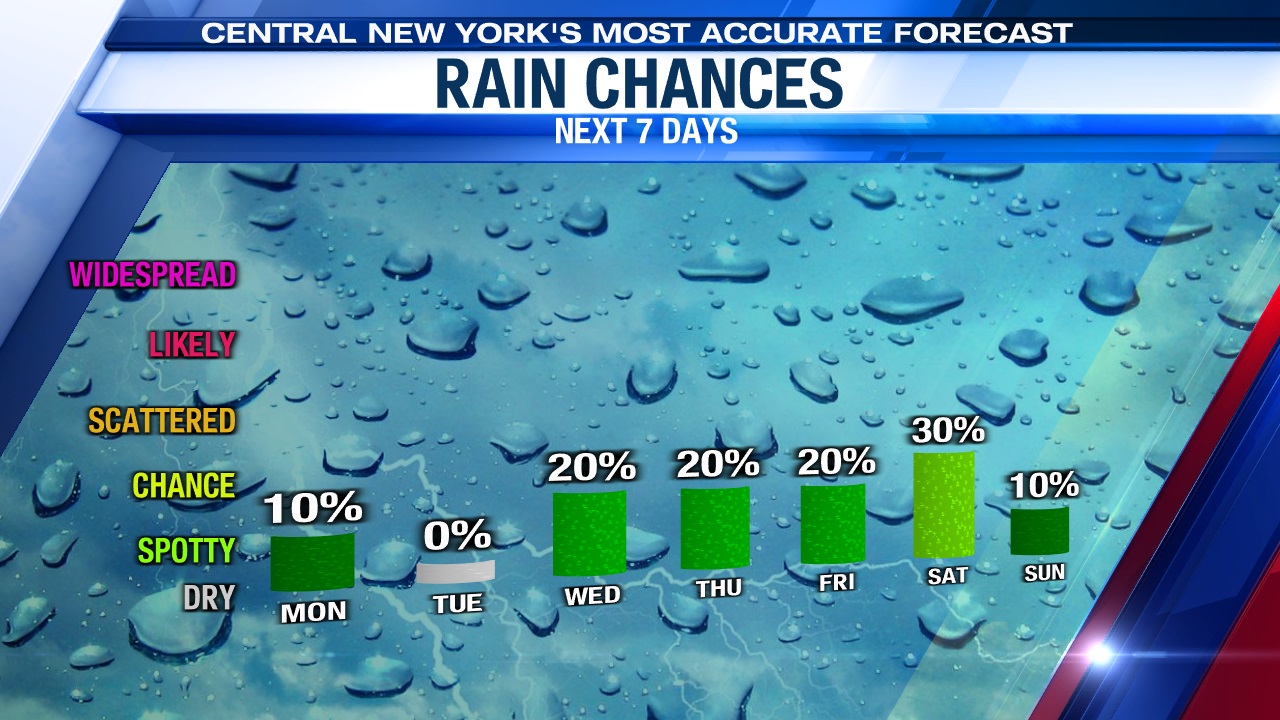
This is great news for all the outdoor activities/festivities, including firework shows taking place for the holiday!
Check out the latest 7-day forecast.