
Clouds hanging tough now, but break up soon
SYRACUSE, NY (WSYR-TV) – Monday was our chilliest June day in 5 years, and Tuesday wasn’t much better! When does the sun and summertime temperatures return?? Find out below…
Clouds prevail for now, but it stays mainly dry
Clouds will have the upper hand into Wednesday morning, so don’t count on seeing much in the way of sunshine at least through lunch time Wednesday, but we think it turns brighter after 2 or 3 pm. Despite how gloomy it looks, there won’t be anything more than patchy drizzle/mist through the start of Wednesday, especially across the hills.
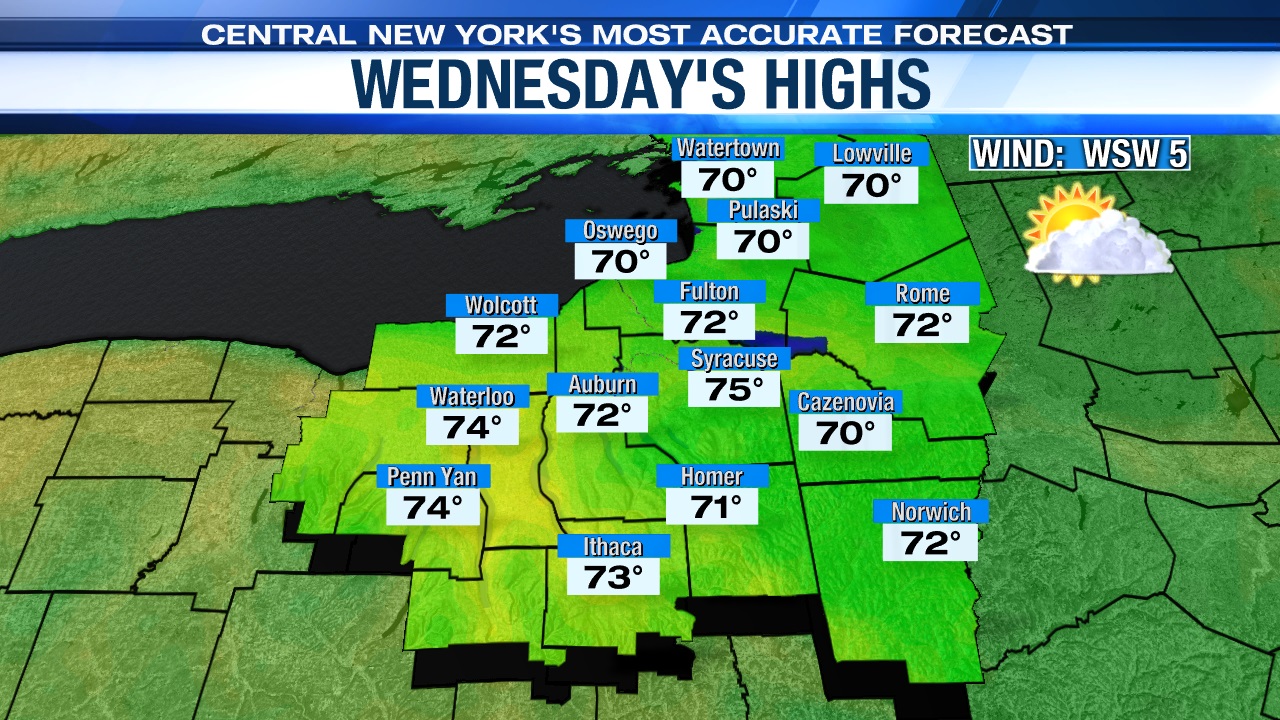
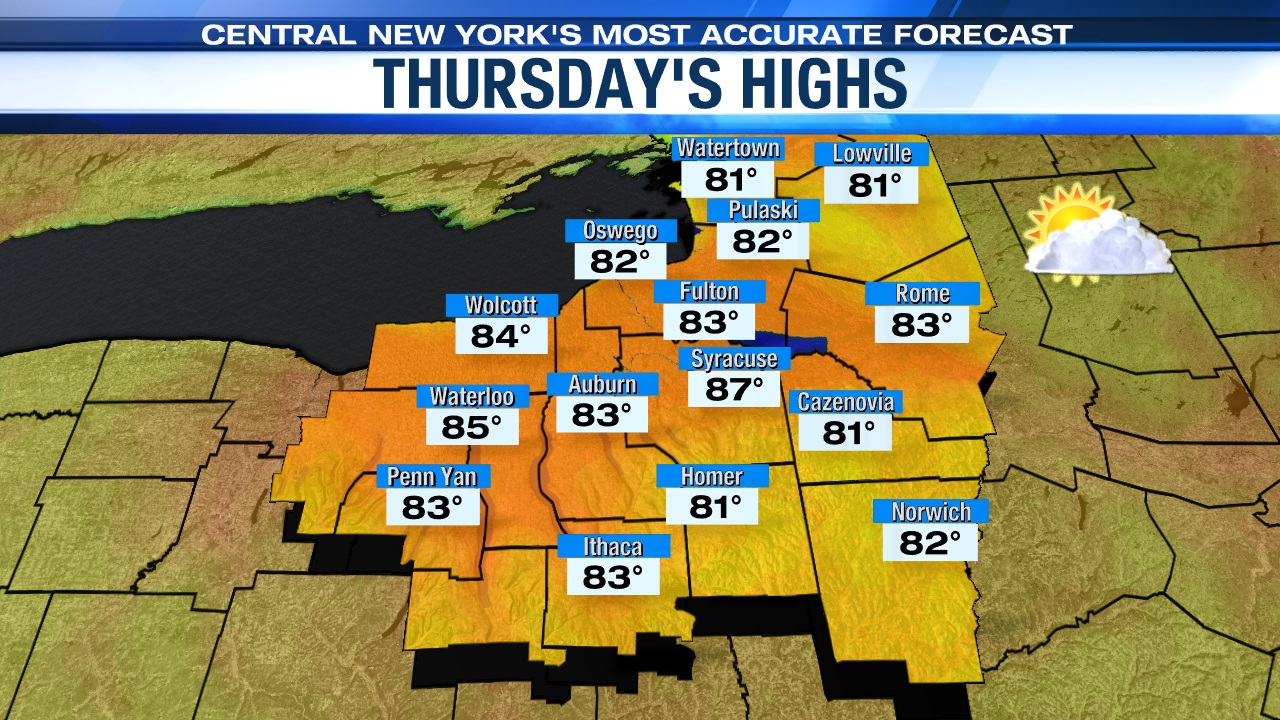
Turns brighter and warmer midweek
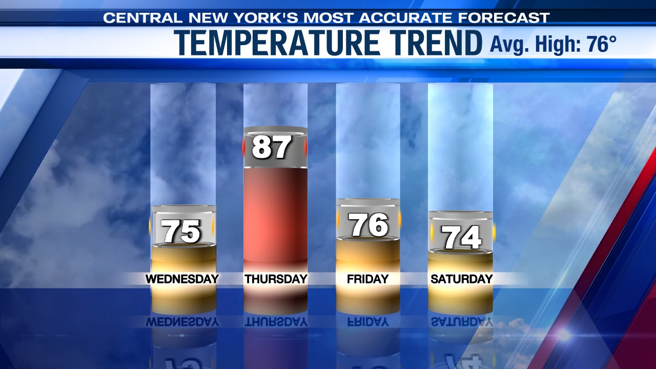
More sunshine develops as mentioned above Wednesday afternoon and evening and continues to shine Thursday aiding in a nice warm up midweek. This is pretty good news if you plan on attending the Syracuse Mets day game and or washing the car.
Highs warm into the low to mid 70s Wednesday and well into the 80s come Thursday with a southwest wind assisting in the warm up on Thursday too.
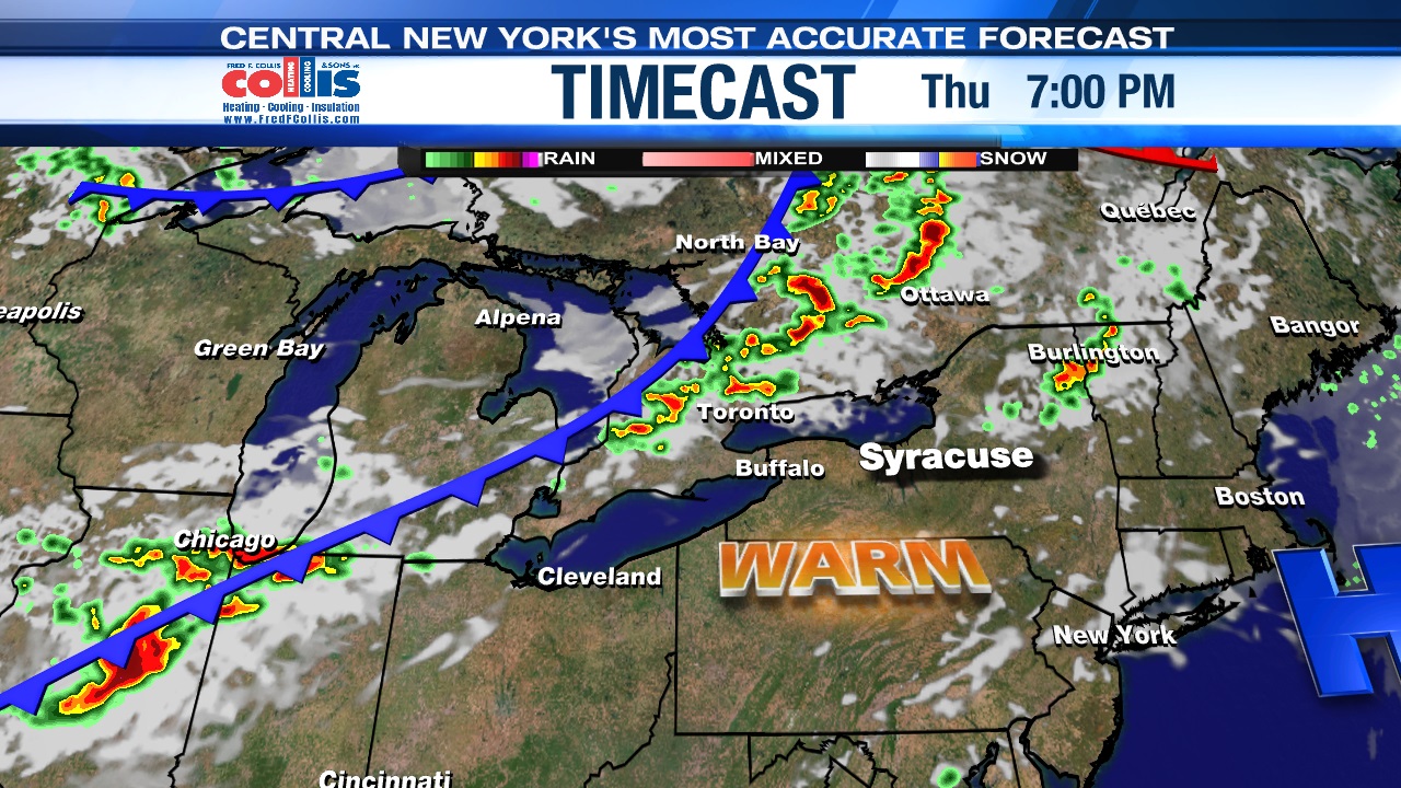
Rain chances return briefly late week
A cold front is slated to arrive late Thursday night with some showers and possibly a storm or two, but other than a lingering shower or two through about 8 am Friday, the end of the week looks mainly dry. We should even see some sun Friday too!
Highs are cooling back into the 70s to round out the week with lowering humidity and a steady breeze kicking up.
Check out the latest 7-day forecast.


