Another round of storms Sunday
SYRACUSE, NY (WSYR-TV) – Our hot and humid stretch will continue Sunday, but thankfully there is some relief in sight. We just have to get past a round of potentially severe weather to end the weekend.
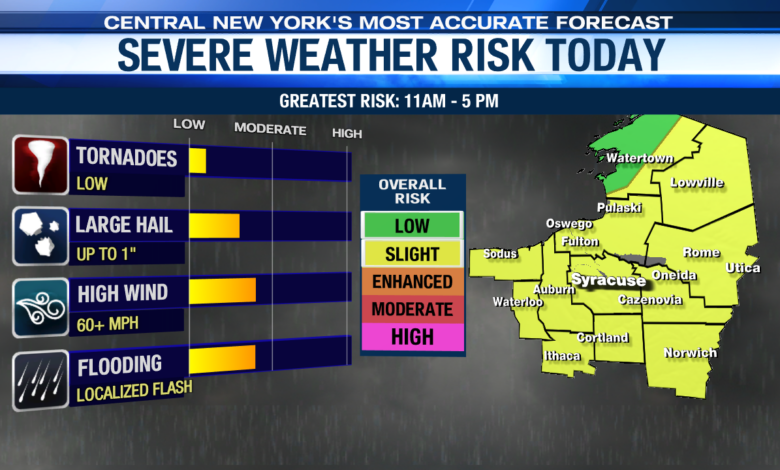
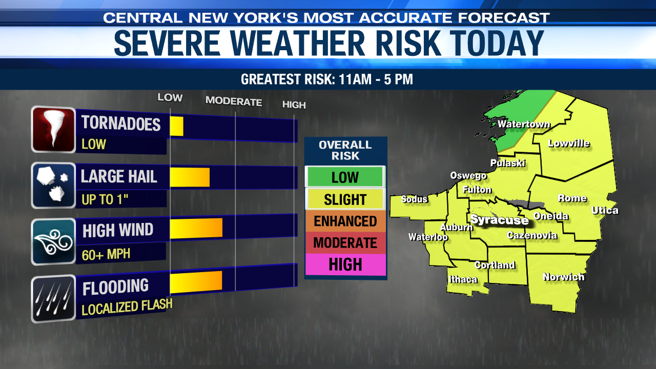
Severe threat remains for Sunday
A stronger cold front will be passing through central New York later this evening, in the wake of this front, we have the potential for some severe weather. The warm temperatures and high humidity are the ingredients needed for this front to trigger showers and thunderstorms.
We’ll have to keep an eye on these storms. A bit more wind shows up aloft than we have seen all week and that increases our chances of severe weather. The Storm Prediction Center has highlighted much of central New York in a ‘Slight’ risk with the most likely time for these stronger storms between 11 am and 5 pm.
While damaging winds and hail are the greatest threat, there is a possibility of an isolated tornado or two, especially east of Syracuse.
How much longer with this heat?
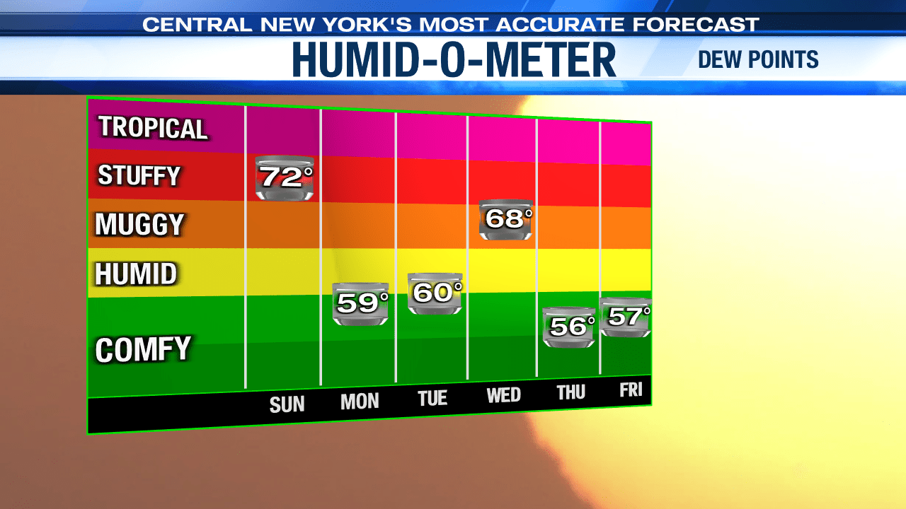
It looks like one more day with temperatures well into the 80s with dew points in the 70s Sunday. Once Sunday’s cold front moves through, we should see the relief return for Monday. Temperatures will be in the 60s for the morning and afternoon as we expect mostly cloudy skies and scattered showers, but the sunshine will be making a return by the afternoon bumping up our temperatures to the low and mid 70s.
Hot temperatures return
The 70s don’t last long. Look for high temperatures to climb back into the mid 80s Tuesday, but the good news is that the humidity is held in check.
We are closer to 90 and more humid Wednesday ahead of a new cold front Wednesday. That should lead to another round of showers and t-storms.
Check out the latest 7-day forecast.