Who could see a t-storm this evening?
SYRACUSE, NY (WSYR-TV) – Summertime warmth sticking around through midweek, but will we hit 90° or higher for the first time this year? Find out below…
Watching for evening showers and storms
After warming close to 90 degrees Tuesday afternoon, central New York is at risk for a few showers and storms into the early evening. They are most likely from Syracuse northward.
While nothing severe is expected this evening, a few of the storms could have winds gusting past 30 mph with a brief heavy downpour.
After sunset, these showers and storms dissipate and the overnight is quiet.
Stretch of summery weather lasts one more day
We’re right in the middle of the hottest weather of the year so far! Grab the shorts, sunscreen, water, and sunglasses to protect yourself from the strong late May sun.
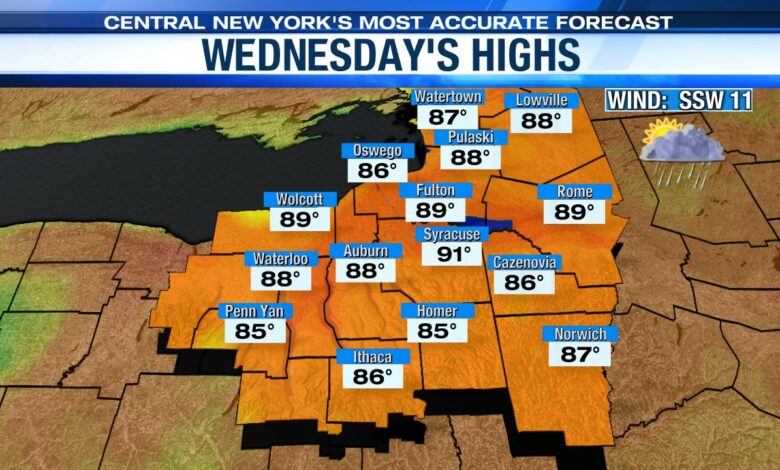
If we see enough sun Wednesday, we could very well warm into the low 90s! The record high Wednesday is 92° set way back in 1911. We shall see…
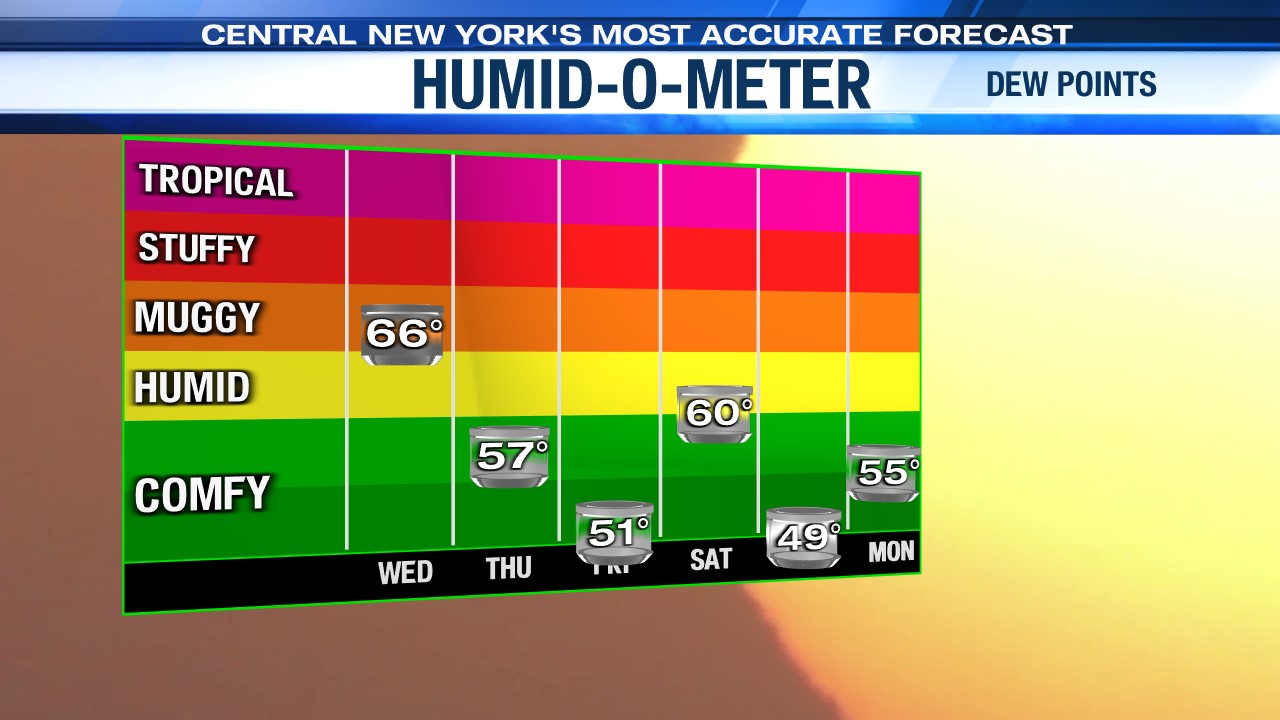
In addition to the heat, the humidity will continue to inch up through Wednesday adding to an early taste of mid-summer weather for Central New York. Check out the rising dew points through midweek below too…
Showers/storm threat goes up midweek
The next best chance of more widespread showers and storms won’t arrive until mid to late Wednesday afternoon. The culprit of the showers and storms will be a cold front that slowly slides out Thursday.
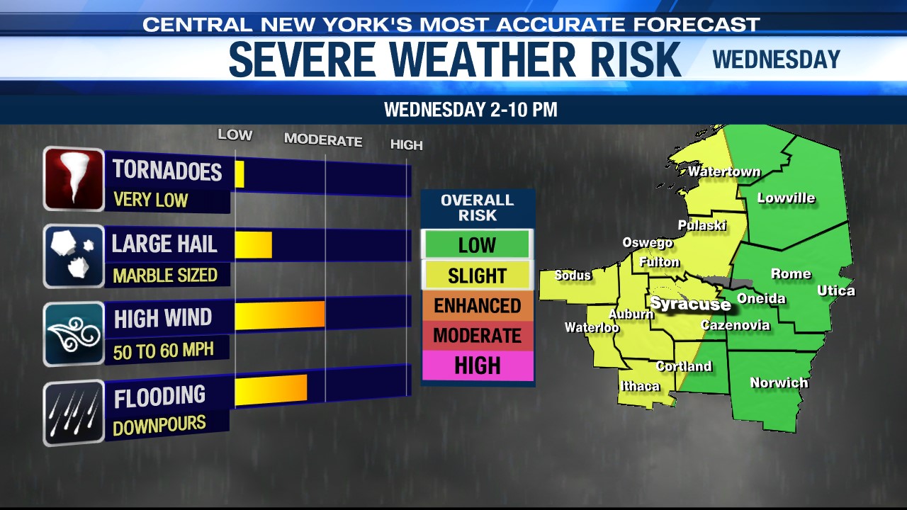
Severe threat?
The Storm Prediction Center has parts of CNY under a Slight Risk of severe weather, meaning a level 2 out of 5 threat of strong and severe thunderstorms. We must be vigilant of storms that could produce gusty damaging winds 50-60 mph, hail, and heavy downpours between 2-10 pm Wednesday. The tornado threat is very low at this time.
Ahh…for the last half of the week
In the wake of the Thursday morning cold front passage, it turns cooler and less humid Thursday afternoon into Friday.
Highs should drop back into the mid to upper 70s Thursday with some developing afternoon sunshine after showers and possibly a storm or two kick off the day.
The coolest day of the week comes Friday with plenty of sun, a nice breeze and temperatures back up around 80 degrees.
Check out the latest 7-day forecast.