Turns even hotter midweek, but any storms?
SYRACUSE, NY (WSYR-TV) – Summertime warmth sticking around through midweek, but will we hit 90° or higher for the first time this year this week? Find out below…
A stretch of summery weather this week
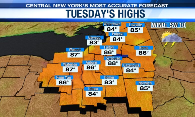
Get ready for very warm to hot temperatures through midweek! Grab the shorts, sunscreen, water, and sunglasses to protect yourself from the strong late May sun. Click here for the swimming and amp show forecast Tuesday.
A developing southwesterly wind (typically a warm wind for Syracuse) helps push temperatures into the upper 80s to near 90 Tuesday!
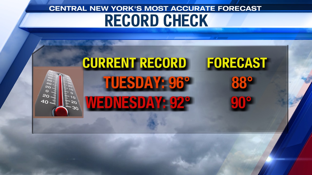
But we don’t stop there! If we see enough sun Wednesday, we could very well warm into the low 90s! The record high Wednesday is 92° set way back in 1911. We shall see…
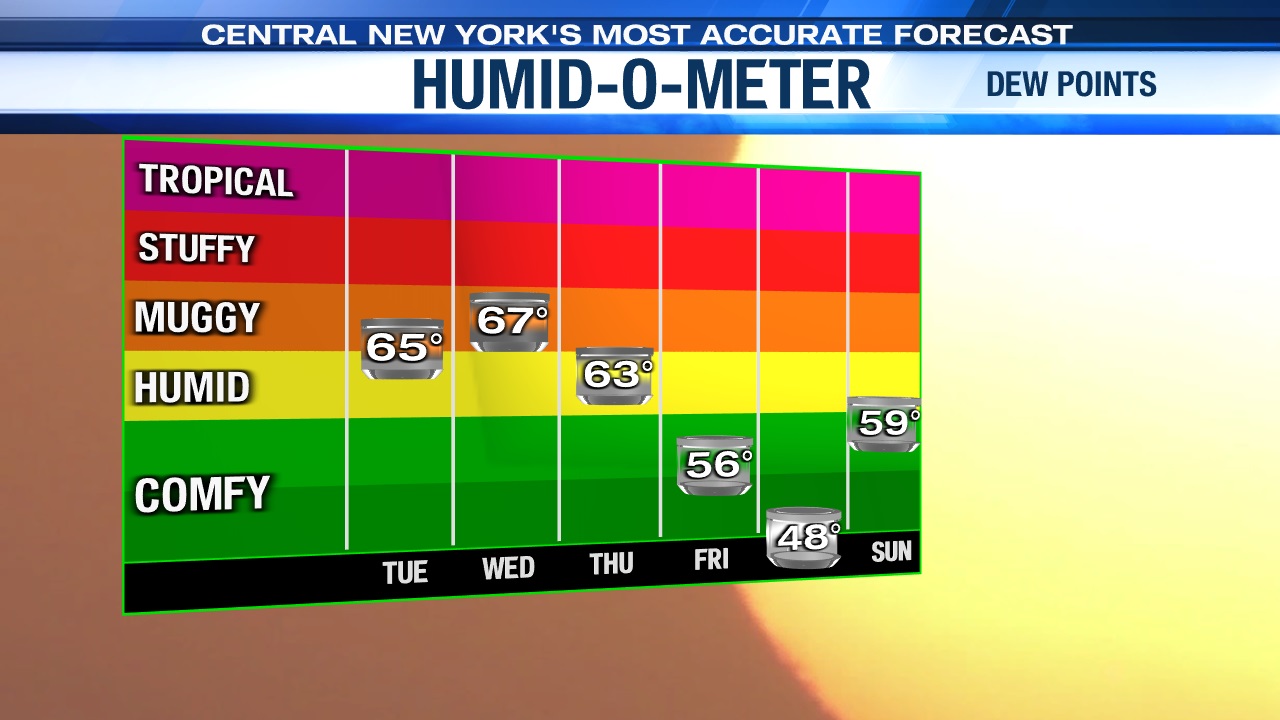
In addition to the heat, the humidity will continue to inch up through Wednesday adding to an early taste of mid-summer weather for Central New York. Check out the rising dew points through midweek below too…
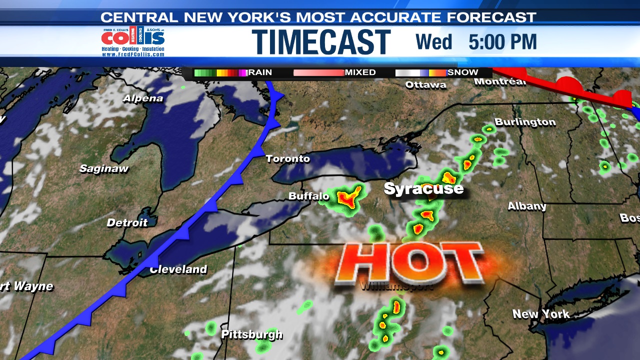
Shower/storm chances go up midweek
While there may be a spotty shower/storm or two Tuesday afternoon/evening, the next best chance of more widespread showers and storms won’t arrive until late Wednesday afternoon through the start of Thursday. The culprit of the showers and storms late Wednesday into the start of Thursday will be a cold front that slowly slides out Thursday.
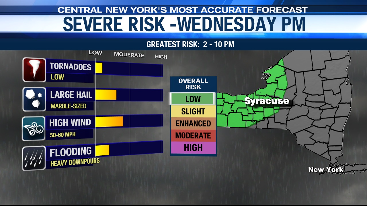
Severe threat?
Any of the storms that develop midweek could be strong with damaging wind gusts and large hail being the main threats. Stay tuned for updates.
Ahh…for the last half of the week
In the wake of the Thursday morning cold front passage, it turns cooler and less humid Thursday afternoon into Friday.
Highs should drop back into the mid to upper 70s Thursday with some developing afternoon sunshine after showers and possibly a storm or two kick off the day.
The coolest day of the week comes Friday with plenty of sun, a nice breeze and a more seasonable high in the mid-70s.
Check out the latest 7-day forecast.