
Staying warm but still watching for showers
SYRACUSE, NY (WSYR-TV) – After a week of on and off rain, things are getting ready to change for central New York and that change is for the better! Check out the latest details below.
Finally some nicer weather
After some widely scattered afternoon showers, we are left with partly cloudy skies overnight with the possibility for some patchy fog.
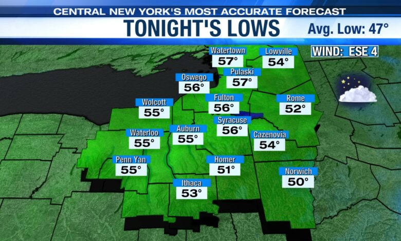
It is another relatively mild night with lows in the low to mid 50s.
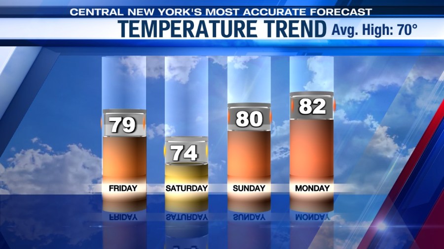
Much of Friday is rain-free too and hotter. Highs could make a run at 80 Friday afternoon. As we get closer to sunset our chances for rain go back up as the next front gets ready to sweep across the area Friday night into Saturday morning.
Weekend looking better
The front that brings us some late day showers Friday is falling apart by Saturday as high pressure at the surface is building in. With the front still close by (although weakened) we are going to keep some showers in for Saturday, especially in the morning, along with a good deal of clouds.
As high pressure begins to build in, we would expect a drier afternoon with sunshine gradually mixing in with the clouds.
For Sunday it continues to look dry as high pressure holds into early next week so too should the dry weather.
This more optimistic forecast calls for more sunshine too, which should help push temperatures to 80 degrees or better from Sunday into the middle of next week. It will be an early taste of summer weather for central New York!
Check out the latest 7-day forecast


