Radar, power outage maps and the Storm Team forecast

SYRACUSE, N.Y. (WSYR-TV) –
- Record heat today
- Thunderstorms are already developing in CNY, some of these could be strong/severe
- CNY Radar (click to see)
- Turning cooler Thursday
It’s another hot and humid day across Central New York, and in addition to potential record warmth, we are on the lookout for some strong to severe storms.
The latest radar
Power Outage Maps
When is the threat of storms highest?
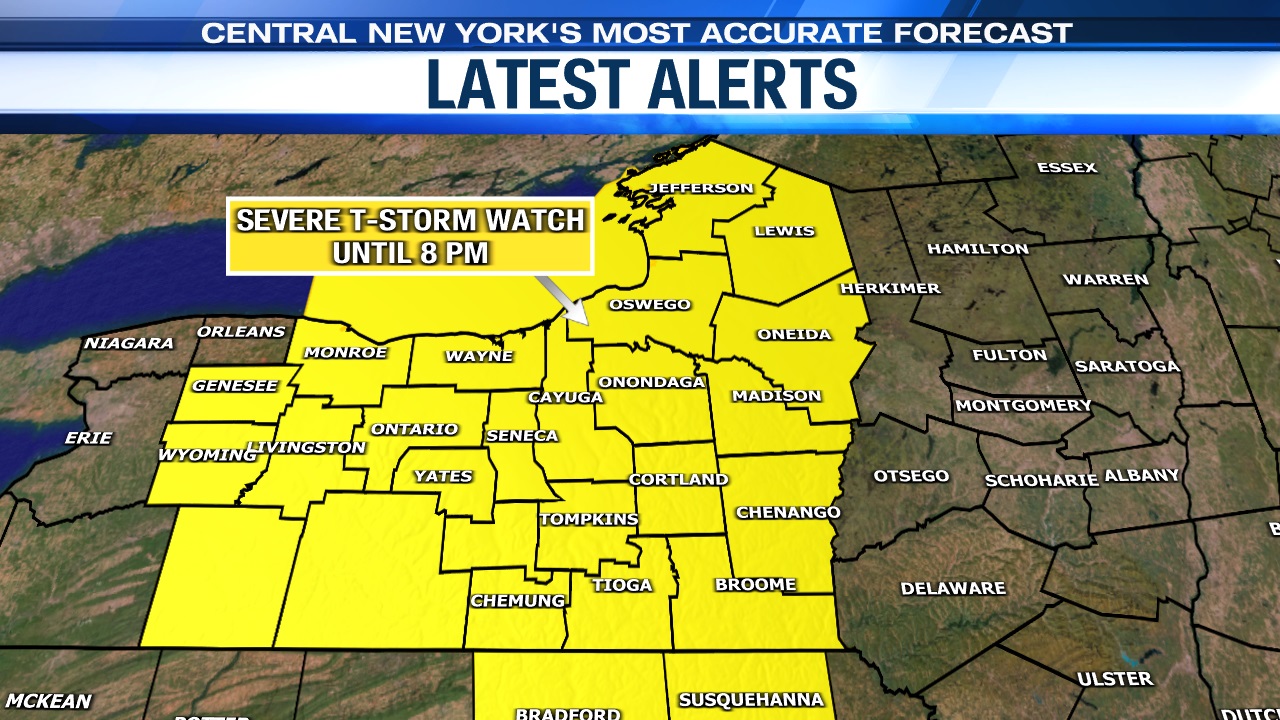
A Severe Thunderstorm Watch has been issued for all of CNY until 8 p.m. this evening.
Stay safe and weather-aware as these storms move through Central New York. Have the Storm Team app downloaded to your phone so you can be notified of lightning strikes nearby and be instantly alerted of any watches and warnings the National Weather Service may issue.
What are the risks with today’s storms?
Any storm that develops today will have the capability of producing wind gusts around 60 miles per hour. Wind gusts that strong could lead to tree damage and some power outages.
There is also the threat of large hail up to an inch in diameter.
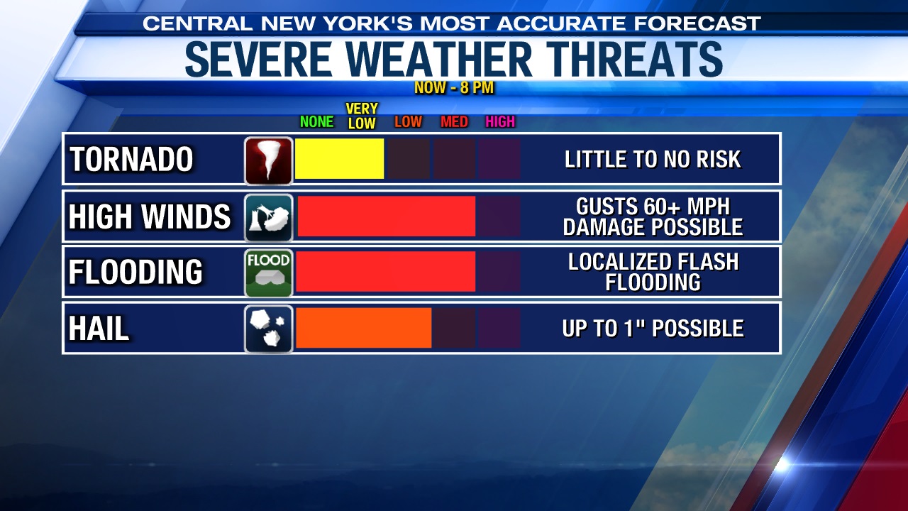
Heavy rainfall and frequent lightning are also possible in thunderstorms. Luckily, the threat for any tornadoes is very low.