
Quiet this evening, but not so much overnight
SYRACUSE, NY (WSYR-TV) – It was a gorgeous Tuesday across CNY, but rain and storms are on the way. When do they arrive? Find out below…
Shower/storm threat late tonight/Wednesday
The same system that hit the Plains hard with severe weather and tornadoes moves into the Northeast late Tuesday night and Wednesday in a weakened state thankfully.
While we are not expecting anything as intense as what areas across the Plains had this week, we’re not ruling out a few isolated strong or severe thunderstorms.
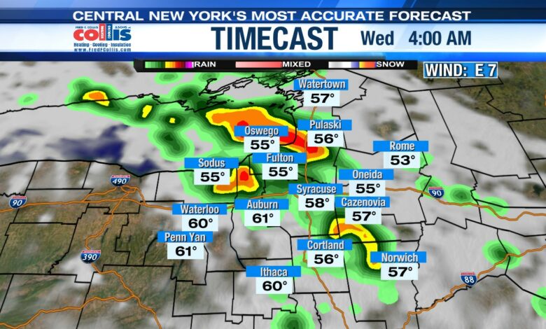
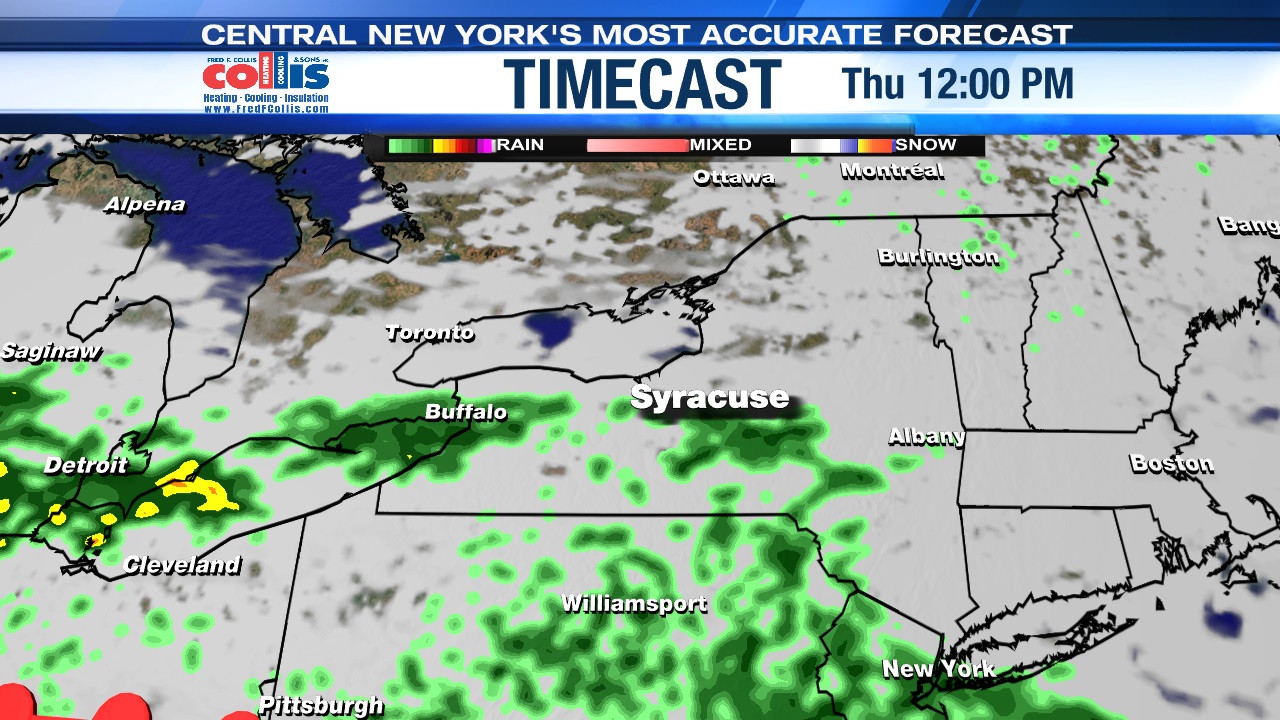
The first wave of showers and storms move through CNY very late Tuesday night and early Wednesday morning between about 2 and 7 a.m.
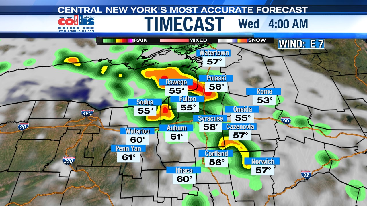
It’s a milder night too with lows in the mid to upper 50s.
When is the best chance of a few strong storms?
The morning turns drier with even sunshine breaking through right into the afternoon, but a few more showers and storms likely pop up again between about 2 and 7 p.m.
Any of these storms that develop Wednesday afternoon/early evening could have gusty/damaging winds, hail, and downpours.
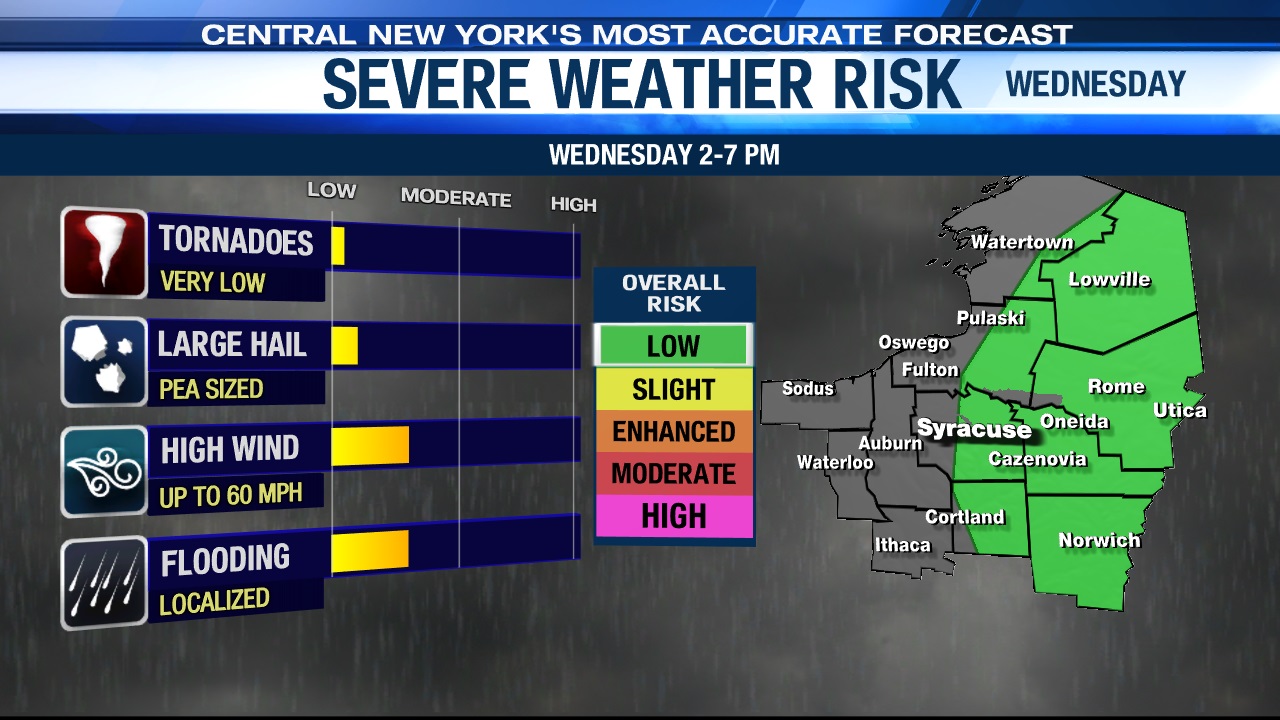
So, if you have any outdoor plans Wednesday afternoon be sure to keep an eye to the sky and on the radar! That said, much of the day will be dry, but don’t let your guard down if you are outside working and or for pleasure.
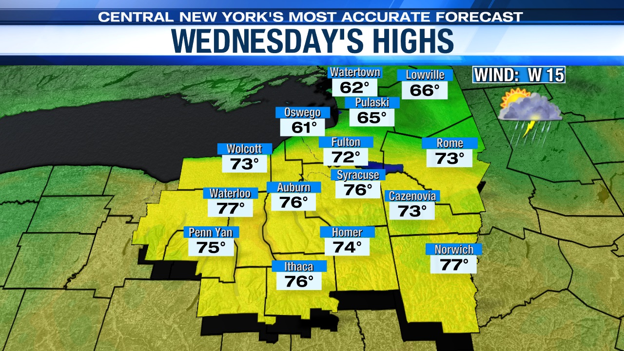
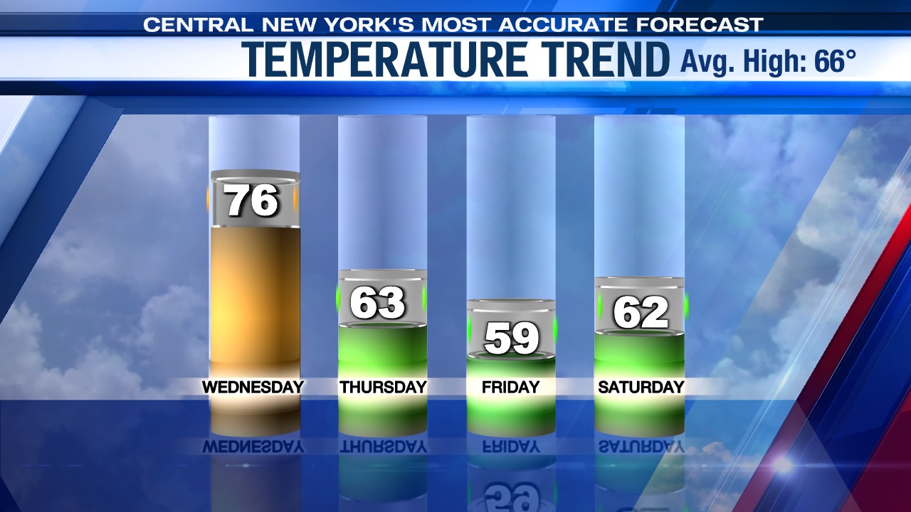
Highs should still be able to reach well into the 70s Wednesday afternoon Syracuse south bound, while areas east of Lake Ontario are likely going to be stuck in the 60s.
Cooler & damper changes later in the week
A cold front slides through Wednesday night, and is then followed by a stronger storm system moving south of CNY Thursday into Friday.
What does this mean for CNY? You guessed it! Another round of showers moves in Thursday afternoon and likely lingers into Friday, but it also turns unseasonably cool.
We think highs may struggle to reach the low to mid 60s Thursday and could be stuck in the 50s Friday!
Check out the latest 7-day forecast.


