Quiet evening weather; what the latest on the weekend?
SYRACUSE, NY (WSYR-TV) –After beautiful weather the past couple of days how will things change for the holiday weekend? Details are below…
Quiet weather Friday night
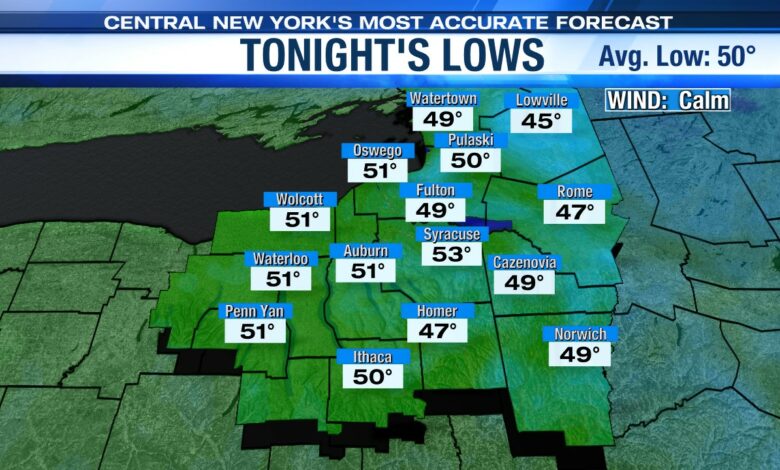
High pressure remains in control of the weather over central New York tonight. Those gusty winds from the afternoon die down close to sunset and skies remain clear.
It is another seasonably cool night with widespread 50s but cooler upper 40s in outlying areas.
A summer-like feel to the start of Memorial Day weekend
The start to the Memorial Day holiday doesn’t look that bad.
Saturday features a mix of clouds and sun with temperatures rising into the low 80s which is more typical for July or early August. Quite appropriate for the unofficial start to the summer season.
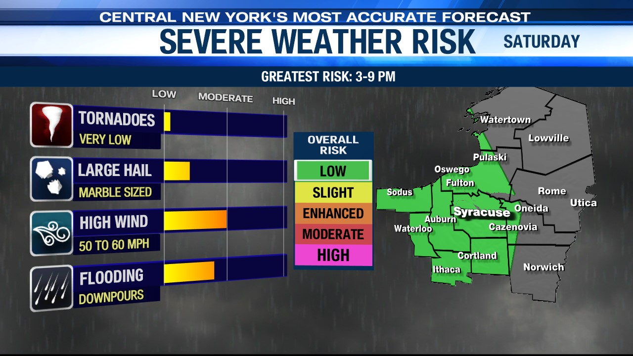
While we do have some showers and storms in the forecast for Saturday, they likely will not arrive until later in the day after 2 or 3 p.m. They would sweep east of central New York close to sunset.
Some of the storms by late in the afternoon could have gusty, damaging winds and even hail. If you have outdoor plans for tomorrow afternoon, make sure you have the radar handy.
The cold front causing these showers moves through Saturday night, and in its place is high pressure so we dry out with a mix of sun and clouds for Sunday and temperatures again above normal, close to 80°.
A wetter end to Memorial Day weekend
Unfortunately, our thinking for Memorial Day itself has not changed the last couple of days. A new frontal system arrives with more showers and T-storms around and this time not confined to just late in the day. The threat of damaging winds and hail looks to be low but heavy downpours seems to be more likely.
As you head back to work after Monday the pattern is shaping up to be a bit damp and cool into the middle of next week.
Check out the latest 7-day forecast.