
It stays warm in CNY, but not for long
SYRACUSE, NY (WSYR-TV) – A terrific Tuesday on tap for all of CNY, but changes are on the way. Find out when changes take place below…
Pick day of the week Tuesday
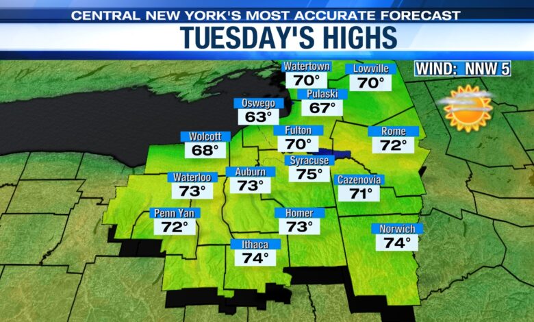
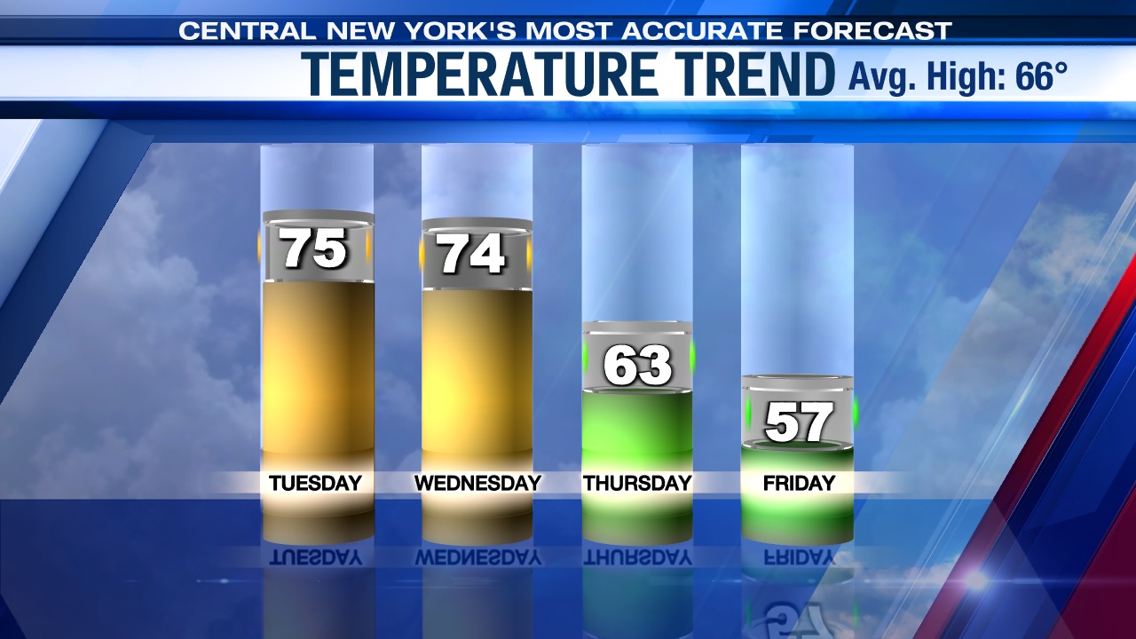
An area of high pressure begins to weaken and slide east Tuesday, but central New York is still dry with plenty of sun. Temperatures on Tuesday are expected to be warmer too, rising into the low to mid 70s.
Stays mild midweek, but…
A weak wave of low pressure pushes a warm front into CNY late Tuesday night/Wednesday morning with some showers and possibly a few t-storms before we turn drier with intervals of sun possible Wednesday afternoon.
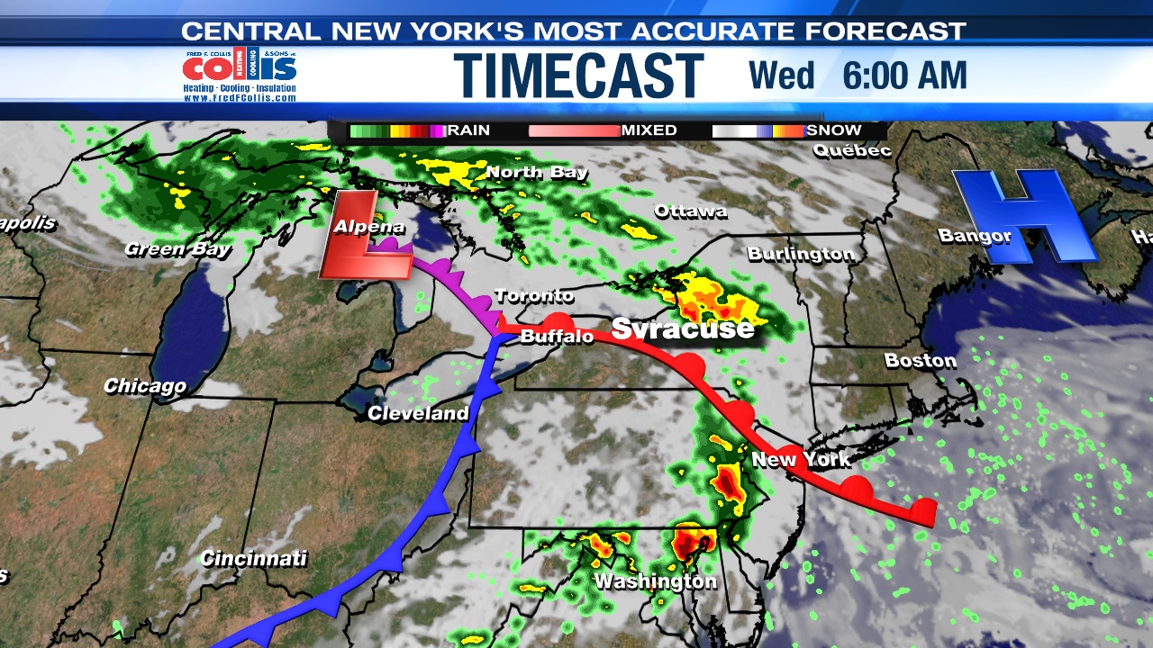
Wednesday looks to be still mild and muggier with highs in the 70s Syracuse southbound, while areas east of Lake Ontario are likely going to be stuck in the 60s on the cooler side of the warm front we mentioned earlier.
Cooler & damper for later in the week
A cold front sliding through Wednesday night is followed by a stronger storm system Thursday into Friday. What’s does this mean for CNY? You guessed it! Another round of showers, but not only will it rain Thursday and Friday, but it also turns unseasonably cool.
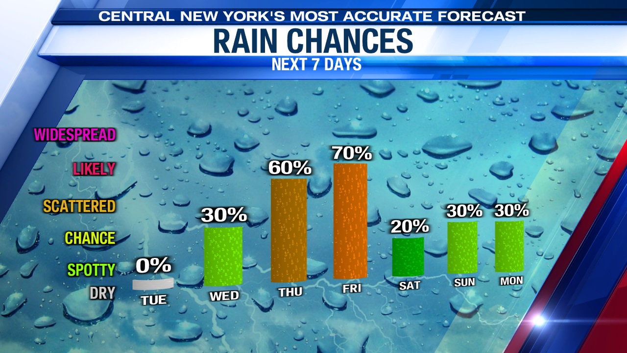
We think highs may struggle to reach the low to mid 60s Thursday and could be stuck in the 50s Friday!
Check out the latest 7-day forecast.


