Heat & storm threat ending; Comfier air on the way!
SYRACUSE, NY (WSYR-TV) – Record heat and strong/severe storms Wednesday will be replaced by a much nicer and comfier last half of the week! Details are below…
Severe threat ending across CNY this evening
The 93° record high in Syracuse was also tied for the second warmest May day ever recorded! That heat and an approaching cold front triggered some strong to severe storms Wednesday afternoon and early evening, but thankfully the storm threat is ending this evening!
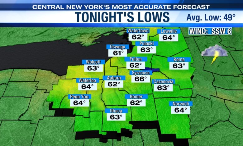
We can’t take out the threat of a few more showers and possibly a storm or two during the late evening and overnight tonight, but the severe threat is over. It remains mild and muggy tonight too with lows dropping into mid-60s.
Relief from the heat for last half of the week
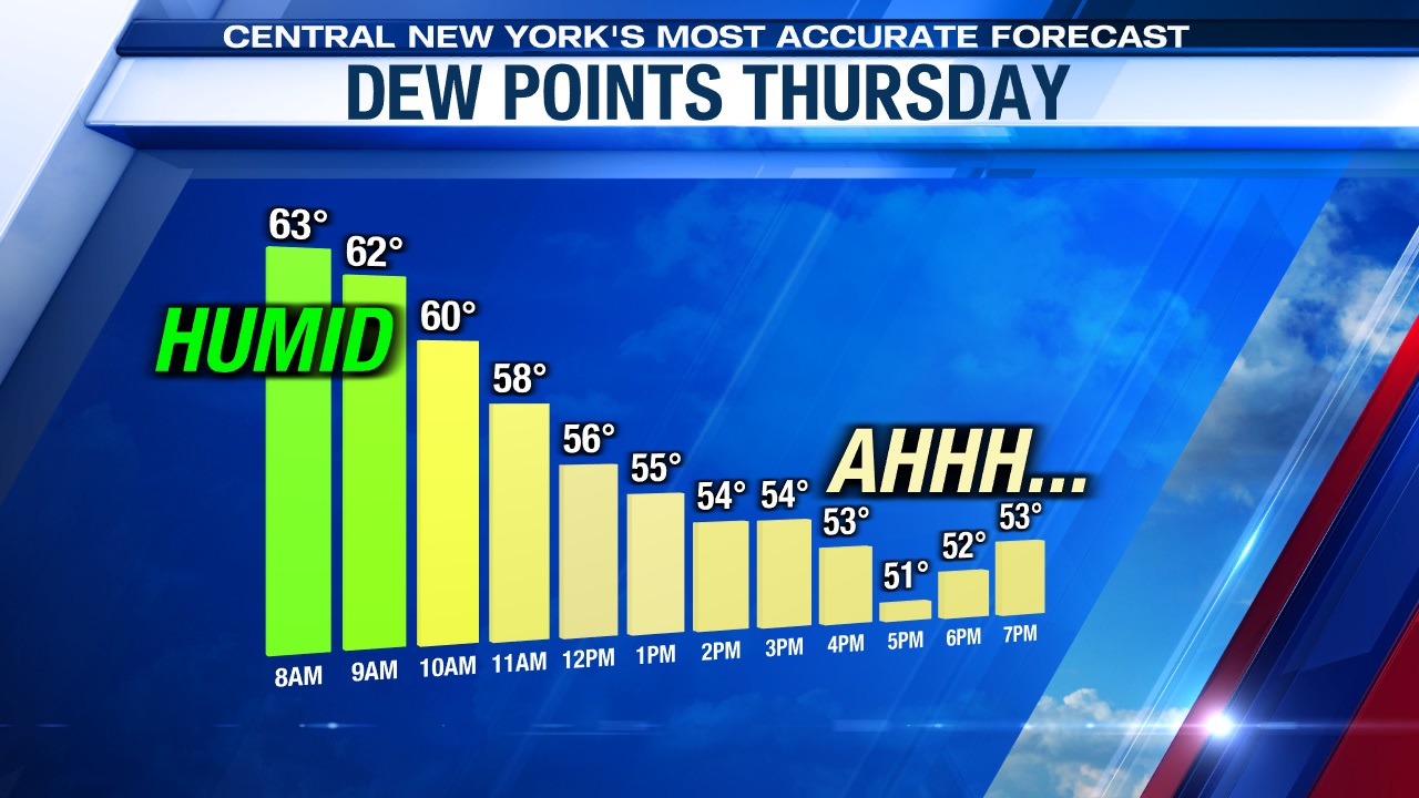
In the wake of the predawn Thursday morning cold front passage, it turns cooler and less humid during the day Thursday and sticks around into Friday. Click here to find out how the weather looks for a trip to the park and or mowing Thursday?
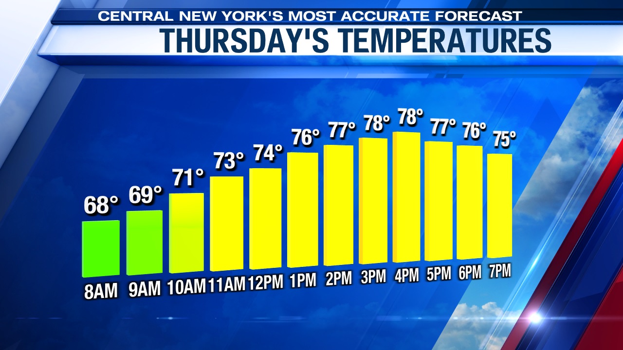
Highs should drop back into the upper 70s and low 80s Thursday with some sunshine expected after possibly seeing a lingering shower or two to start the day.
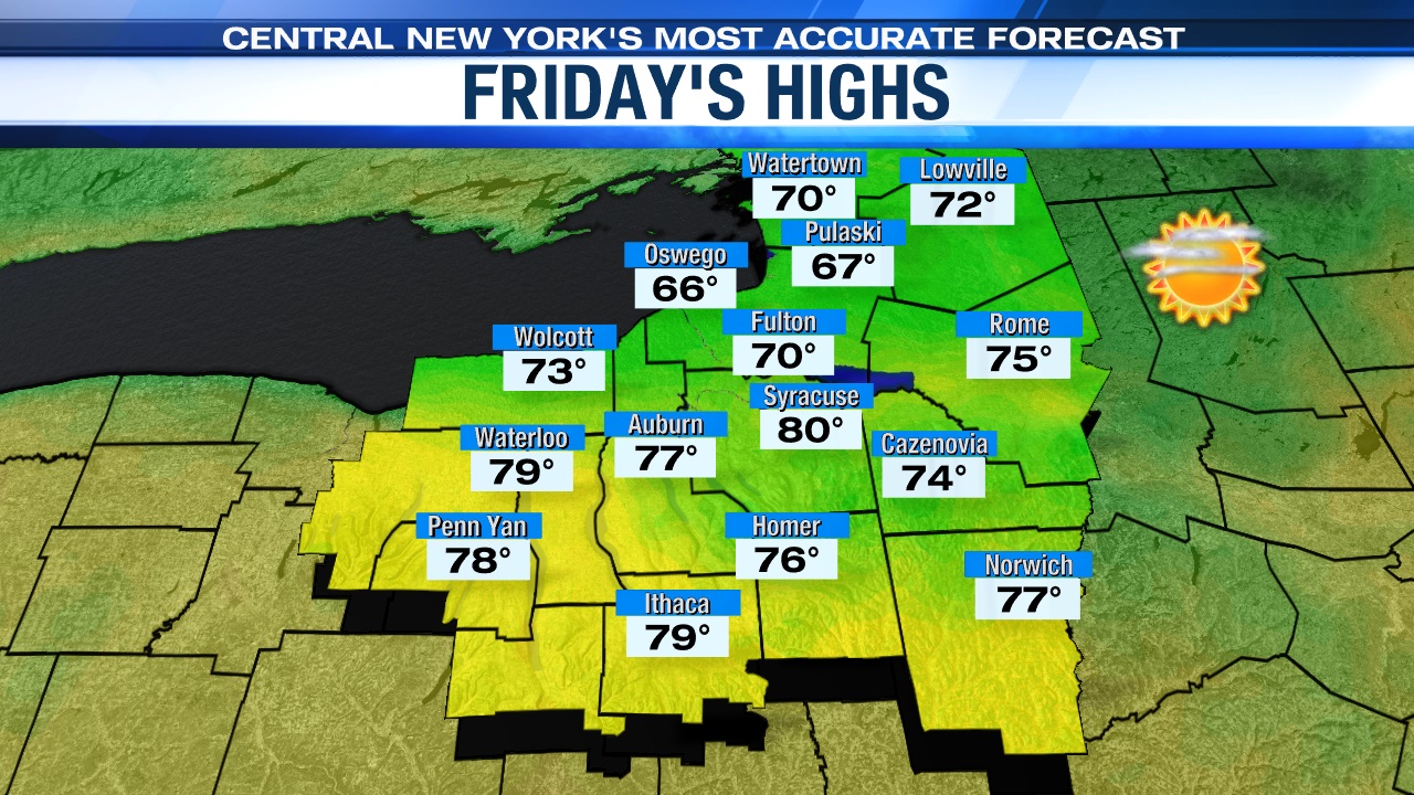
The nicest day of the week comes Friday with plenty of sun from start to finish, a nice, steady breeze, and temperatures in the upper 70s to possibly 80 degrees.
What about the Memorial Day weekend? Click here to see how it’s looking right now.
Check out the latest 7-day forecast.